File:Martellus-Lacerda.jpg
Jump to navigation
Jump to search

Size of this preview: 800 × 535 pixels. Other resolutions: 320 × 214 pixels | 640 × 428 pixels | 1,024 × 685 pixels | 1,280 × 856 pixels | 2,500 × 1,672 pixels.
Original file (2,500 × 1,672 pixels, file size: 951 KB, MIME type: image/jpeg)
Captions
Captions
Add a one-line explanation of what this file represents
Summary[edit]
| Author |
Original: Heinrich Hammer the German ("Henricus Martellus Germanus") Reproduction: Jose de Lacerda |
| Description |
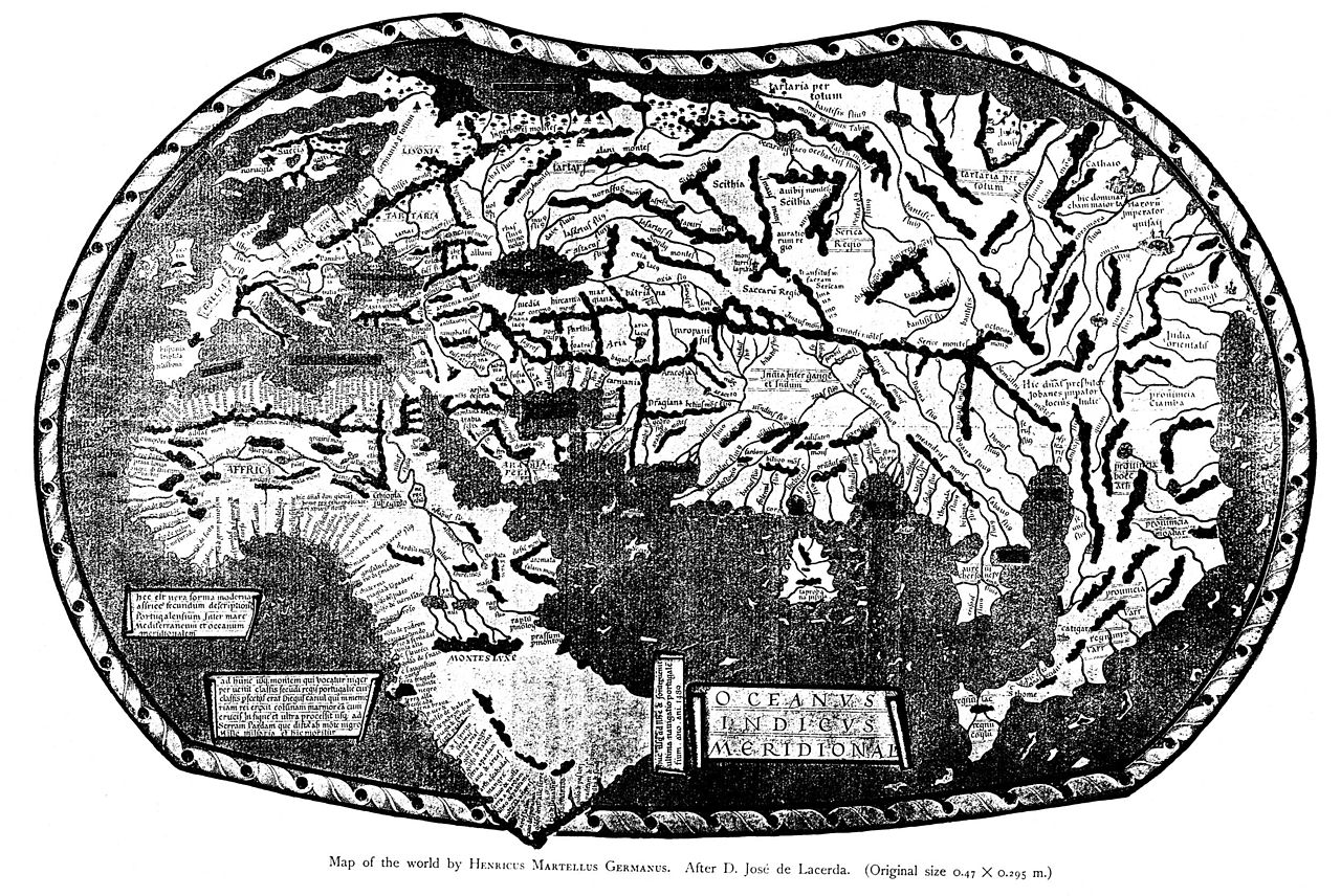
English: A 19th-century reproduction of the world map of "Henricus Martellus Germanus" (Heinrich Hammer the German), Florence, c. 1489. The first map with the Dragon Tail. It is a mixture of Ptolemy, recent Portuguese discoveries and unknown sources. Displays the Cape of Good Hope, rounded by Bartolomeo Dias in 1488. Deutsch: Weltkarte des de:Henricus Martellus Germanus |
| Date |
Original: 1489 Reproduction: 19th century |
| Source/Photographer | Insularium Illustratum (Account of the Islands of the Mediterranean) |
| Other versions |
|


.jpg)
,_ff.68v-69_-_BL_Add_MS_15760.jpg)

Licensing[edit]
|
This work is in the public domain in its country of origin and other countries and areas where the copyright term is the author's life plus 100 years or fewer. | |
| This file has been identified as being free of known restrictions under copyright law, including all related and neighboring rights. | |
File history
Click on a date/time to view the file as it appeared at that time.
| Date/Time | Thumbnail | Dimensions | User | Comment | |
|---|---|---|---|---|---|
| current | 10:30, 14 December 2011 | | 2,500 × 1,672 (951 KB) | Portolanero (talk | contribs) | {{Information |Description={{en|1=The world map of "Henricus Martellus Germanus" (Heinrich Hammer), Florence 1490-92. A carefully prepared reproduction by Jose de Lacerda. Unlike the photography, here the date 1489 at South Africa is visible.}} | Source |
You cannot overwrite this file.
File usage on Commons
The following 6 pages use this file:
- File:Henricus Martellus' World Map.jpg
- File:Henricus Martellus Germanus (Wirkungsjahre 1480-1496).jpg
- File:Martellus-Lacerda.jpg
- File:Martellus World-Map.jpg
- File:Martellus world map.jpg
- File:World map by Martellus - Account of the Islands of the Mediterranean (1489), ff.68v-69 - BL Add MS 15760.jpg
File usage on other wikis
The following other wikis use this file:
- Usage on ca.wikipedia.org
- Usage on ru.wikipedia.org