File:Marceau u. Hoche Gräber.jpg
Original file (1,879 × 1,117 pixels, file size: 945 KB, MIME type: image/jpeg)
Captions
Captions
Summary[edit]
| Description |
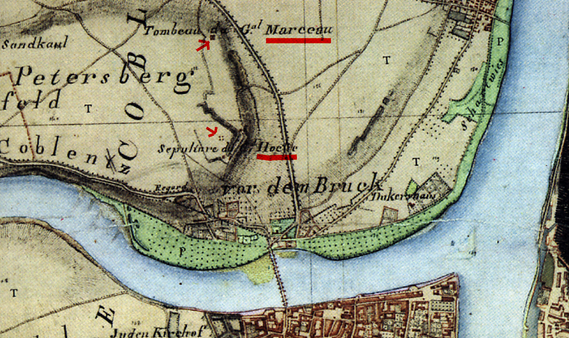
Deutsch: Erste kartografische Aufnahme von den Grabstätten der französischen Revolutionsgenerale Hoche und Marceau in Koblenz
|
| Date | |
| Source |
Transferred from de.wikipedia to Commons by Saibo using CommonsHelper. |
| Author |
Ing. Geograph Boucher unter Oberst Tranchot Das gesamte Kartenwerk linksrheinisches Rheinland wurde 1803 von franz. Ingenieuren begonnen und 1816/17 von preußischen Geometern unter General v. Müffling fertiggestellt. Angaben: Landesvermessungsamt Rheinland-Pfalz 1975 |
Licensing[edit]
|
This work is in the public domain in its country of origin and other countries and areas where the copyright term is the author's life plus 100 years or fewer. | |
| This file has been identified as being free of known restrictions under copyright law, including all related and neighboring rights. | |
Scan was released in PD at dewp src.
Original upload log[edit]
- 2011-01-28 13:20 Dieter rogge 1879×1117× (967692 bytes) {{Information |Beschreibung = Erste karthografische Darstellung der Grabstätten der 1796 und 1797 verstorbenen französischen Revolutionsgeneräle Marceau und Hoche in Koblenz am Rhein |Quelle = Eigener Detail-Scann vom Nachdruck der Landk
- 2011-01-27 16:49 Dieter rogge 1879×1117× (967692 bytes) {{Information |Beschreibung = Erste kartografische Aufnahme von den Grabstätten der französischen revolutionsgenerale Hoche und Marceau in Koblenz |Quelle = Scann-Reproduktion von Kartenblatt 136 Koblenz der Kartenaufnahme der Rheinlande d
File history
Click on a date/time to view the file as it appeared at that time.
| Date/Time | Thumbnail | Dimensions | User | Comment | |
|---|---|---|---|---|---|
| current | 15:16, 3 February 2011 | | 1,879 × 1,117 (945 KB) | File Upload Bot (Magnus Manske) (talk | contribs) | {{BotMoveToCommons|de.wikipedia|year={{subst:CURRENTYEAR}}|month={{subst:CURRENTMONTHNAME}}|day={{subst:CURRENTDAY}}}} {{Information |Description={{de|Erste kartografische Aufnahme von den Grabstätten der französischen revolutionsgenerale Hoche und Mar |
You cannot overwrite this file.
File usage on Commons
There are no pages that use this file.
File usage on other wikis
The following other wikis use this file:
- Usage on de.wikipedia.org