File:Map of the United States with flags with territories and DC final2.png
Jump to navigation
Jump to search
Size of this preview: 800 × 505 pixels. Other resolutions: 320 × 202 pixels | 640 × 404 pixels | 1,024 × 646 pixels | 1,600 × 1,010 pixels.
Original file (1,600 × 1,010 pixels, file size: 518 KB, MIME type: image/png)
Captions
Captions
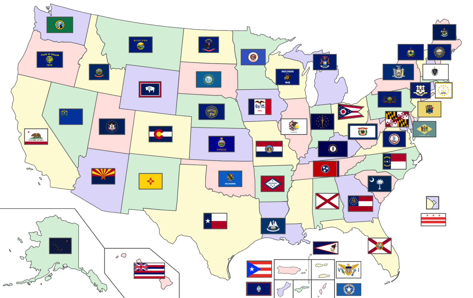
A map of the United States showing the flags of the 50 U.S. states, the District of Columbia, and the 5 inhabited U.S. territories
Summary
[edit]
| Description |
English: A map of the United States showing the flags of the 50 U.S. states, the District of Columbia, and the 5 inhabited U.S. territories (Total number of flags: 56) |
| Date | |
| Source | Modified version of map already on Wikimedia Commons; Flags are in public domain |
| Author | Original author: User:SiBr4 |
Licensing
[edit]
This file is licensed under the Creative Commons Attribution-Share Alike 3.0 Unported license.
- You are free:
- to share – to copy, distribute and transmit the work
- to remix – to adapt the work
- Under the following conditions:
- attribution – You must give appropriate credit, provide a link to the license, and indicate if changes were made. You may do so in any reasonable manner, but not in any way that suggests the licensor endorses you or your use.
- share alike – If you remix, transform, or build upon the material, you must distribute your contributions under the same or compatible license as the original.
File history
Click on a date/time to view the file as it appeared at that time.
| Date/Time | Thumbnail | Dimensions | User | Comment | |
|---|---|---|---|---|---|
| current | 16:00, 10 November 2020 | | 1,600 × 1,010 (518 KB) | CapLiber (talk | contribs) | transparent background |
| 18:57, 20 October 2020 |  | 1,600 × 1,010 (571 KB) | The Image Editor (talk | contribs) | Updated New York flag as of April 2020 | |
| 20:55, 17 August 2020 |  | 2,000 × 1,263 (557 KB) | Davidwr (talk | contribs) | Reverted to version as of 01:39, 29 June 2020 (UTC) - the August 10 version was missing territorial flags | |
| 05:36, 10 August 2020 |  | 2,000 × 1,263 (493 KB) | RootOfAllLight (talk | contribs) | N/A | |
| 01:39, 29 June 2020 |  | 2,000 × 1,263 (557 KB) | BasilLeaf (talk | contribs) | State of Mississipi wil officially have no flag until at least November 3rd, 2020, as per State law passed on June 28th, 2020. | |
| 17:03, 7 September 2019 |  | 2,000 × 1,263 (390 KB) | LumaP15 (talk | contribs) | User created page with UploadWizard |
You cannot overwrite this file.
File usage on Commons
There are no pages that use this file.
File usage on other wikis
The following other wikis use this file:
- Usage on ml.wikipedia.org
- Usage on tr.wikipedia.org