File:Map of route of North Australia Railway.png
Jump to navigation
Jump to search

Size of this preview: 666 × 600 pixels. Other resolutions: 267 × 240 pixels | 533 × 480 pixels | 853 × 768 pixels | 1,137 × 1,024 pixels | 2,000 × 1,801 pixels.
Original file (2,000 × 1,801 pixels, file size: 6.31 MB, MIME type: image/png)
Captions
Captions
Map of route of North Australia Railway
Summary[edit]
| Description |
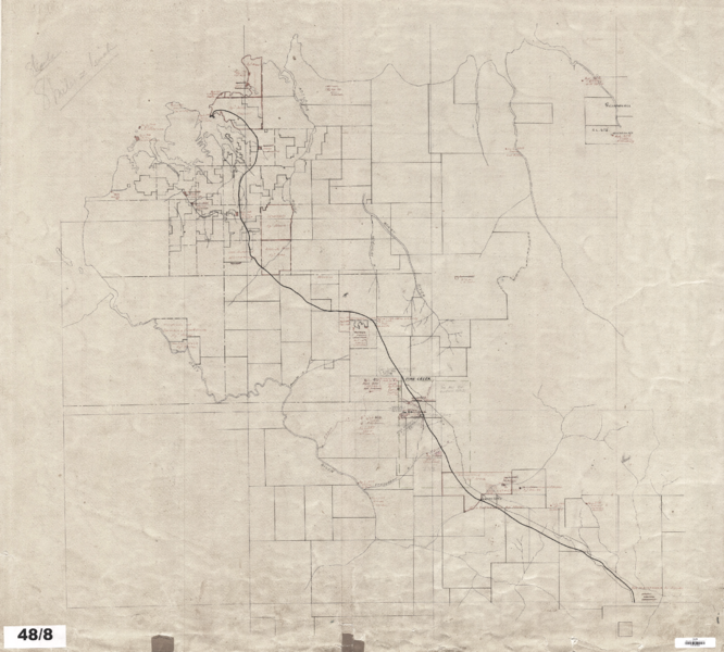
English: Map of route of North Australia Railway, Darwin to just north of Mataranka. Drawn in pencil. Shows some of the land parcels associated with the line. |
| Date | Unknown early 20th century |
| Source | Northern Territory Land Information System -- https://www.ntlis.nt.gov.au/imfPublic/sites/historic_map_index/displayLargeMap.jsp?mapId=01556 |
| Author | Unknown author |
Licensing[edit]
This file is in the public domain because it is an artistic work made or first published more than 50 years ago by a government of the Australian Commonwealth or an Australian state or territory. The Australian Government's policy on duration of copyright specifies that copyright in such works expires 50 years after the end of the year in which it was made or first published.
|
This work is in the public domain in the United States because it meets three requirements:
For background information, see the explanations on Non-U.S. copyrights.
Note: This tag should not be used for sound recordings. |
↑ The public domain status of this image in Australia and the United States satisfies the requirements of Wikimedia Commons licensing policy.
File history
Click on a date/time to view the file as it appeared at that time.
| Date/Time | Thumbnail | Dimensions | User | Comment | |
|---|---|---|---|---|---|
| current | 05:54, 19 December 2021 | | 2,000 × 1,801 (6.31 MB) | SCHolar44 (talk | contribs) | Uploaded a work by Unknown from Northern Territory Library and Information Service -- https://www.ntlis.nt.gov.au/imfPublic/sites/historic_map_index/displayLargeMap.jsp?mapId=01556 with UploadWizard |
You cannot overwrite this file.
File usage on Commons
The following 2 pages use this file: