File:Map of TIROS II infrared Spac0080-repair.jpg
Jump to navigation
Jump to search

Size of this preview: 794 × 600 pixels. Other resolutions: 318 × 240 pixels | 636 × 480 pixels | 1,017 × 768 pixels | 1,280 × 967 pixels | 1,517 × 1,146 pixels.
Original file (1,517 × 1,146 pixels, file size: 481 KB, MIME type: image/jpeg)
Captions
Captions
Add a one-line explanation of what this file represents
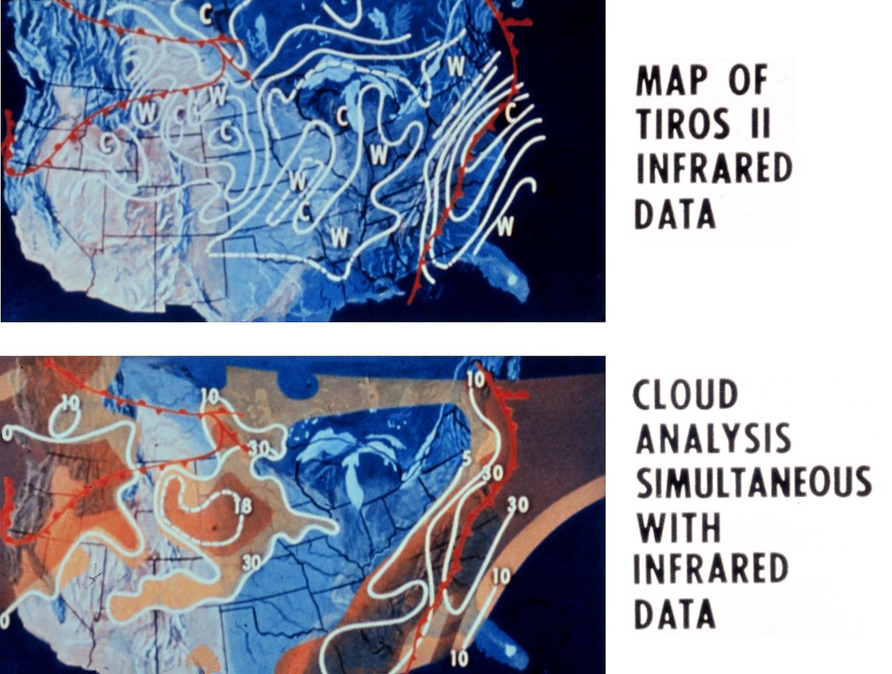
| Description | Map of TIROS II infrared imagery with accompanying cloud analysis. TIROS II was the first meteorological satellite to carry infra-red remote sensing instruments. | |||||
| Date | circa 1961 | |||||
| Source | spac0080, NOAA In Space Collection | |||||
| Author | NOAA Photo Library | |||||
| Permission (Reusing this file) |
|
|||||
| Other versions |
 |
File history
Click on a date/time to view the file as it appeared at that time.
| Date/Time | Thumbnail | Dimensions | User | Comment | |
|---|---|---|---|---|---|
| current | 05:43, 22 October 2007 | | 1,517 × 1,146 (481 KB) | CarolSpears (talk | contribs) | {{Information |Description=Map of TIROS II infrared imagery with accompanying cloud analysis. TIROS II was the first meteorological satellite to carry infra-red remote sensing instruments. |Source=[http://www.photolib.noaa.gov/htmls/spac0080.htm spac0080, |
You cannot overwrite this file.
File usage on Commons
The following 2 pages use this file:
File usage on other wikis
The following other wikis use this file:
- Usage on en.wikipedia.org