File:Map of Pennsylvania highlighting Wayne County.svg
Jump to navigation
Jump to search

Size of this PNG preview of this SVG file: 800 × 460 pixels. Other resolutions: 320 × 184 pixels | 640 × 368 pixels | 1,024 × 589 pixels | 1,280 × 736 pixels | 2,560 × 1,472 pixels | 4,950 × 2,846 pixels.
Original file (SVG file, nominally 4,950 × 2,846 pixels, file size: 106 KB)
Captions
Captions
Add a one-line explanation of what this file represents
Summary[edit]
| Description |
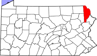
English: This is a locator map showing Wayne County in Pennsylvania. For more information, see Commons:United States county locator maps. |
| Date | |
| Source |
Own work: English: The maps use data from nationalatlas.gov, specifically countyp020.tar.gz on the Raw Data Download page. The maps also use state outline data from statesp020.tar.gz. The Florida maps use hydrogm020.tar.gz to display Lake Okeechobee. |
| Author | David Benbennick |
| SVG development |
Licensing[edit]
| I, the copyright holder of this work, release this work into the public domain. This applies worldwide. In some countries this may not be legally possible; if so: I grant anyone the right to use this work for any purpose, without any conditions, unless such conditions are required by law. |
File history
Click on a date/time to view the file as it appeared at that time.
| Date/Time | Thumbnail | Dimensions | User | Comment | |
|---|---|---|---|---|---|
| current | 16:23, 12 February 2006 | | 4,950 × 2,846 (106 KB) | David Benbennick (talk | contribs) | {{subst:User:Dbenbenn/clm|county=Wayne County|state=Pennsylvania|type=county}} |
You cannot overwrite this file.
File usage on Commons
The following 6 pages use this file:
File usage on other wikis
The following other wikis use this file:
- Usage on ar.wikipedia.org
- Usage on bg.wikipedia.org
- Usage on bpy.wikipedia.org
- Usage on cdo.wikipedia.org
- Usage on ceb.wikipedia.org
- Usage on cy.wikipedia.org
- Usage on de.wikipedia.org
- Usage on en.wikipedia.org
- List of counties in Pennsylvania
- Wayne County, Pennsylvania
- Berlin Township, Wayne County, Pennsylvania
- Bethany, Pennsylvania
- Buckingham Township, Wayne County, Pennsylvania
- Canaan Township, Pennsylvania
- Cherry Ridge Township, Wayne County, Pennsylvania
- Clinton Township, Wayne County, Pennsylvania
- Damascus Township, Wayne County, Pennsylvania
- Dreher Township, Wayne County, Pennsylvania
- Dyberry Township, Wayne County, Pennsylvania
- Hawley, Pennsylvania
- Honesdale, Pennsylvania
- Lake Township, Wayne County, Pennsylvania
- Lebanon Township, Wayne County, Pennsylvania
- Lehigh Township, Wayne County, Pennsylvania
- Manchester Township, Wayne County, Pennsylvania
- Mount Pleasant Township, Wayne County, Pennsylvania
- Oregon Township, Pennsylvania
- Palmyra Township, Wayne County, Pennsylvania
- Paupack Township, Pennsylvania
- Preston Township, Pennsylvania
- Prompton, Pennsylvania
- Salem Township, Wayne County, Pennsylvania
- Scott Township, Wayne County, Pennsylvania
- South Canaan Township, Pennsylvania
- Starrucca, Pennsylvania
- Sterling Township, Pennsylvania
- Texas Township, Pennsylvania
- Waymart, Pennsylvania
- Newfoundland, Pennsylvania
- Lake Ariel, Pennsylvania
- Orson, Pennsylvania
- Template:Wayne County, Pennsylvania
- Forest City Regional School District
- Equinunk, Pennsylvania
- Gouldsboro, Pennsylvania
- Starlight, Pennsylvania
- Lake Como, Pennsylvania
View more global usage of this file.