File:Map of Minnesota highlighting Cook County.svg
Jump to navigation
Jump to search

Size of this PNG preview of this SVG file: 527 × 600 pixels. Other resolutions: 211 × 240 pixels | 422 × 480 pixels | 675 × 768 pixels | 900 × 1,024 pixels | 1,800 × 2,048 pixels | 5,746 × 6,539 pixels.
Original file (SVG file, nominally 5,746 × 6,539 pixels, file size: 104 KB)
Captions
Captions
Add a one-line explanation of what this file represents
Summary
[edit]
| Description |
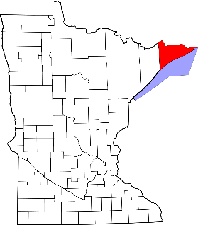
English: This is a locator map showing Cook County in Minnesota. For more information, see Commons:United States county locator maps. |
| Date | |
| Source |
Own work: English: The maps use data from nationalatlas.gov, specifically countyp020.tar.gz on the Raw Data Download page. The maps also use state outline data from statesp020.tar.gz. The Florida maps use hydrogm020.tar.gz to display Lake Okeechobee. |
| Author | David Benbennick |
Licensing
[edit]
| I, the copyright holder of this work, release this work into the public domain. This applies worldwide. In some countries this may not be legally possible; if so: I grant anyone the right to use this work for any purpose, without any conditions, unless such conditions are required by law. |
File history
Click on a date/time to view the file as it appeared at that time.
| Date/Time | Thumbnail | Dimensions | User | Comment | |
|---|---|---|---|---|---|
| current | 13:13, 12 February 2006 | | 5,746 × 6,539 (104 KB) | David Benbennick (talk | contribs) | {{subst:User:Dbenbenn/clm|county=Cook County|state=Minnesota|type=county}} |
| 13:02, 12 February 2006 |  | 5,746 × 6,539 (104 KB) | David Benbennick (talk | contribs) | {{subst:User:Dbenbenn/clm|county=Cook County|state=Minnesota|type=county}} |
You cannot overwrite this file.
File usage on Commons
The following 7 pages use this file:
- Category:Births in Cook County, Minnesota
- Category:Cook County, Minnesota
- Category:Cook County, Minnesota Image by Chris Light
- Category:Geography of Cook County, Minnesota
- Category:Maps of Cook County, Minnesota
- Category:People of Cook County, Minnesota
- Category:Populated places in Cook County, Minnesota
File usage on other wikis
The following other wikis use this file:
- Usage on ar.wikipedia.org
- Usage on bg.wikipedia.org
- Usage on bpy.wikipedia.org
- Usage on ca.wikipedia.org
- Usage on cdo.wikipedia.org
- Usage on ceb.wikipedia.org
- Usage on cy.wikipedia.org
- Usage on da.wikipedia.org
- Usage on de.wikipedia.org
- Usage on el.wikipedia.org
- Usage on en.wikipedia.org
- List of counties in Minnesota
- Cook County, Minnesota
- Grand Marais, Minnesota
- Lutsen Township, Cook County, Minnesota
- Schroeder Township, Cook County, Minnesota
- Tofte Township, Cook County, Minnesota
- East Cook, Minnesota
- Grand Portage, Minnesota
- West Cook, Minnesota
- Grand Portage Indian Reservation
- Sawbill Lake
- Carlton Peak
- Mount Reunion
- Moose Mountain (Minnesota)
- Template:Cook County, Minnesota
- Hovland, Minnesota
- Mallmann's Peak
- Lutsen, Minnesota
- Tofte, Minnesota
- Schroeder, Minnesota
- User:Nyttend/County templates/MN/1
- National Register of Historic Places listings in Cook County, Minnesota
- Crow Lake (Cook County, Minnesota)
- Croftville, Minnesota
- Taconite Harbor, Minnesota
- Chippewa City, Minnesota
- Cascade River (Minnesota)
- Cross River (Lake Superior)
- Devil Track River
- Flute Reed River
- Greenwood River (Brule River tributary)
View more global usage of this file.