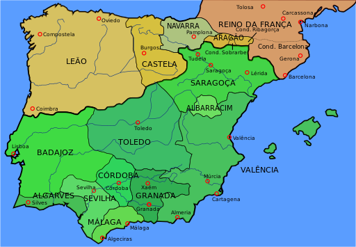
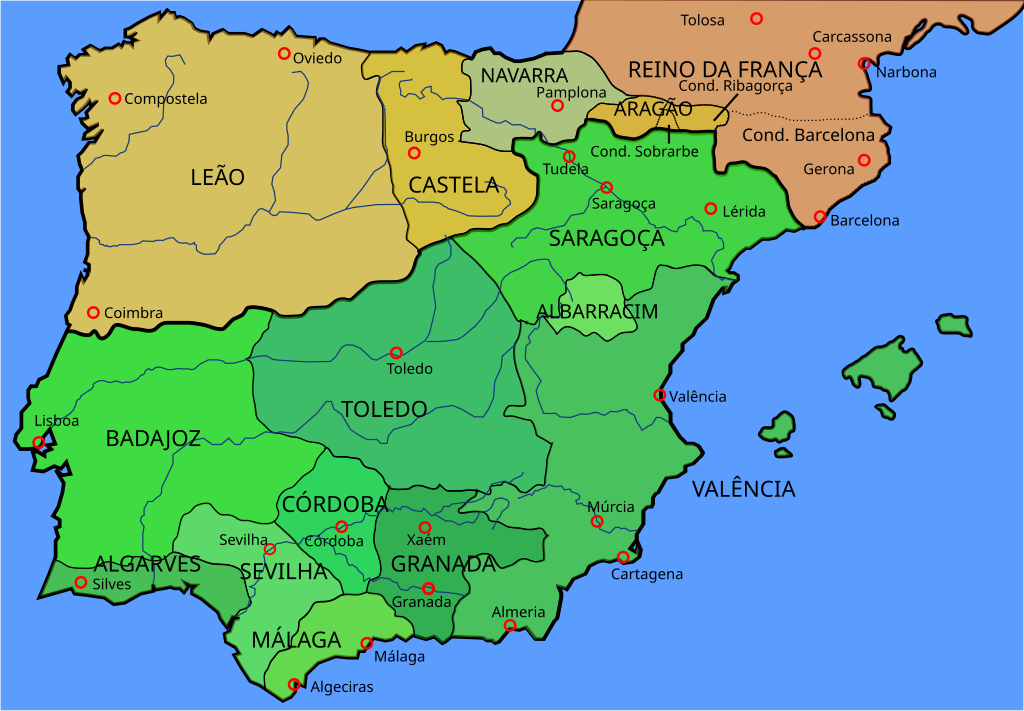
File:Map Iberian Peninsula 1037-pt.svg
Jump to navigation
Jump to search

Size of this PNG preview of this SVG file: 512 × 355 pixels. Other resolutions: 320 × 222 pixels | 640 × 444 pixels | 1,024 × 710 pixels | 1,280 × 888 pixels | 2,560 × 1,775 pixels.
Original file (SVG file, nominally 512 × 355 pixels, file size: 101 KB)
Captions
Captions
Add a one-line explanation of what this file represents
Summary[edit]
| Description |
Português: Península Ibérica em 1037 |
| Date | |
| Source |
This file was derived from: Map Iberian Peninsula 1037-es.svg: |
| Author | Phirosiberia (talk · contribs) |
| Other versions |
[]
See also[edit] |


Licensing[edit]
This file is licensed under the Creative Commons Attribution 3.0 Unported license.
- You are free:
- to share – to copy, distribute and transmit the work
- to remix – to adapt the work
- Under the following conditions:
- attribution – You must give appropriate credit, provide a link to the license, and indicate if changes were made. You may do so in any reasonable manner, but not in any way that suggests the licensor endorses you or your use.
File history
Click on a date/time to view the file as it appeared at that time.
| Date/Time | Thumbnail | Dimensions | User | Comment | |
|---|---|---|---|---|---|
| current | 18:43, 13 October 2015 | | 512 × 355 (101 KB) | Renato de Carvalho Ferreira (talk | contribs) | Correção de alguns topônimos |
| 01:21, 24 August 2014 |  | 827 × 574 (145 KB) | Renato de Carvalho Ferreira (talk | contribs) | User created page with UploadWizard |
You cannot overwrite this file.
File usage on Commons
The following 7 pages use this file:
File usage on other wikis
The following other wikis use this file:
- Usage on pt.wikipedia.org
Metadata
Categories:
- Maps showing 1037
- History of Catalonia
- Iberian kingdoms
- Maps of 11th-century Iberian Peninsula
- Maps of the Frankish territory
- Maps of the Kingdom of Aragon
- Maps of the Kingdom of León
- Maps showing 11th-century history
- Spanish-language SVG maps showing history of Europe
- Portuguese-language SVG maps showing history
- Maps of the taifa kingdoms
- Maps of the County of Barcelona
- 1037 in Spain