File:Maastricht1749LarcherDAubencourt2 (detail Vrijthof & 1e stadsmuur).jpg
Jump to navigation
Jump to search

Size of this preview: 625 × 600 pixels. Other resolutions: 250 × 240 pixels | 500 × 480 pixels | 801 × 768 pixels | 1,068 × 1,024 pixels | 1,301 × 1,248 pixels.
Original file (1,301 × 1,248 pixels, file size: 658 KB, MIME type: image/jpeg)
Captions
Captions
Add a one-line explanation of what this file represents
Summary[edit]
| Description |
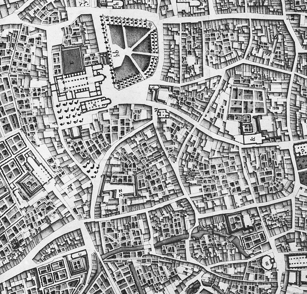
English: Maastricht, the Netherlands. Part of a map showing the southwestern part of the city in 1749. The map by French military engineer Jean-Baptiste Larcher d'Aubencourt was used to build the Maquette of Maastricht (1752), now in the Musée de Beaux Arts in Lille, France. The map (or a copy?) is in the collection of RHCL archives, Maastricht. |
| Date | |
| Source | http://beeldbank.cultureelerfgoed.nl/alle-afbeeldingen/weergave/search/layout/result/indeling/detail/start/2?searchfield=Larcher+d%5C%5C%5C%27Aubancourt |
| Author | Jean-Baptiste Larcher d'Aubencourt (1716–1796) |
| Other versions |

.jpg&action=edit§ion=1)
Licensing[edit]
.jpg&action=edit§ion=2)
|
This work is in the public domain in its country of origin and other countries and areas where the copyright term is the author's life plus 100 years or fewer. | |
| This file has been identified as being free of known restrictions under copyright law, including all related and neighboring rights. | |
File history
Click on a date/time to view the file as it appeared at that time.
| Date/Time | Thumbnail | Dimensions | User | Comment | |
|---|---|---|---|---|---|
| current | 16:46, 19 January 2024 | | 1,301 × 1,248 (658 KB) | Kleon3 (talk | contribs) | File:Maastricht1749LarcherDAubencourt2.jpg cropped 55 % horizontally, 42 % vertically, rotated -0.76° using CropTool with precise mode. |
You cannot overwrite this file.
File usage on Commons
The following 2 pages use this file:
.jpg&redirect=no)
File usage on other wikis
The following other wikis use this file:
- Usage on nl.wikipedia.org
.jpg&oldid=843460197)