File:Llancillo Ordnance Survey Herefordshire Sheet 32, 1 to 25,000 1951.jpg
Jump to navigation
Jump to search
Size of this preview: 800 × 493 pixels. Other resolutions: 320 × 197 pixels | 640 × 394 pixels | 1,024 × 631 pixels | 1,468 × 904 pixels.
Original file (1,468 × 904 pixels, file size: 1.63 MB, MIME type: image/jpeg)
Captions
Captions
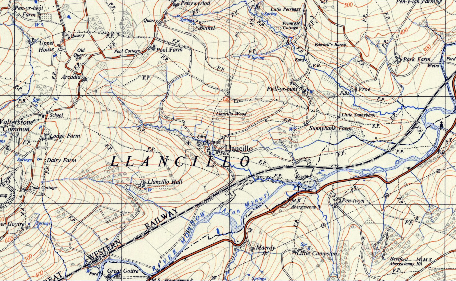
Llancillo in the Ordnance Survey Herefordshire Sheet 32, 1ː25,000 1951
Summary[edit]
| Description |
English: Llancillo, Herefordshire, detail in the Ordnance Survey map of Herefordshire Sheet 32, 1ː25,000 1951. Reproduced with the permission of the National Library of Scotland.[1] |
| Date | |
| Source | Ordnance Survey map 1951 |
| Author | Unknown author |
| Permission (Reusing this file) |
Public domain. OS maps become public domain 50 years after first publication, and include any subsequent reprint of the original, official or otherwise. This includes any republication from the original with adaptions, additions, redrawing, manipulation or incorporation into other images. |
Licensing[edit]
|
This work is in the public domain in its country of origin and other countries and areas where the copyright term is the author's life plus 70 years or fewer. This work is in the public domain in the United States because it was published (or registered with the U.S. Copyright Office) before January 1, 1929. | |
| This file has been identified as being free of known restrictions under copyright law, including all related and neighboring rights. | |
File history
Click on a date/time to view the file as it appeared at that time.
| Date/Time | Thumbnail | Dimensions | User | Comment | |
|---|---|---|---|---|---|
| current | 12:00, 1 June 2022 | | 1,468 × 904 (1.63 MB) | Acabashi (talk | contribs) | Uploaded own work with UploadWizard |
You cannot overwrite this file.
File usage on Commons
There are no pages that use this file.