File:Liberty Bridge, Falls Park on the Reedy, Greenville SC 20160701 1.jpg
Original file (4,565 × 5,706 pixels, file size: 10.26 MB, MIME type: image/jpeg)
Captions
Summary[edit]
DescriptionLiberty Bridge, Falls Park on the Reedy, Greenville SC 20160701 1.jpg |
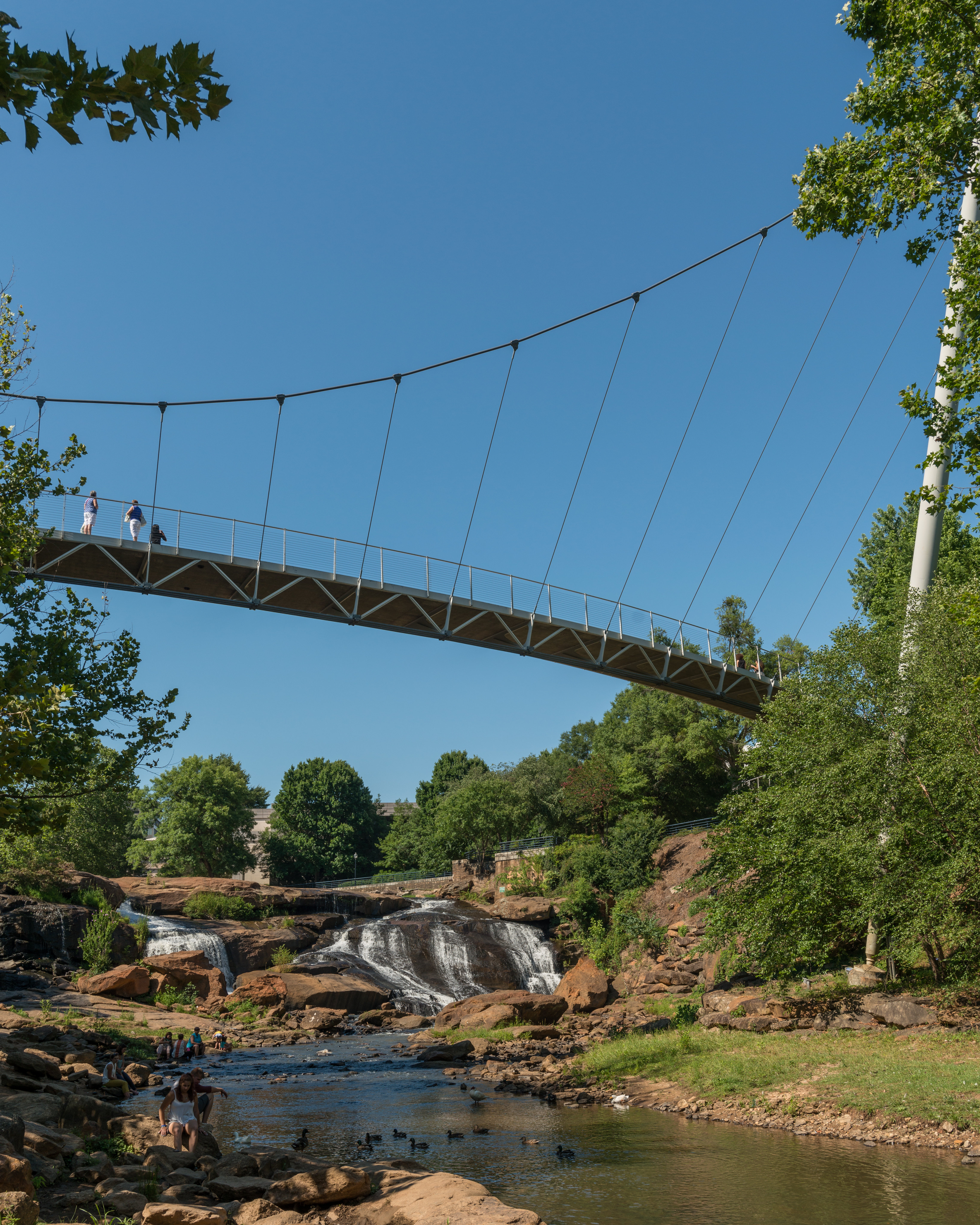
English: A south view of Liberty Bridge, Falls Park on the Reedy, Greenville, South Carolina |
Date | |
Source | Own work |
Author | DXR |
Camera location | 34° 50′ 39.47″ N, 82° 24′ 04.32″ W | View this and other nearby images on: OpenStreetMap | 34.844296; -82.401200 |
---|
Personality rightsAlthough this work is freely licensed or in the public domain, the person(s) shown may have rights that legally restrict certain re-uses unless those depicted consent to such uses. In these cases, a model release or other evidence of consent could protect you from infringement claims. Though not obliged to do so, the uploader may be able to help you to obtain such evidence. See our general disclaimer for more information. |
Licensing[edit]
- You are free:
- to share – to copy, distribute and transmit the work
- to remix – to adapt the work
- Under the following conditions:
- attribution – You must give appropriate credit, provide a link to the license, and indicate if changes were made. You may do so in any reasonable manner, but not in any way that suggests the licensor endorses you or your use.
- share alike – If you remix, transform, or build upon the material, you must distribute your contributions under the same or compatible license as the original.
This image has been assessed using the Quality image guidelines and is considered a Quality image.
العربية ∙ جازايرية ∙ беларуская ∙ беларуская (тарашкевіца) ∙ български ∙ বাংলা ∙ català ∙ čeština ∙ Cymraeg ∙ Deutsch ∙ Schweizer Hochdeutsch ∙ Zazaki ∙ Ελληνικά ∙ English ∙ Esperanto ∙ español ∙ eesti ∙ euskara ∙ فارسی ∙ suomi ∙ français ∙ galego ∙ עברית ∙ हिन्दी ∙ hrvatski ∙ magyar ∙ հայերեն ∙ Bahasa Indonesia ∙ italiano ∙ 日本語 ∙ Jawa ∙ ქართული ∙ 한국어 ∙ kurdî ∙ Lëtzebuergesch ∙ lietuvių ∙ македонски ∙ മലയാളം ∙ मराठी ∙ Bahasa Melayu ∙ Nederlands ∙ Norfuk / Pitkern ∙ polski ∙ português ∙ português do Brasil ∙ rumantsch ∙ română ∙ русский ∙ sicilianu ∙ slovenčina ∙ slovenščina ∙ shqip ∙ српски / srpski ∙ svenska ∙ தமிழ் ∙ తెలుగు ∙ ไทย ∙ Tagalog ∙ Türkçe ∙ toki pona ∙ українська ∙ vèneto ∙ Tiếng Việt ∙ 中文 ∙ 中文(简体) ∙ 中文(繁體) ∙ +/− |
File history
Click on a date/time to view the file as it appeared at that time.
Date/Time | Thumbnail | Dimensions | User | Comment | |
---|---|---|---|---|---|
current | 10:05, 5 February 2017 | 4,565 × 5,706 (10.26 MB) | DXR (talk | contribs) | Dust (LrMediaWiki 0.4) | |
17:30, 24 July 2016 | 4,565 × 5,706 (10.25 MB) | DXR (talk | contribs) | Uploaded with LrMediaWiki 0.4 |
You cannot overwrite this file.
File usage on Commons
The following 3 pages use this file:
Metadata
This file contains additional information such as Exif metadata which may have been added by the digital camera, scanner, or software program used to create or digitize it. If the file has been modified from its original state, some details such as the timestamp may not fully reflect those of the original file. The timestamp is only as accurate as the clock in the camera, and it may be completely wrong.
Camera manufacturer | NIKON CORPORATION |
---|---|
Camera model | NIKON D800 |
Author | Daniel Vorndran |
Copyright holder |
|
Exposure time | 1/320 sec (0.003125) |
F-number | f/7.1 |
ISO speed rating | 100 |
Date and time of data generation | 16:48, 1 July 2016 |
Lens focal length | 27 mm |
Latitude | 34° 50′ 39.47″ N |
Longitude | 82° 24′ 4.32″ W |
Altitude | 265.22 meters above sea level |
Short title |
|
City shown | Greenville |
Horizontal resolution | 240 dpi |
Vertical resolution | 240 dpi |
Software used | Adobe Photoshop Lightroom 5.7 (Windows) |
File change date and time | 11:04, 5 February 2017 |
Exposure Program | Aperture priority |
Exif version | 2.3 |
Date and time of digitizing | 16:48, 1 July 2016 |
APEX shutter speed | 8.321928 |
APEX aperture | 5.655638 |
APEX exposure bias | 0.33333333333333 |
Maximum land aperture | 4.2 APEX (f/4.29) |
Metering mode | Pattern |
Light source | Unknown |
Flash | Flash did not fire, compulsory flash suppression |
DateTimeOriginal subseconds | 10 |
DateTimeDigitized subseconds | 10 |
Focal plane X resolution | 2,048.4022216797 |
Focal plane Y resolution | 2,048.4022216797 |
Focal plane resolution unit | 3 |
Sensing method | One-chip color area sensor |
File source | Digital still camera |
Scene type | A directly photographed image |
Custom image processing | Normal process |
Exposure mode | Auto exposure |
White balance | Auto white balance |
Digital zoom ratio | 1 |
Focal length in 35 mm film | 27 mm |
Scene capture type | Standard |
Scene control | None |
Contrast | Normal |
Saturation | Normal |
Sharpness | Normal |
Subject distance range | Unknown |
GPS tag version | 0.0.2.2 |
Serial number of camera | 6129754 |
Lens used | 18.0-35.0 mm f/3.5-4.5 |
Date metadata was last modified | 12:04, 5 February 2017 |
Unique ID of original document | C0D7225D2DA0BC2899B0367BCB0FC876 |
Province or state shown | South Carolina |
Country shown | USA |
IIM version | 4 |
- Files with coordinates missing SDC location of creation
- Personality rights warning
- CC-BY-SA-4.0
- Uploads by User:DXR
- Uploads by User:DXR in South Carolina
- Uploads by User:DXR in 2016
- Uploaded with LrMediaWiki
- Quality Images by User:DXR
- Quality images of South Carolina
- Quality images
- Quality images missing SDC depicts
- Pages with maps