File:Lagekarte NSG Helgoländer Felssockel.png
Jump to navigation
Jump to search
Size of this preview: 551 × 600 pixels. Other resolutions: 220 × 240 pixels | 441 × 480 pixels | 845 × 920 pixels.
Original file (845 × 920 pixels, file size: 80 KB, MIME type: image/png)
Captions
Captions
Add a one-line explanation of what this file represents
Summary[edit]
| Description |
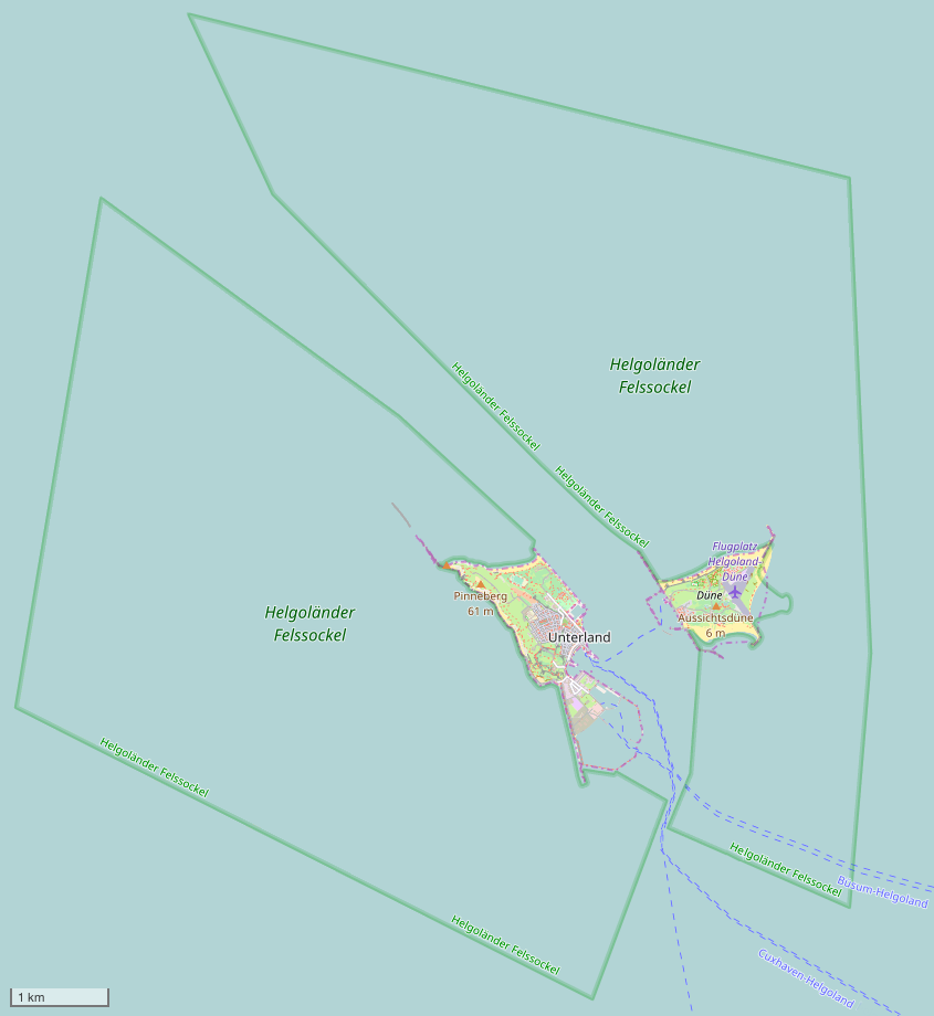
Deutsch: Lagekarte der zwei Teilflächen (grün umrandet) des Naturschutzgebiets „Helgoländer Felssockel“ in der Nordsee bei Helgoland. Das NSG umfasst den Felssockel (Meer) um Helgoland mit Ausnahme der Insel, der Düne und der Häfen. Landseitig, zur Insel und Düne hin, wird es durch die Mitteltide-Hochwasserlinie begrenzt. |
|||
| Date | ||||
| Source | www.openstreetmap.org | |||
| Author | © OpenStreetMap contributors, CC BY-SA | |||
| Permission (Reusing this file) |
This file is licensed under the Creative Commons Attribution-Share Alike 2.0 Generic license.
|
File history
Click on a date/time to view the file as it appeared at that time.
| Date/Time | Thumbnail | Dimensions | User | Comment | |
|---|---|---|---|---|---|
| current | 10:05, 13 February 2017 | | 845 × 920 (80 KB) | Holger1959 (talk | contribs) | {{Information |Description={{de|Lagekarte der zwei Teilflächen (grün umrandet) des Naturschutzgebiets „Helgoländer Felssockel“ in der Nordsee bei Helgoland.<br/>''Das NSG umfasst den Felssockel (Meer) um Helgoland mit Ausnahme der Insel, der Dü... |
You cannot overwrite this file.
File usage on Commons
The following 2 pages use this file:
File usage on other wikis
The following other wikis use this file:
- Usage on de.wikipedia.org
- Usage on www.wikidata.org