File:Kirovograd province physical map.svg
Jump to navigation
Jump to search

Size of this PNG preview of this SVG file: 533 × 291 pixels. Other resolutions: 320 × 175 pixels | 640 × 349 pixels | 1,024 × 559 pixels | 1,280 × 699 pixels | 2,560 × 1,398 pixels.
Original file (SVG file, nominally 533 × 291 pixels, file size: 500 KB)
Captions
Captions
Add a one-line explanation of what this file represents
Summary[edit]
| Description |
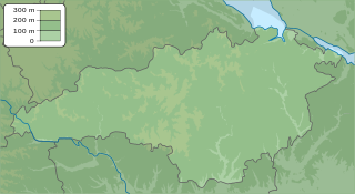
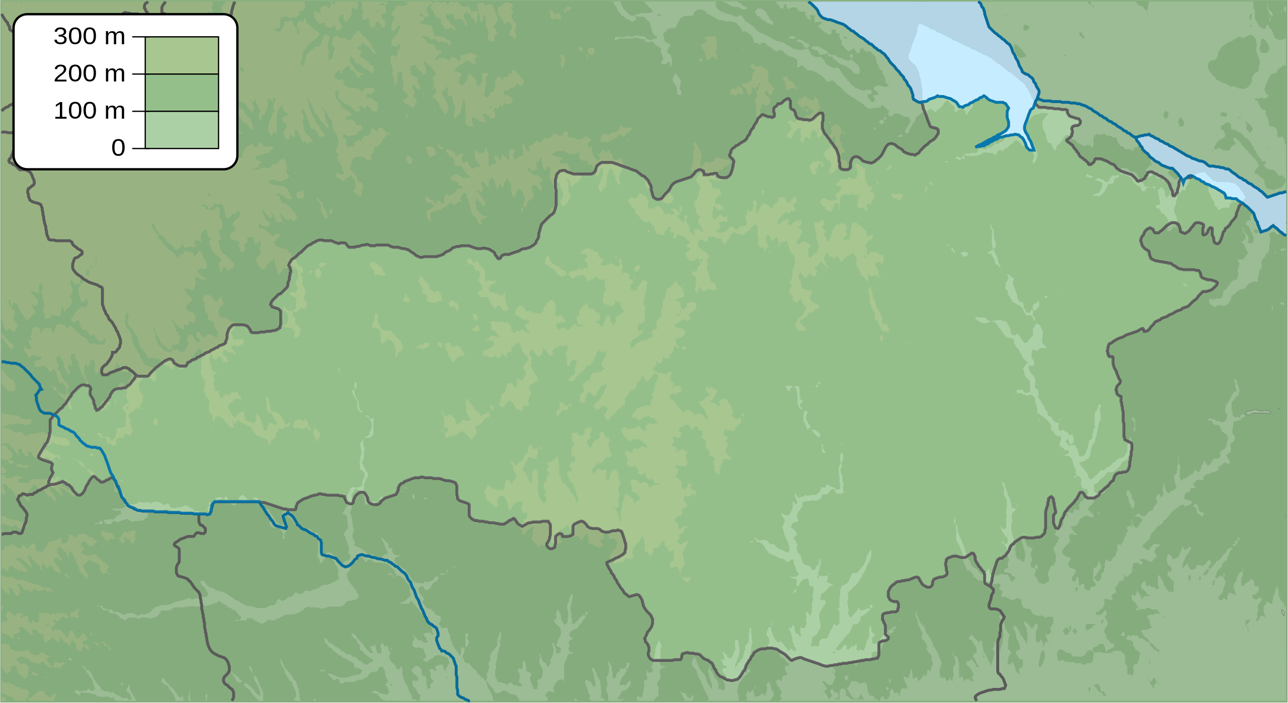
English: Physical map of Kirovograd province, Ukraine
Русский: Физическая карта Кировоградской области, Украина |
| Date | |
| Source | Own work |
| Author | Urutseg |
Licensing[edit]
| I, the copyright holder of this work, release this work into the public domain. This applies worldwide. In some countries this may not be legally possible; if so: I grant anyone the right to use this work for any purpose, without any conditions, unless such conditions are required by law. |
File history
Click on a date/time to view the file as it appeared at that time.
| Date/Time | Thumbnail | Dimensions | User | Comment | |
|---|---|---|---|---|---|
| current | 17:27, 15 December 2010 | | 533 × 291 (500 KB) | Urutseg (talk | contribs) | == {{int:filedesc}} == {{Information |Description={{en|1=Physical map of Kirovograd province, Ukraine}} {{ru|1=Физическая карта Кировоградской области, Украина}} |Source={{own}} |Author=Urutseg | |
You cannot overwrite this file.
File usage on Commons
There are no pages that use this file.
File usage on other wikis
The following other wikis use this file:
- Usage on ar.wikipedia.org
- Usage on be.wikipedia.org
- Usage on bg.wikipedia.org
- Usage on ce.wikipedia.org
- Usage on da.wikipedia.org
- Usage on de.wikipedia.org
- Usage on en.wikipedia.org
- Usage on eo.wikipedia.org
- Usage on es.wikipedia.org
- Usage on fi.wikipedia.org
- Usage on frr.wikipedia.org
- Usage on fr.wikipedia.org
- Kropyvnytskyï
- Bobrynets
- Dolynska
- Haïvoron
- Mala Vyska
- Novomyrhorod
- Novooukraïnka
- Oleksandria
- Blahovichtchenske
- Pomitchna
- Svitlovodsk
- Znamianka
- Petrove (oblast de Kirovohrad)
- Modèle:Géolocalisation/Oblast de Kirovohrad
- Vlassivka (oblast de Kirovohrad)
- Smoline
- Oleksandrivka (oblast de Kirovohrad)
- Holovanivsk
- Mochoryne
View more global usage of this file.