File:Kingdoms of Israel and Judah map 830-es.svg
Jump to navigation
Jump to search

Size of this PNG preview of this SVG file: 503 × 600 pixels. Other resolutions: 201 × 240 pixels | 402 × 480 pixels | 644 × 768 pixels | 858 × 1,024 pixels | 1,717 × 2,048 pixels | 768 × 916 pixels.
Original file (SVG file, nominally 768 × 916 pixels, file size: 393 KB)
Captions
Captions
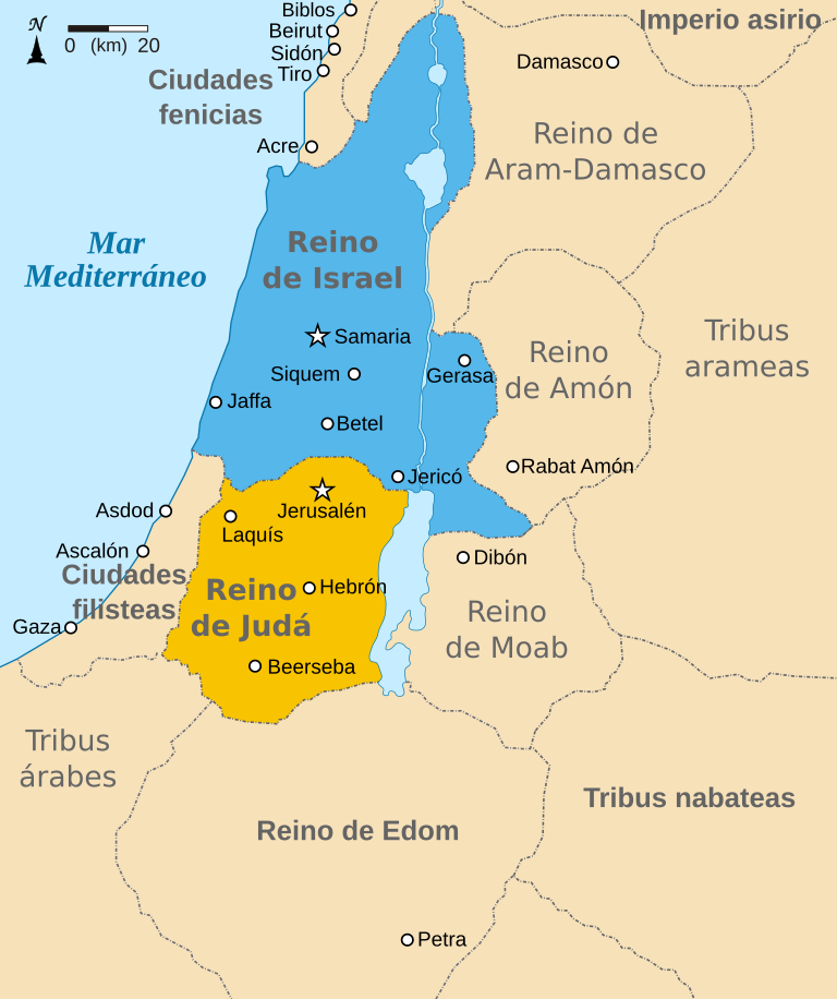
kingdoms of Israel and Judah map.
| Description |
Español: Mapa mostrando los reinos de Israel (azul) y de Judá (naranja) showing the Kingdoms of Israel (blue) and Judah (orange), antiguas fronteras levantinas y ciudades como Damasco y Gerasa. El mapa muestra la región en torno al siglo IX a. C. |
| Date | (UTC) |
| Source | |
| Author |
|
| Other versions |
[]
|


| This is a retouched picture, which means that it has been digitally altered from its original version. Modifications: translated to Spanish. The original can be viewed here: Kingdoms of Israel and Judah map 830.svg:
|
I, the copyright holder of this work, hereby publish it under the following licenses:
This file is licensed under the Creative Commons Attribution-Share Alike 3.0 Unported license.
- You are free:
- to share – to copy, distribute and transmit the work
- to remix – to adapt the work
- Under the following conditions:
- attribution – You must give appropriate credit, provide a link to the license, and indicate if changes were made. You may do so in any reasonable manner, but not in any way that suggests the licensor endorses you or your use.
- share alike – If you remix, transform, or build upon the material, you must distribute your contributions under the same or compatible license as the original.

|
Permission is granted to copy, distribute and/or modify this document under the terms of the GNU Free Documentation License, Version 1.2 or any later version published by the Free Software Foundation; with no Invariant Sections, no Front-Cover Texts, and no Back-Cover Texts. A copy of the license is included in the section entitled GNU Free Documentation License. |
You may select the license of your choice.
Original upload log[edit]
This image is a derivative work of the following images:
- File:Kingdoms_of_Israel_and_Judah_map_830.svg licensed with Cc-by-sa-3.0, GFDL
- 2010-07-13T11:29:47Z Richardprins 720x859 (80899 Bytes) Fixed Judah color
- 2010-07-13T10:51:49Z Richardprins 720x859 (80858 Bytes) Added colors for the two kingdoms and converted their text to path and arial
- 2010-07-12T23:53:35Z Richardprins 720x859 (63843 Bytes) Shrinked down the borders
- 2010-07-12T19:43:31Z Richardprins 720x859 (63800 Bytes) {{Information |Description={{en|1=Map showing the ancient levant borders and ancient cities such as [[Urmomium]] and [[Jerash]]. The map also shows the region in the 9th century BCE. Notice the coastal land of Philistia, from
Uploaded with derivativeFX
File history
Click on a date/time to view the file as it appeared at that time.
| Date/Time | Thumbnail | Dimensions | User | Comment | |
|---|---|---|---|---|---|
| current | 07:28, 20 March 2017 | | 768 × 916 (393 KB) | Rowanwindwhistler (talk | contribs) | Fake text added |
| 18:22, 23 September 2010 |  | 720 × 859 (65 KB) | Kordas (talk | contribs) | {{Information |Description={{es|1=Mapa mostrando los reinos de Israel (azul) y de Judá (naranja) showing the Kingdoms of Israel (blue) and Judah (orange), antiguas fronteras levantinas y ciudades como Damasco y Gerasa. El mapa muestra la región en torno |
You cannot overwrite this file.
File usage on Commons
The following 30 pages use this file:
- User:Geagea/Israel/2017 March 20
- File:Amón 830-es.svg
- File:Edom 830-es.svg
- File:Kingdoms around Israel 830 map-el.svg
- File:Kingdoms around Israel 830 map-nl.svg
- File:Kingdoms around Israel 830 map-pt.svg
- File:Kingdoms around Israel 830 map.svg
- File:Kingdoms around Israel 830 map mk.svg
- File:Kingdoms around Israel 830 map sh.svg
- File:Kingdoms around Israel 830 map sr.svg
- File:Kingdoms of Israel and Judah map 830-ar.svg
- File:Kingdoms of Israel and Judah map 830-el.svg
- File:Kingdoms of Israel and Judah map 830-es.svg
- File:Kingdoms of Israel and Judah map 830-hu.svg
- File:Kingdoms of Israel and Judah map 830-nl.svg
- File:Kingdoms of Israel and Judah map 830-pt.svg
- File:Kingdoms of Israel and Judah map 830.svg
- File:Kingdoms of Israel and Judah map 830 zh.svg
- File:Levant 830-HE-2.svg
- File:Levant 830-HE.svg
- File:Levant 830-rus.svg
- File:Levant 830.svg
- File:Levant 830 map-pt.svg
- File:Levant hu.svg
- File:Levante 830-es.svg
- File:Moab 830-es.svg
- File:Royaumes autour d'Israel en 830.svg
- File:イスラエル王国とユダ王国.svg
- Template:Other versions/Kingdoms around Israel 830 map
- Template:Other versions/Kingdoms of Israel and Juda map 830
File usage on other wikis
The following other wikis use this file:
- Usage on ast.wikipedia.org
- Usage on ca.wikipedia.org
- Usage on es.wikipedia.org
- Usage on eu.wikipedia.org
- Usage on gl.wikipedia.org
- Usage on wuu.wikipedia.org