File:Kingdoms around Israel 830 map-es.svg
Jump to navigation
Jump to search

Size of this PNG preview of this SVG file: 503 × 600 pixels. Other resolutions: 201 × 240 pixels | 402 × 480 pixels | 644 × 768 pixels | 858 × 1,024 pixels | 1,717 × 2,048 pixels | 768 × 916 pixels.
Original file (SVG file, nominally 768 × 916 pixels, file size: 228 KB)
Captions
Captions
Add a one-line explanation of what this file represents
Summary[edit]
| Description |
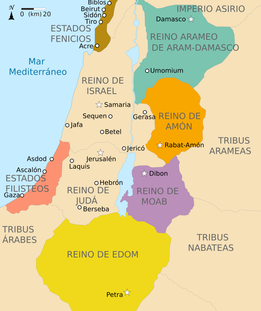
Português: Mapa dos Estados vizinhos aos Reinos de Judá e Israel ca. 830 a.C. Español: Los reinos de Judá e Israel y los Estados vecinos hacia el 830 a. de C. |
| Date | |
| Source |
This file was derived from: Kingdoms around Israel 830 map-pt.svg : Richardprins |
| Author |
|
Licensing[edit]
I, the copyright holder of this work, hereby publish it under the following license:
This file is licensed under the Creative Commons Attribution-Share Alike 3.0 Unported license.
- You are free:
- to share – to copy, distribute and transmit the work
- to remix – to adapt the work
- Under the following conditions:
- attribution – You must give appropriate credit, provide a link to the license, and indicate if changes were made. You may do so in any reasonable manner, but not in any way that suggests the licensor endorses you or your use.
- share alike – If you remix, transform, or build upon the material, you must distribute your contributions under the same or compatible license as the original.
File history
Click on a date/time to view the file as it appeared at that time.
| Date/Time | Thumbnail | Dimensions | User | Comment | |
|---|---|---|---|---|---|
| current | 07:27, 20 March 2017 | | 768 × 916 (228 KB) | Rowanwindwhistler (talk | contribs) | Fake text added |
| 18:34, 15 July 2014 |  | 720 × 859 (46 KB) | Rowanwindwhistler (talk | contribs) | User created page with UploadWizard |
You cannot overwrite this file.
File usage on Commons
The following page uses this file:
File usage on other wikis
The following other wikis use this file:
- Usage on es.wikipedia.org