File:JRF Onagigawa station as of 1989.jpg
Jump to navigation
Jump to search

Size of this preview: 511 × 600 pixels. Other resolutions: 204 × 240 pixels | 409 × 480 pixels | 654 × 768 pixels | 872 × 1,024 pixels | 1,745 × 2,048 pixels | 3,015 × 3,539 pixels.
Original file (3,015 × 3,539 pixels, file size: 2.82 MB, MIME type: image/jpeg)
Captions
Captions
Add a one-line explanation of what this file represents
Summary[edit]
| Description | |
| Date | |
| Source | http://w3land.mlit.go.jp/cgi-bin/WebGIS2/WC_AirPhoto.cgi?IT=p&DT=n&PFN=CKT-89-3&PCN=C6A&IDX=36 |
| Author | The Ministry of Land, Infrastructure and Transport of Japan |
| Other versions |

Licensing[edit]

|
The copyright holder of this file, the Ministry of Land, Infrastructure, Transport and Tourism of Japan, allows anyone to use it for any purpose, provided that the copyright holder is properly attributed. Redistribution, derivative work, commercial use, and all other use is permitted. |
Attribution:
Copyright © National Land Image Information (Color Aerial Photographs), Ministry of Land, Infrastructure, Transport and Tourism
|
 |
This image is copyrighted by the Ministry of Land, Infrastructure, Transport and Tourism of Japan. For terms of use, see the stipulation to use of National Land Information (in Japanese) and message from MLIT (in Japanese and English). When you display this image on an article, include the following phrase in the description: "Made based on National Land Image Information (Color Aerial Photographs), Ministry of Land, Infrastructure, Transport and Tourism".
|
File history
Click on a date/time to view the file as it appeared at that time.
| Date/Time | Thumbnail | Dimensions | User | Comment | |
|---|---|---|---|---|---|
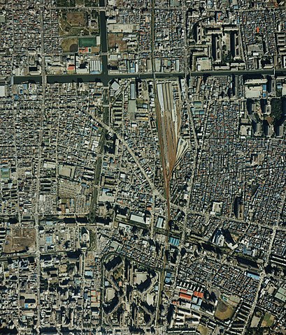
| current | 09:30, 24 September 2008 | | 3,015 × 3,539 (2.82 MB) | LERK (talk | contribs) | {{Information| Description={{en|Onagigawa Station(Sōbu Main Line) from satellite in 1989}}{{ja|小名木川駅(総武本線)の衛星写真、1989年(平 |
You cannot overwrite this file.
File usage on Commons
The following page uses this file: