File:Indonesia provinces blank map-AR.png
Jump to navigation
Jump to search

Size of this preview: 800 × 375 pixels. Other resolutions: 320 × 150 pixels | 640 × 300 pixels | 1,024 × 481 pixels | 1,280 × 601 pixels | 3,966 × 1,861 pixels.
Original file (3,966 × 1,861 pixels, file size: 967 KB, MIME type: image/png)
Captions
Captions
Add a one-line explanation of what this file represents
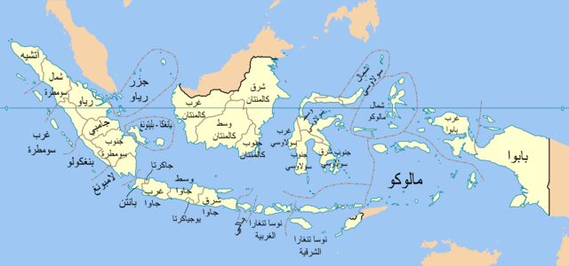
| Description | Indonesia provinces map in Indonesian |
| Date | (UTC) |
| Source | |
| Author |
|
| This is a retouched picture, which means that it has been digitally altered from its original version. Modifications: Translate into Arabic. The original can be viewed here: Indonesia provinces blank map.svg:
|
This file is licensed under the Creative Commons Attribution-Share Alike 3.0 Unported license.
- You are free:
- to share – to copy, distribute and transmit the work
- to remix – to adapt the work
- Under the following conditions:
- attribution – You must give appropriate credit, provide a link to the license, and indicate if changes were made. You may do so in any reasonable manner, but not in any way that suggests the licensor endorses you or your use.
- share alike – If you remix, transform, or build upon the material, you must distribute your contributions under the same or compatible license as the original.
Original upload log[edit]
This image is a derivative work of the following images:
- File:Indonesia_provinces_blank_map.svg licensed with Cc-by-sa-3.0-migrated, GFDL
- 2007-02-21T11:04:30Z Bwmodular 1322x620 (398286 Bytes) Added border between Bali and West Nusa Tenggara. Removed arrow from strait between Bali and Lombok.
- 2007-02-07T10:24:05Z Bwmodular 1322x620 (397362 Bytes) Same as previous version, have just tidied up provincial boundaries so they don't poke out beyond coastal boundaries.
- 2007-02-05T17:28:24Z Bwmodular 1322x620 (397362 Bytes) Identical to previous version, just tidying up some of the boundary lines so they don't spill into the ocean.
- 2007-01-20T23:03:54Z Indon 1322x620 (396953 Bytes) {{Information |Description= Indonesia provinces blank map |Source= Base map is [[:Image:Southeast asia.svg]] |Date=2007 |Author=[[:en:User:Indon]] |Permission={{GFDL self}} |other_versions= }} {{Base map|w:Wikipedia:WikiProje
Uploaded with derivativeFX
File history
Click on a date/time to view the file as it appeared at that time.
| Date/Time | Thumbnail | Dimensions | User | Comment | |
|---|---|---|---|---|---|
| current | 03:31, 26 November 2009 | | 3,966 × 1,861 (967 KB) | Ciphers (talk | contribs) | {{Information |Description=Indonesia provinces map in Arabic |Source=*File:Indonesia_provinces_blank_map.svg |Date=2009-11-26 03:30 (UTC) |Author=*File:Indonesia_provinces_blank_map.svg: en:User:Indon *derivative work: ~~~ |Permission=see |
You cannot overwrite this file.
File usage on Commons
There are no pages that use this file.
File usage on other wikis
The following other wikis use this file:
- Usage on ar.wikipedia.org