File:ICAC Map-World.png
Jump to navigation
Jump to search

Size of this preview: 800 × 351 pixels. Other resolutions: 320 × 140 pixels | 640 × 281 pixels | 1,425 × 625 pixels.
Original file (1,425 × 625 pixels, file size: 34 KB, MIME type: image/png)
Captions
Captions
Add a one-line explanation of what this file represents
| Description |
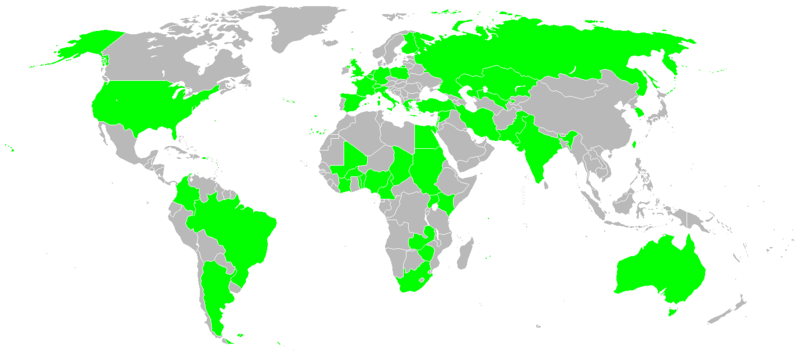
en map of members of the INTERNATIONAL COTTON ADVISORY COMMITTEE icac.org Derrived from a blank map of the world as of 2008, with country outlines, for making country locator maps. This map uses the Robinson projection centered on the Greenwich Prime Meridian and includes various microstates and island nations. All territories indicated in the UN listing of territories and regions are exhibited. The map was made by User:Vardion and adapted by User:E Pluribus Anthony for Wikipedia. Version with additional miscellaneous islands at Image:BlankMap-World-alt.png. Also see v2 and v4 for versions with micro-states, and v3 and v5 for versions with microstates + thin lines joining country areas. A version of this map is available with black lines for borders at Image:BlankMap-World-Borders.png. Other blank maps are available at Wikipedia:Blank maps and Category:Blank maps of the world If you plan on generating a new map for wikipedia by zooming in on this map and making some modifications, please consider a source map in SVG format instead, which will produce a higher quality image. These can be found in the SVG section at Wikipedia:Blank Maps
|
| Date | (UTC) |
| Source | |
| Author |
|

| This is a retouched picture, which means that it has been digitally altered from its original version. The original can be viewed here: BlankMap-World.png:
|
| I, the copyright holder of this work, release this work into the public domain. This applies worldwide. In some countries this may not be legally possible; if so: I grant anyone the right to use this work for any purpose, without any conditions, unless such conditions are required by law. |
Original upload log[edit]
This image is a derivative work of the following images:
- Image:BlankMap-World.png licensed with PD-user
- 2008-09-27T10:52:47Z Hoshie 1425x625 (58087 Bytes) Re-added Kosovo; see [[Image talk:Continental-Europe-map.png#Kosovo - a solution]]
- 2008-09-16T00:00:45Z Tocino 1425x625 (58067 Bytes) Reverted to version as of 17:22, 15 September 2008
- 2008-09-15T20:44:31Z Cradel 1425x625 (58091 Bytes) Reverted to version as of 19:25, 14 September 2008
- 2008-09-15T17:22:47Z Tocino 1425x625 (58067 Bytes) Reverted to version as of 07:29, 14 September 2008
- 2008-09-14T19:25:58Z Cradel 1425x625 (58091 Bytes) Reverted to version as of 13:33, 11 September 2008
- 2008-09-14T07:29:32Z Hoshie 1425x625 (58067 Bytes) removed Kosovo from a previous version of the map so that changes made before can show
- 2008-09-11T13:33:05Z EmilJ 1425x625 (58091 Bytes) Reverted to version as of 04:01, 12 April 2008
- 2008-07-31T14:48:33Z Avala 1425x625 (15167 Bytes)
- 2008-04-12T04:01:57Z Hoshie 1425x625 (58091 Bytes) added St. John (USVI), St. Pierre and Miquelon, Turks and Caicos
- 2008-04-05T07:54:33Z Hoshie 1425x625 (58019 Bytes) redrew Kosovo; added the insular parts of the French S. and Antarctic Lands based off of [[:Image:TAAF-CIA WFB Map.png]]
- 2008-02-17T17:00:48Z IAMTHEEGGMAN 1425x625 (58032 Bytes) Kosovo has declared independence from Serbia
- 2008-01-26T17:10:27Z Time3000 1425x625 (15167 Bytes) Optimise using Optipng, AdvanceCOMP and PNGOUT
- 2007-11-26T19:57:31Z Hoshie 1425x625 (50585 Bytes) re-drew Australia's indian ocean territories
- 2007-11-09T23:35:30Z Hoshie 1425x625 (50603 Bytes) added Christmas Island % Cocos (Keeling) Islands and redrew Cabinda (Angola); under same lic. as before.
- 2007-11-05T03:59:57Z Wiz9999 1425x625 (50585 Bytes) Fixed colour issue in Luxembourg
- 2007-10-04T00:12:32Z R-41 1425x625 (31038 Bytes) Corrected the size of a British island added on the English Channel and corrected the size and position of two Greek islands on Greece's western coast.
- 2007-09-25T11:12:30Z Hoshie 1425x625 (50558 Bytes) added Clipperton Island, St. Barthelemy, St. Martin, Yns Mon (Anglesey), the Isle of Wight. the Chagos (BIOT), SBAs on Cyprus, and Lough Neagh in NI. under same lic. as before.
- 2007-09-08T03:16:35Z R-41 1425x625 (31033 Bytes) Added two lakes near the Finnish-Russian border
- 2007-09-04T17:26:35Z R-41 1425x625 (30993 Bytes) Removed visability of Suez Canal, it probably is very narrow, and unlikely to easily be seen
- 2007-09-04T16:22:08Z R-41 1425x625 (30995 Bytes) Gibaltrer fixed
- 2007-09-04T15:59:23Z R-41 1425x625 (30995 Bytes) added more detail to Spain and other areas
- 2007-09-04T00:59:32Z R-41 1425x625 (30973 Bytes) Corrected various borders with more detail and gave more detail to some of the continents and islands as best as possible
- 2007-09-03T18:29:54Z R-41 1425x625 (30846 Bytes) Fixed up Indonesia more, with more detail as well as Russia
- 2007-09-03T14:52:49Z R-41 1425x625 (30554 Bytes) Corrected an earlier revision I made to Europe
- 2007-08-30T20:02:31Z R-41 1425x625 (30540 Bytes) Fixed up some overly simplified sections of South America, North and South Korea, Europe.
- 2007-08-20T22:05:58Z R-41 1425x625 (30217 Bytes) Fixed up a lot of areas, such as Canada, Greece, Japan the Baltic, Indonesia, Greenland, and the Philippines and some other minor changes
- 2007-06-07T13:43:08Z Aivazovsky 1425x625 (29236 Bytes) Fixed the Maldives and added islands off the coast of Iran
- 2007-04-05T00:43:06Z David Levy 1425x625 (13984 Bytes) better compression
- 2007-03-15T23:56:17Z Aivazovsky 1425x625 (29157 Bytes) Fixing Cyprus
- 2007-03-06T03:17:13Z Hoshie 1425x625 (48475 Bytes) added Gibraltar, Madeira, WSBA/ESBA, and SGSSI. Locator maps were used for Madeira and SGSSI.
- 2007-02-15T13:07:39Z Aivazovsky 1425x625 (29089 Bytes) Adding bodies of water
- 2007-02-15T12:47:44Z Aivazovsky 1425x625 (28828 Bytes) Fixing Slovenia and Cyprus
- 2007-02-13T01:31:03Z David Levy 1425x625 (13538 Bytes) better compression
- 2007-01-28T06:43:15Z Wiz9999 1427x628 (48255 Bytes) Fixed some odd colouring issues with Algeria and Germany's border.
- 2006-12-24T00:31:03Z David Levy 1425x625 (13888 Bytes) better compression
- 2006-12-19T08:17:31Z Hoshie 1427x628 (50888 Bytes) Minor fixes for Singapore, Montenegro, and Monaco. Under same license as orginal.
- 2006-12-18T02:21:49Z Murraybuckley 1427x628 (29693 Bytes)
- 2006-12-18T02:20:10Z Murraybuckley 1427x628 (29690 Bytes)
- 2006-12-15T08:41:07Z Roke 1427x628 (48162 Bytes) Reverted to earlier revision
- 2006-12-12T18:49:56Z David Levy 1425x625 (18056 Bytes) better compression
- 2006-12-08T06:14:29Z Hoshie 1427x628 (48162 Bytes) Added Cabinda. Under same license as original.
- 2006-11-26T02:16:09Z Hexagon1 1427x628 (48218 Bytes) fix polish off-colour blotches
- 2006-10-15T13:05:07Z Nádvorník 1427x628 (30898 Bytes) White baltic Sea
- 2006-08-09T12:58:40Z Satesclop 1427x628 (48356 Bytes)
- 2006-06-26T13:11:59Z 334a 1427x628 (29062 Bytes) Reverted to earlier revision
- 2006-06-15T13:55:44Z Stern 1350x625 (29550 Bytes) Reverted to earlier revision
- 2006-06-09T10:36:41Z Aivazovsky 1427x628 (29062 Bytes)
- 2006-06-09T01:34:31Z Aivazovsky 1427x628 (29124 Bytes) Fixing odd coloring mistakes
- 2006-06-09T01:24:14Z Aivazovsky 1427x628 (29199 Bytes) Just the same as before except it includes Hawaii, the Galápagos Islands, the Canary Islands, and more detailed borders on Armenia and Nakhichevan.
- 2006-06-05T02:41:07Z Roke 1350x625 (29550 Bytes) montenegro independent
File history
Click on a date/time to view the file as it appeared at that time.
| Date/Time | Thumbnail | Dimensions | User | Comment | |
|---|---|---|---|---|---|
| current | 19:43, 18 November 2008 | | 1,425 × 625 (34 KB) | T L Miles (talk | contribs) | {{Information |Description=''en'' map of members of the INTERNATIONAL COTTON ADVISORY COMMITTEE icac.org Derrived from a blank map of the world as of 2008, with country outlines, for making country locator maps. This map uses the [[:en:Robinson projec |
You cannot overwrite this file.
File usage on Commons
There are no pages that use this file.
File usage on other wikis
The following other wikis use this file:
- Usage on es.wikipedia.org
- Usage on fr.wikipedia.org
- Usage on it.wikipedia.org
- Usage on www.wikidata.org