File:HulaHebrew.svg
Jump to navigation
Jump to search

Size of this PNG preview of this SVG file: 374 × 599 pixels. Other resolutions: 150 × 240 pixels | 300 × 480 pixels | 479 × 768 pixels | 639 × 1,024 pixels | 1,279 × 2,048 pixels | 534 × 855 pixels.
Original file (SVG file, nominally 534 × 855 pixels, file size: 124 KB)
Captions
Captions
Add a one-line explanation of what this file represents
| Description |
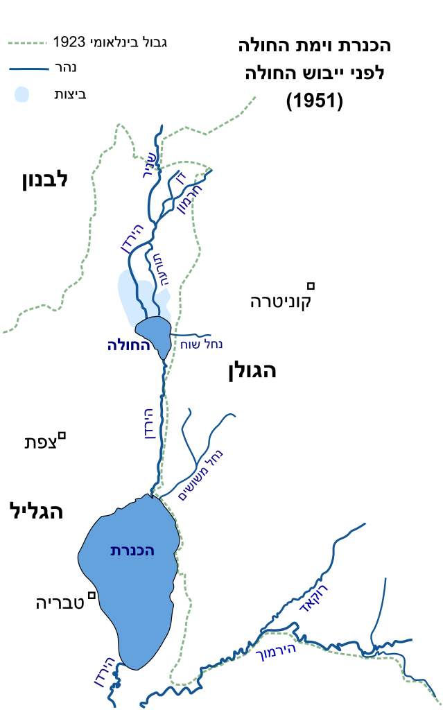
עברית: מקורות המים בצפון מזרח הגליל לפני ייבוש אגם החולה ב-1951 English: Hebrew map of water sources NE part of the Galilee before 1951 |
||
| Source | Own work | ||
| Author | Drork | ||
| Permission (Reusing this file) |
|
File history
Click on a date/time to view the file as it appeared at that time.
| Date/Time | Thumbnail | Dimensions | User | Comment | |
|---|---|---|---|---|---|
| current | 18:59, 30 August 2008 | | 534 × 855 (124 KB) | Drork (talk | contribs) | {{Information |Description={{he|מקורות המים בצפון מזרח הגליל '''לפני''' ייבוש אגם החולה ב-1951}} {{en|Hebrew map of water sources NE part of the Galilee before 1951}} |Source=self-made |Date= |Author= [[User:Drork |
You cannot overwrite this file.
File usage on Commons
The following 2 pages use this file:
.png)