File:Hooker Valley Pano2 MC.jpg
Jump to navigation
Jump to search
Size of this preview: 800 × 446 pixels. Other resolutions: 320 × 178 pixels | 640 × 357 pixels | 1,024 × 571 pixels | 1,280 × 713 pixels | 3,589 × 2,000 pixels.
Original file (3,589 × 2,000 pixels, file size: 3.65 MB, MIME type: image/jpeg)
Captions
Captions
Add a one-line explanation of what this file represents
| Camera location | | View this and other nearby images on: OpenStreetMap |
|---|
| Description |
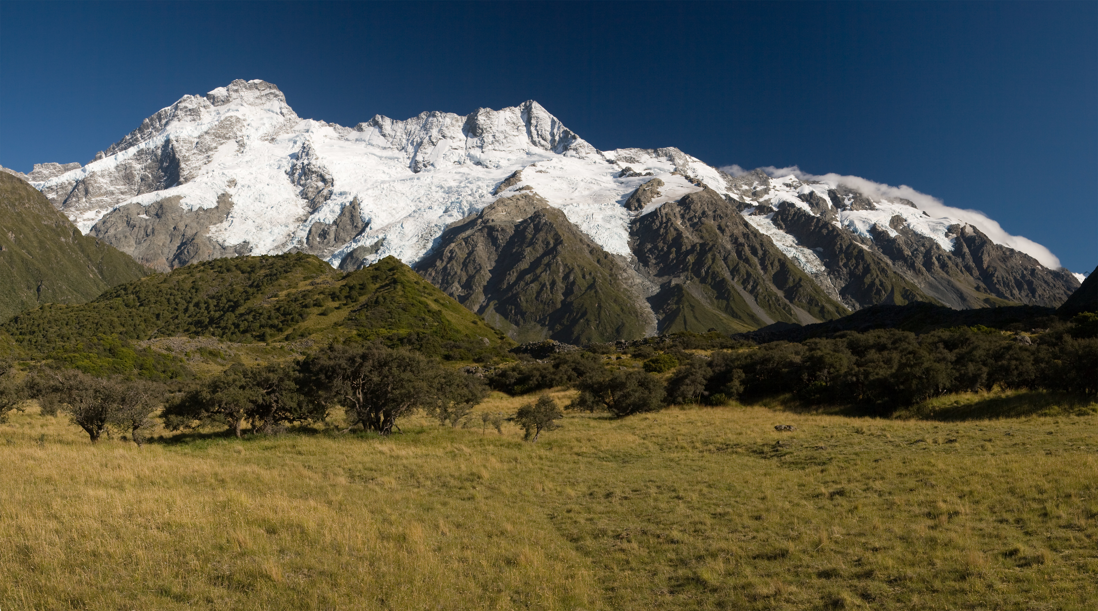
Deutsch: Die Main Divide mit Mt. Sefton und The Footstool, vom Hooker Valley aus gesehen. Panorama zusammengesetzt aus 4 Hochformatbildern.
English: The Main Divide with Mt. Sefton and The Footstool, view from Hooker Valley. Panorama stitched from 4 portrait format images.
Français : Paysage des Alpes du Sud de la Nouvelle-Zélande, depuis la Hooker Valley. On peut voir le Mont Sefton et The Footstool. Image panoramique obtenue en assemblant quatre images format portrait. |
| Date | |
| Source | Own work |
| Author | Christian Mehlführer, User:Chmehl |
| Permission (Reusing this file) |
This file is licensed under the Creative Commons Attribution 2.5 Generic license.
|
| Other versions |
 |
This image has been assessed using the Quality image guidelines and is considered a Quality image.
|
File history
Click on a date/time to view the file as it appeared at that time.
| Date/Time | Thumbnail | Dimensions | User | Comment | |
|---|---|---|---|---|---|
| current | 17:03, 24 March 2008 | | 3,589 × 2,000 (3.65 MB) | Chmehl (talk | contribs) | {{Location|43|43|6.1|S|170|6|0.2|E|type:landmark}} {{Information |Description={{de|Die Main Divide mit Mt. Sefton und The Footstool, vom Hooker Valley aus gesehen. Panorama zusammengesetzt aus 4 Hochformatbildern.}} {{en|The Main Divide with Mt. Sefton an |
You cannot overwrite this file.
File usage on Commons
The following 7 pages use this file:
File usage on other wikis
The following other wikis use this file:
- Usage on fr.wikipedia.org
- Usage on id.wikipedia.org