File:Highway 401 cropped.png
Jump to navigation
Jump to search

Size of this preview: 696 × 600 pixels. Other resolutions: 279 × 240 pixels | 557 × 480 pixels | 768 × 662 pixels.
Original file (768 × 662 pixels, file size: 1.14 MB, MIME type: image/png)
Captions
Captions
Add a one-line explanation of what this file represents
Summary[edit]
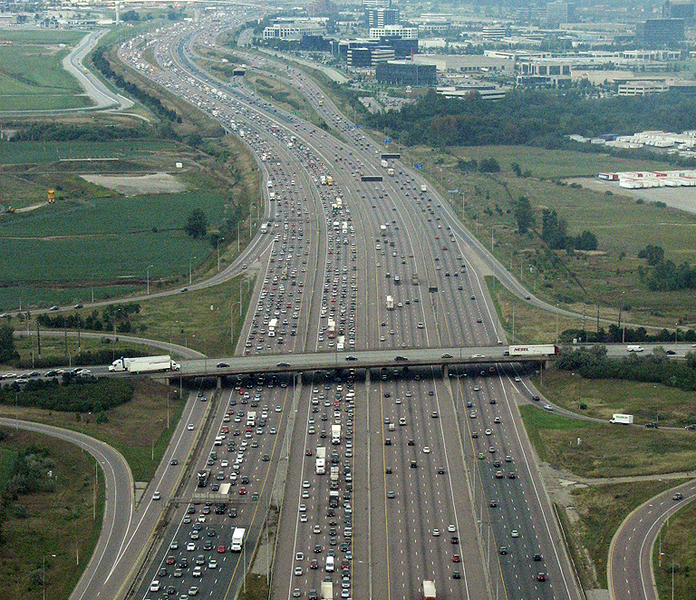
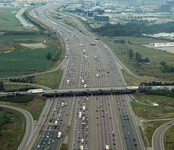
| Description | The 18-lane wide Highway 401 south of Toronto Pearson International Airport (YYZ) in Mississauga, Ontario. This is one of the widest points of the highway. It's also near the crash of Air France Flight 358 |
| Date | |
| Source | Cropped version of File:Highway 401.png |
| Author | Clashmaker |
| Other versions |
 |
| Camera location | | View this and other nearby images on: OpenStreetMap |
|---|
Licensing[edit]
This file is licensed under the Creative Commons Attribution-Share Alike 2.0 Generic license.
- You are free:
- to share – to copy, distribute and transmit the work
- to remix – to adapt the work
- Under the following conditions:
- attribution – You must give appropriate credit, provide a link to the license, and indicate if changes were made. You may do so in any reasonable manner, but not in any way that suggests the licensor endorses you or your use.
- share alike – If you remix, transform, or build upon the material, you must distribute your contributions under the same or compatible license as the original.
| This image, originally posted to Flickr, was reviewed on 19 February 2012 by the administrator or reviewer Materialscientist, who confirmed that it was available on Flickr under the stated license on that date. |
File history
Click on a date/time to view the file as it appeared at that time.
| Date/Time | Thumbnail | Dimensions | User | Comment | |
|---|---|---|---|---|---|
| current | 23:17, 3 March 2021 | | 768 × 662 (1.14 MB) | Floydian (talk | contribs) | little shorter |
| 23:15, 3 March 2021 |  | 768 × 768 (1.32 MB) | Floydian (talk | contribs) | == {{int:filedesc}} == {{Information |Description = The 18-lane wide Highway 401 south of Toronto Pearson International Airport (YYZ) in Mississauga, Ontario. This is the widest point of the highway. |Source = Cropped version of File:Highway 401.png |Date = 2006-09-12 |Author = [https://www.flickr.com/photos/clashmaker/ Clashmaker] |Permission = |other_versions = 100px }} [[Category:Aerial photographs of Ontario Highway 401 in Mi... |
You cannot overwrite this file.
File usage on Commons
The following page uses this file:
File usage on other wikis
The following other wikis use this file:
- Usage on bn.wikipedia.org
- Usage on en.wikipedia.org
- Usage on no.wikipedia.org
- Usage on ru.wikipedia.org