File:H1N1 Dominican Republic Map.svg
Jump to navigation
Jump to search

Size of this PNG preview of this SVG file: 200 × 138 pixels. Other resolutions: 320 × 221 pixels | 640 × 442 pixels | 1,024 × 707 pixels | 1,280 × 883 pixels | 2,560 × 1,766 pixels.
Original file (SVG file, nominally 200 × 138 pixels, file size: 135 KB)
Captions
Captions
Add a one-line explanation of what this file represents
Summary[edit]
| Description |
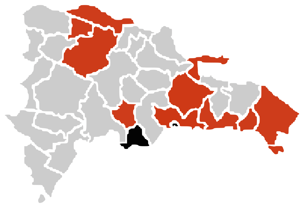
Español: Un mapa sobre el brote de gripe A (H1N1) en República Dominicana de 2009
muertes confirmadas
casos confirmados
casos sin confirmar English: A map about the 2009 A (H1N1) flu outbreak in Dominican Republic
death confirmed
confirmed cases
unconfirmed cases Português: Mapa da pandemia de gripe de 2009 na República Dominicana.
Mortes
Casos confirmados
Casos suspeitos |
| Date | |
| Source | Own work |
| Author | Vrysxy |
Licensing[edit]
I, the copyright holder of this work, hereby publish it under the following licenses:
This file is licensed under the Creative Commons Attribution-Share Alike 3.0 Unported license.
- You are free:
- to share – to copy, distribute and transmit the work
- to remix – to adapt the work
- Under the following conditions:
- attribution – You must give appropriate credit, provide a link to the license, and indicate if changes were made. You may do so in any reasonable manner, but not in any way that suggests the licensor endorses you or your use.
- share alike – If you remix, transform, or build upon the material, you must distribute your contributions under the same or compatible license as the original.

|
Permission is granted to copy, distribute and/or modify this document under the terms of the GNU Free Documentation License, Version 1.2 or any later version published by the Free Software Foundation; with no Invariant Sections, no Front-Cover Texts, and no Back-Cover Texts. A copy of the license is included in the section entitled GNU Free Documentation License. |
You may select the license of your choice.
File history
Click on a date/time to view the file as it appeared at that time.
| Date/Time | Thumbnail | Dimensions | User | Comment | |
|---|---|---|---|---|---|
| current | 03:48, 14 July 2009 | | 200 × 138 (135 KB) | Vrysxy (talk | contribs) | actualizando al 13 de julio |
| 03:55, 27 June 2009 |  | 200 × 138 (135 KB) | Vrysxy (talk | contribs) | Actualizando al 25 de junio conforme a la OPS http://ais.paho.org/flu/sm/atlas.html | |
| 22:02, 12 June 2009 |  | 200 × 138 (135 KB) | Vrysxy (talk | contribs) | Actualizando al 12 de junio conforme a la OPS http://ais.paho.org/flu/sm/atlas.html | |
| 22:31, 5 June 2009 |  | 200 × 138 (135 KB) | Vrysxy (talk | contribs) | {{Information |Description={{es|1=Un mapa sobre el brote de gripe A (H1N1) en Ecuador de 2009 <br /> {{legend|#000000|muertes confirmadas}} {{legend|#cd3412|casos confirmados}} {{legend|#eaa912|casos sin confirmar}}}} {{en|1=A map about the 2009 A (H1N1) |
You cannot overwrite this file.
File usage on Commons
The following page uses this file:
File usage on other wikis
The following other wikis use this file:
- Usage on en.wikipedia.org
- Usage on fr.wikipedia.org
- Usage on nl.wikipedia.org
- Usage on pl.wikipedia.org