File:Greenbelt Park. LOC 75692094.jpg
Jump to navigation
Jump to search

Size of this preview: 799 × 345 pixels. Other resolutions: 320 × 138 pixels | 640 × 276 pixels | 1,024 × 442 pixels | 1,280 × 553 pixels | 2,560 × 1,105 pixels | 7,862 × 3,395 pixels.
Original file (7,862 × 3,395 pixels, file size: 3.68 MB, MIME type: image/jpeg)
Captions
Captions
Add a one-line explanation of what this file represents
Summary[edit]
| Description |
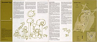
English: Scale ca. 1:37,000. Folded title: Greenbelt Park, Maryland. "1971-435-412/62." Includes text and location inset. Text and illus. on verso. Available also through the Library of Congress Web site as a raster image. AACR2 |
||
| Title | Greenbelt Park. | ||
| Shelf ID | G3842.G78 1971 .U5 | ||
| Date | |||
| Source | https://www.loc.gov/item/75692094/ | ||
| Author | United States. National Park Service | ||
| Permission (Reusing this file) |
|
||
| Other versions |
|
||
| Location | United States · Maryland · Greenbelt Park · Greenbelt Park. | ||
| Part of | American Memory · General Maps · Catalog · Geography And Map Division | ||
| Subject | United States · Maps · Maryland · Greenbelt Park · Greenbelt Park (Md.) |


Licensing[edit]
| This image or media file contains material based on a work of a National Park Service employee, created as part of that person's official duties. As a work of the U.S. federal government, such work is in the public domain in the United States. See the NPS website and NPS copyright policy for more information. |
File history
Click on a date/time to view the file as it appeared at that time.
| Date/Time | Thumbnail | Dimensions | User | Comment | |
|---|---|---|---|---|---|
| current | 09:38, 26 June 2018 | | 7,862 × 3,395 (3.68 MB) | Fæ (talk | contribs) | LOC Maps https://www.loc.gov/item/75692094/ #29154 |
You cannot overwrite this file.
File usage on Commons
The following page uses this file: