File:Furnas Mill Bridge, southeastern angle.jpg
Jump to navigation
Jump to search
Size of this preview: 800 × 600 pixels. Other resolutions: 320 × 240 pixels | 640 × 480 pixels | 1,024 × 768 pixels | 1,280 × 960 pixels | 2,560 × 1,920 pixels | 2,816 × 2,112 pixels.
Original file (2,816 × 2,112 pixels, file size: 3.13 MB, MIME type: image/jpeg)
Captions
Captions
Add a one-line explanation of what this file represents
|
This is an image of a place or building that is listed on the National Register of Historic Places in the United States of America. Its reference number is 1000985. |
| Camera location | | View this and other nearby images on: OpenStreetMap |
|---|
| Description |
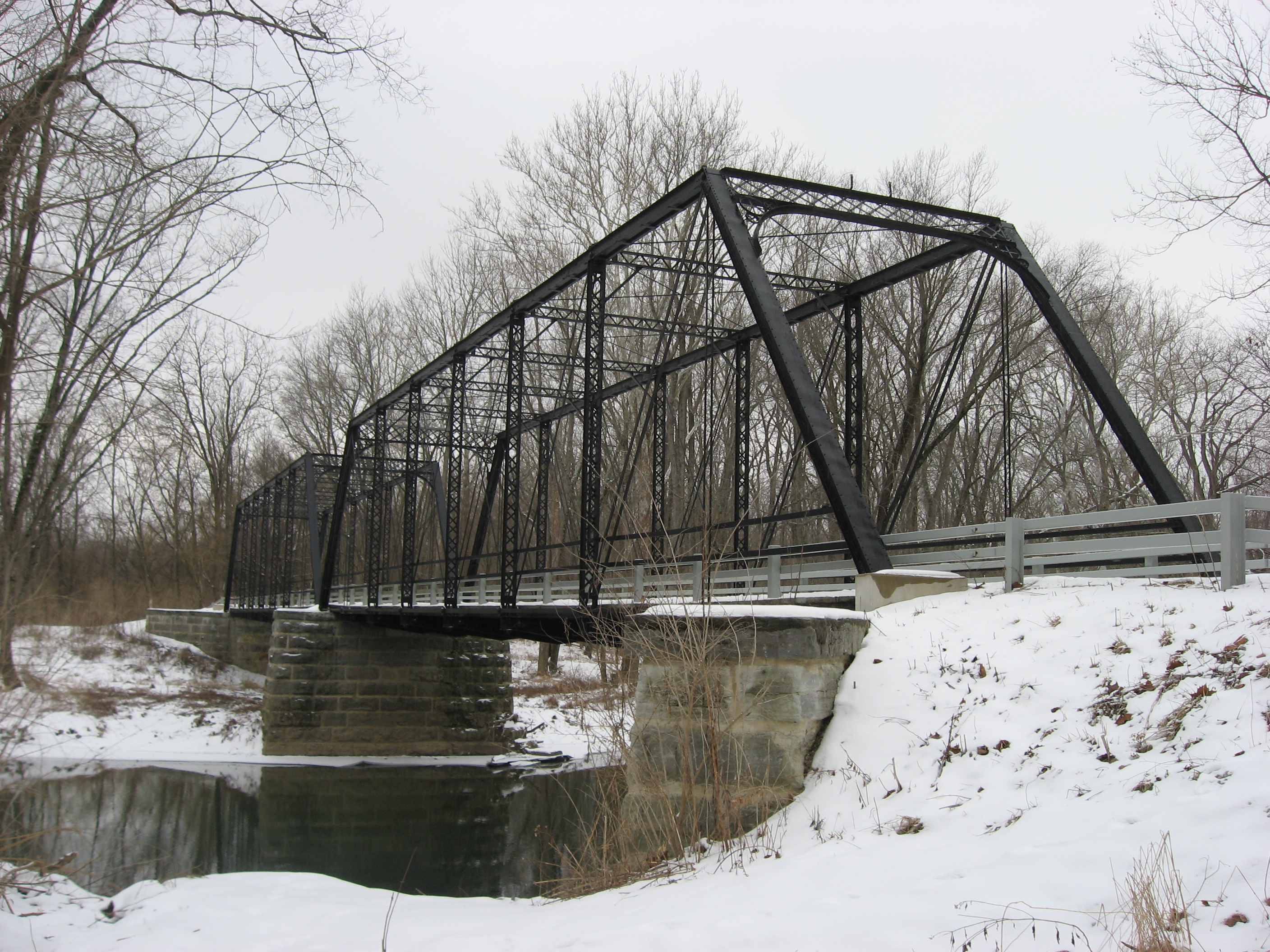
English: Eastern portal and southern (downstream) side of the Furnas Mill Bridge, which carries Road 650S over Sugar Creek in the Atterbury Fish and Wildlife Area northwest of Edinburgh in Blue River Township, Johnson County, Indiana, United States. Built in 1891, it is listed on the National Register of Historic Places. |
||
| Date | Taken on 28 January 2011 | ||
| Source | Own work | ||
| Author | Nyttend | ||
| Permission (Reusing this file) |
|
File history
Click on a date/time to view the file as it appeared at that time.
| Date/Time | Thumbnail | Dimensions | User | Comment | |
|---|---|---|---|---|---|
| current | 03:45, 30 January 2011 | | 2,816 × 2,112 (3.13 MB) | Nyttend (talk | contribs) | {{Location|39|22|56|N|85|59|53|W}} {{Information |Description={{en|Eastern portal and southern (downstream) side of the {{w|Furnas Mill Bridge}}, which carries Road 650S over Sugar Creek in the Atterbury Fish and Wildlife Area northwest of {{w|Edinburgh, |
You cannot overwrite this file.
File usage on Commons
The following page uses this file:
File usage on other wikis
The following other wikis use this file:
- Usage on en.wikipedia.org
- Usage on www.wikidata.org