File:French Indochina subdivisions Ru.svg
Jump to navigation
Jump to search

Size of this PNG preview of this SVG file: 393 × 599 pixels. Other resolutions: 157 × 240 pixels | 315 × 480 pixels | 504 × 768 pixels | 671 × 1,024 pixels | 1,343 × 2,048 pixels | 667 × 1,017 pixels.
Original file (SVG file, nominally 667 × 1,017 pixels, file size: 154 KB)
Captions
Captions
Add a one-line explanation of what this file represents
Summary[edit]
| Description |
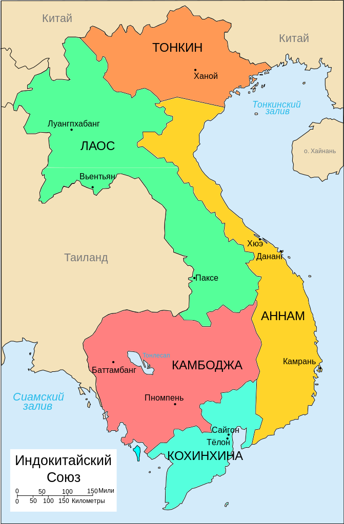
Русский: Административное деление Французского Индокитая |
| Date | |
| Source | русифицированный файл File:French Indochina subdivisions.svg, загруженный участником Bearsmalaysia |
| Author | LyXX |
Licensing[edit]
This file is licensed under the Creative Commons Attribution-Share Alike 3.0 Unported license.
- You are free:
- to share – to copy, distribute and transmit the work
- to remix – to adapt the work
- Under the following conditions:
- attribution – You must give appropriate credit, provide a link to the license, and indicate if changes were made. You may do so in any reasonable manner, but not in any way that suggests the licensor endorses you or your use.
- share alike – If you remix, transform, or build upon the material, you must distribute your contributions under the same or compatible license as the original.
File history
Click on a date/time to view the file as it appeared at that time.
| Date/Time | Thumbnail | Dimensions | User | Comment | |
|---|---|---|---|---|---|
| current | 07:48, 12 April 2017 | | 667 × 1,017 (154 KB) | LyXX (talk | contribs) | Correct name of map in legend |
| 07:37, 12 April 2017 |  | 667 × 1,017 (154 KB) | LyXX (talk | contribs) | User created page with UploadWizard |
You cannot overwrite this file.
File usage on Commons
There are no pages that use this file.
File usage on other wikis
The following other wikis use this file:
- Usage on azb.wikipedia.org
- Usage on az.wikipedia.org
- Usage on ba.wikipedia.org
- Usage on hy.wikipedia.org
- Usage on ru.wikipedia.org
- Usage on uz.wikipedia.org