File:EuropeCent.PNG
Jump to navigation
Jump to search
Size of this preview: 722 × 600 pixels. Other resolutions: 289 × 240 pixels | 578 × 480 pixels | 946 × 786 pixels.
Original file (946 × 786 pixels, file size: 391 KB, MIME type: image/png)
Captions
Captions
Add a one-line explanation of what this file represents
| Description |
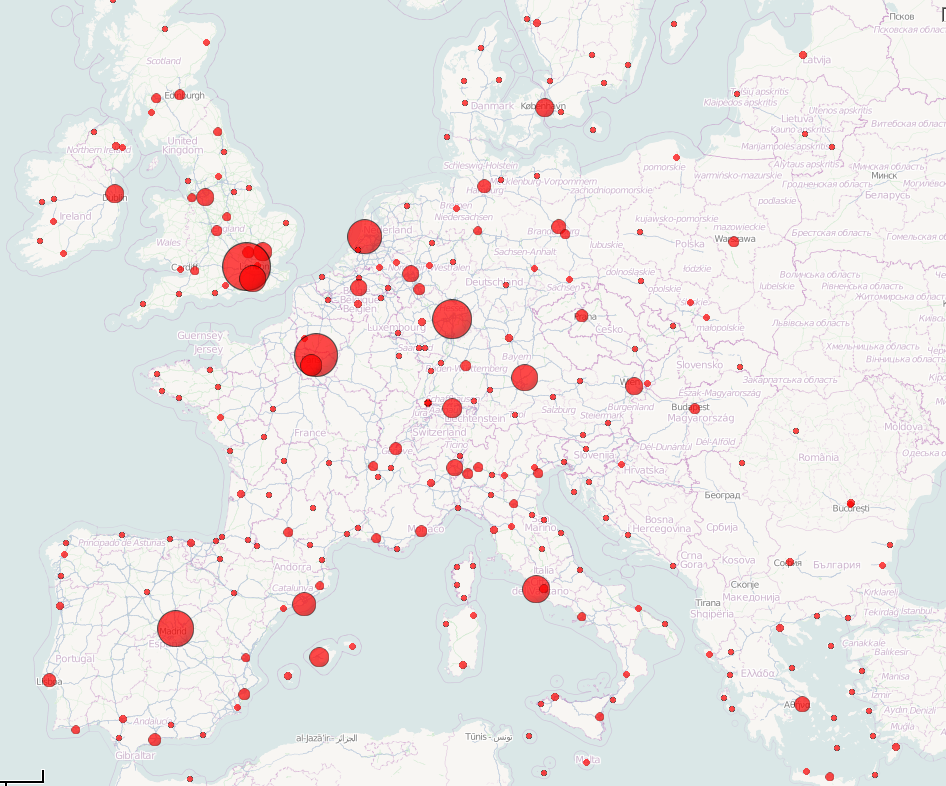
English: Main Western European Airports, sized (area) according to passenger numbers in 2009. Only airports with more than 100 000 passengers are shown. Data Eurostat, background OpenStreetMap. |
| Source | Own work |
| Author | PemFR |
| Permission (Reusing this file) |
This file is licensed under the Creative Commons Attribution-Share Alike 3.0 Unported license.
|

|
This economic map image could be re-created using vector graphics as an SVG file. This has several advantages; see Commons:Media for cleanup for more information. If an SVG form of this image is available, please upload it and afterwards replace this template with
{{vector version available|new image name}}.
It is recommended to name the SVG file “EuropeCent.svg”—then the template Vector version available (or Vva) does not need the new image name parameter. |
File history
Click on a date/time to view the file as it appeared at that time.
| Date/Time | Thumbnail | Dimensions | User | Comment | |
|---|---|---|---|---|---|
| current | 13:30, 28 December 2010 | | 946 × 786 (391 KB) | PemFR (talk | contribs) | Now cropped. |
| 13:28, 28 December 2010 |  | 1,280 × 800 (482 KB) | PemFR (talk | contribs) | fixed location of Frankfurt-Hahn Airport Added minimum radius of 3px for smaller airports | |
| 15:54, 27 December 2010 |  | 896 × 786 (385 KB) | PemFR (talk | contribs) | {{Information |Description={{en|1=Main Western European Airports, sized (area) according to passenger numbers in 2009. Data Eurostat, background OpenStreetMap.}} |Source={{own}} |Author=PemFR |Date= |Permission={{cc-by-sa-3.0}} Background M |
You cannot overwrite this file.
File usage on Commons
There are no pages that use this file.
File usage on other wikis
The following other wikis use this file:
- Usage on es.wikipedia.org
- Usage on fr.wikipedia.org
- Usage on it.wikipedia.org
- Usage on it.wikivoyage.org