File:Eastern side of the Scotland Bridge.jpg
Jump to navigation
Jump to search
Size of this preview: 800 × 450 pixels. Other resolutions: 320 × 180 pixels | 640 × 360 pixels | 1,024 × 576 pixels | 1,280 × 720 pixels | 2,816 × 1,584 pixels.
Original file (2,816 × 1,584 pixels, file size: 2.11 MB, MIME type: image/jpeg)
Captions
Captions
Add a one-line explanation of what this file represents
|
This is an image of a place or building that is listed on the National Register of Historic Places in the United States of America. Its reference number is 94000228. |
| Camera location | | View this and other nearby images on: OpenStreetMap |
|---|
| Description |
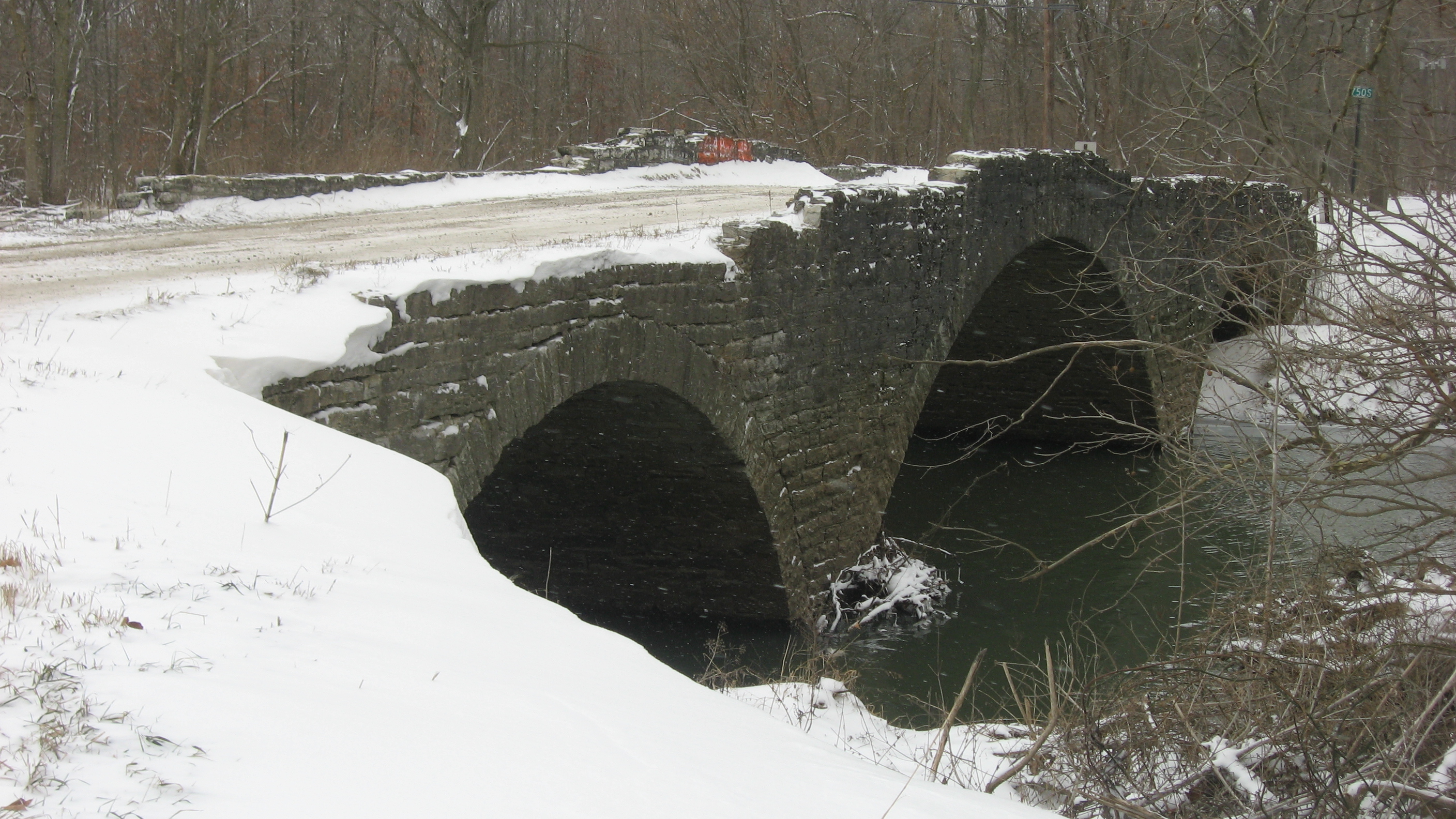
English: Eastern (upstream) side of the Scotland Bridge, which carries Lost Road over Sugar Creek near Mechanicsburg across the border between Boone County (foreground) and Clinton County (background) in the U.S. state of Indiana. The Boone County portion of the bridge is located in Clinton Township, while the Clinton County portion straddles the line between Jackson Township (left side) and Kirklin Township (right side). Built in 1901, the bridge is listed on the National Register of Historic Places. |
||
| Date | Taken on 13 January 2012 | ||
| Source | Own work | ||
| Author | Nyttend | ||
| Permission (Reusing this file) |
|
File history
Click on a date/time to view the file as it appeared at that time.
| Date/Time | Thumbnail | Dimensions | User | Comment | |
|---|---|---|---|---|---|
| current | 20:49, 12 March 2012 | | 2,816 × 1,584 (2.11 MB) | Nyttend (talk | contribs) | {{NRHP|94000228}} {{Location|40|10|36|N|86|25|54|W}} {{Information |Description={{en|Eastern (upstream) side of the {{w|Scotland Bridge}}, which carries Lost Road over Sugar Creek near {{w|Mechanicsburg, Boone County, Indiana|Mechanicsburg}} across the... |
You cannot overwrite this file.
File usage on Commons
The following page uses this file:
File usage on other wikis
The following other wikis use this file: