File:East Timor, administrative divisions (since 2015) - th - colored.svg
Jump to navigation
Jump to search

Size of this PNG preview of this SVG file: 800 × 353 pixels. Other resolutions: 320 × 141 pixels | 640 × 283 pixels | 1,024 × 452 pixels | 1,280 × 565 pixels | 2,560 × 1,131 pixels | 1,714 × 757 pixels.
Original file (SVG file, nominally 1,714 × 757 pixels, file size: 865 KB)
Captions
Captions
Add a one-line explanation of what this file represents
Summary[edit]
_-_th_-_colored.svg&action=edit§ion=1)
| Description |
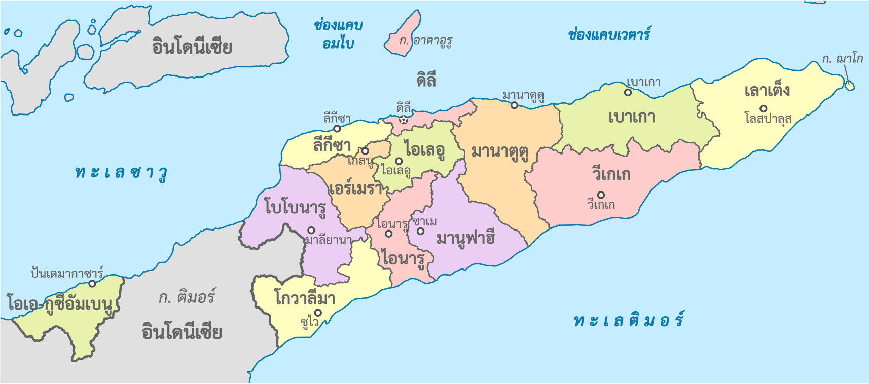
ไทย: แผนที่การแบ่งเขตการปกครองของประเทศติมอร์-เลสเต
English: Map of the administrative divisions of Timor-Leste (in Thai) |
| Date | |
| Source |
This W3C-unspecified vector image was created with Inkscape . This vector image includes elements that have been taken or adapted from this file: This vector image includes elements that have been taken or adapted from this file: |
| Author | Potapt |
_-_Munic%C3%ADpios_and_Posto_Administrativos_(with_names).png)
Licensing[edit]
_-_th_-_colored.svg&action=edit§ion=2)
I, the copyright holder of this work, hereby publish it under the following license:
This file is licensed under the Creative Commons Attribution-Share Alike 3.0 Unported license.
- You are free:
- to share – to copy, distribute and transmit the work
- to remix – to adapt the work
- Under the following conditions:
- attribution – You must give appropriate credit, provide a link to the license, and indicate if changes were made. You may do so in any reasonable manner, but not in any way that suggests the licensor endorses you or your use.
- share alike – If you remix, transform, or build upon the material, you must distribute your contributions under the same or compatible license as the original.
File history
Click on a date/time to view the file as it appeared at that time.
| Date/Time | Thumbnail | Dimensions | User | Comment | |
|---|---|---|---|---|---|
| current | 23:54, 13 July 2021 | | 1,714 × 757 (865 KB) | Potapt (talk | contribs) | / |
| 01:08, 15 July 2018 |  | 1,714 × 757 (803 KB) | Potapt (talk | contribs) | Transliteration | |
| 00:04, 22 December 2017 |  | 1,714 × 757 (800 KB) | Potapt (talk | contribs) | User created page with UploadWizard |
You cannot overwrite this file.
File usage on Commons
The following 2 pages use this file:
File usage on other wikis
The following other wikis use this file:
- Usage on th.wikipedia.org
Metadata
_-_th_-_colored.svg&oldid=712009674)
Categories:
- SVG labeled maps of administrative divisions of East Timor (location map scheme)
- SVG labeled maps of administrative divisions of countries of Asia (location map scheme) (thai)
- SVG labeled maps of administrative divisions of countries of Asia (location map scheme) (colored scheme)
- Maps of municipalities of East Timor
- Maps of Subdivisions of East Timor (2015–2022)