File:Dust storms in the Namib desert.jpg

Original file (3,508 × 2,540 pixels, file size: 1.73 MB, MIME type: image/jpeg)
Captions
Captions
Summary[edit]
| Description |
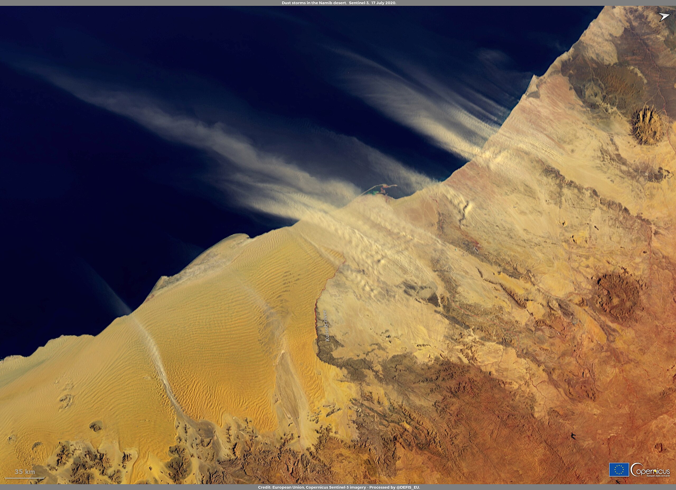
English: On 17 July 2020, several plumes of dust from the Namib desert were streaming westward off the coast of Namibia, as shown in this Copernicus Sentinel-3 image. The Namib desert stretches hundreds of kilometres along the coast of Namibia. Its geological features are very different on each bank of the Kuiseb river. To the south of the river, there are gigantic sand dunes, while to the north, the desert is largely made up of gravel plains and rocky hills. Most dust storms originate from the northern part of the desert, where light sand and dust is blown by inland winds, while the dunes in the south tend to be made of heavier sand. Data acquired by the Copernicus Sentinel-3 satellites allow accurate imaging of atmospheric particulates, including emissions from wildfires or desert dust: these data will enable to improve modelling of both climate change and air quality. |
| Date | 19 July 2020 (upload date) |
| Source | Dust storms in the Namib desert |
| Author | European Union , Copernicus Sentinel-3 imagery |
Licensing[edit]

|
This image contains data from a satellite in the Copernicus Programme, such as Sentinel-1, Sentinel-2 or Sentinel-3. Attribution is required when using this image.
Attribution: Contains modified Copernicus Sentinel data 2020
The use of Copernicus Sentinel Data is regulated under EU law (Commission Delegated Regulation (EU) No 1159/2013 and Regulation (EU) No 377/2014). Relevant excerpts:
Free access shall be given to GMES dedicated data [...] made available through GMES dissemination platforms [...].
Access to GMES dedicated data [...] shall be given for the purpose of the following use in so far as it is lawful:
GMES dedicated data [...] may be used worldwide without limitations in time.
GMES dedicated data and GMES service information are provided to users without any express or implied warranty, including as regards quality and suitability for any purpose. |
File history
Click on a date/time to view the file as it appeared at that time.
| Date/Time | Thumbnail | Dimensions | User | Comment | |
|---|---|---|---|---|---|
| current | 21:28, 28 July 2023 | | 3,508 × 2,540 (1.73 MB) | OptimusPrimeBot (talk | contribs) | #Spacemedia - Upload of https://www.copernicus.eu/system/files/2020-07/image_day/Namibia_credit_row.jpg via Commons:Spacemedia |
You cannot overwrite this file.
File usage on Commons
There are no pages that use this file.