File:Dry stream beds among Putangirua Pinnacles.jpg
Jump to navigation
Jump to search

Size of this preview: 800 × 533 pixels. Other resolutions: 320 × 213 pixels | 640 × 427 pixels | 1,024 × 683 pixels | 1,280 × 853 pixels | 2,560 × 1,707 pixels | 4,896 × 3,264 pixels.
Original file (4,896 × 3,264 pixels, file size: 6.37 MB, MIME type: image/jpeg)
Captions
Captions
Add a one-line explanation of what this file represents
Summary[edit]
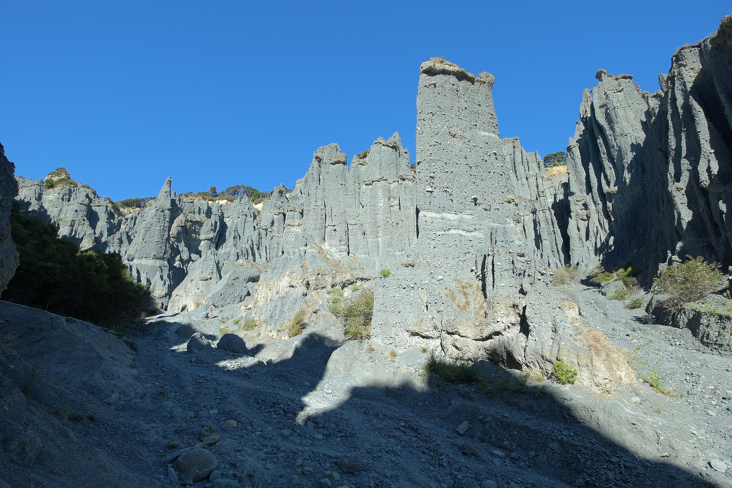
| Description | Dry stream beds among tall earth pillars (hoodoos) made of conglomerate at Putangirua Pinnacles. The "Dimholt Road" scenes (also known as the paths to the dead) of the "The Lord of the Rings - The Return of the King" movie were filmed in this area. A person is standing to the lower left of center, for scale. |
| Date | |
| Source | Own work |
| Author | Pseudopanax at English Wikipedia |
| Camera location | | View this and other nearby images on: OpenStreetMap |
|---|
Licensing[edit]
| I, the copyright holder of this work, release this work into the public domain. This applies worldwide. In some countries this may not be legally possible; if so: I grant anyone the right to use this work for any purpose, without any conditions, unless such conditions are required by law. |
File history
Click on a date/time to view the file as it appeared at that time.
| Date/Time | Thumbnail | Dimensions | User | Comment | |
|---|---|---|---|---|---|
| current | 02:15, 5 March 2021 | | 4,896 × 3,264 (6.37 MB) | Pseudopanax (talk | contribs) | == {{int:filedesc}} == {{Information |Description=Dry stream beds among tall earth pillars (hoodoos) made of conglomerate at Putangirua Pinnacles |Source={{Own}} |Date=2021-02-03 |Author={{user at project|Pseudopanax|wikipedia|en}} }} {{location|41|26|47.2|S|175|14|47.4|E}} == {{int:license-header}} == {{PD-self}} Category:Putangirua Pinnacles |
You cannot overwrite this file.
File usage on Commons
The following page uses this file:
File usage on other wikis
The following other wikis use this file:
- Usage on en.wikipedia.org