File:Dominica, administrative divisions - th - colored.svg
Jump to navigation
Jump to search

Size of this PNG preview of this SVG file: 525 × 599 pixels. Other resolutions: 210 × 240 pixels | 421 × 480 pixels | 673 × 768 pixels | 897 × 1,024 pixels | 1,794 × 2,048 pixels | 1,104 × 1,260 pixels.
Original file (SVG file, nominally 1,104 × 1,260 pixels, file size: 354 KB)
Captions
Captions
Add a one-line explanation of what this file represents
Summary[edit]
| Description |
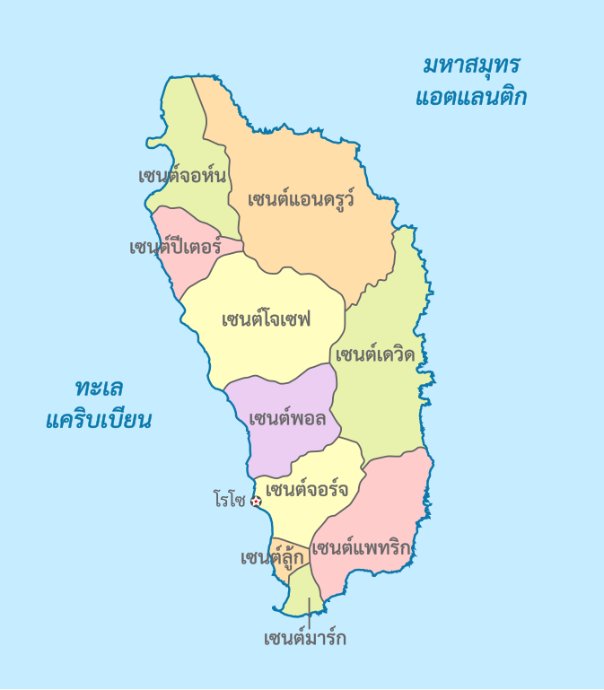
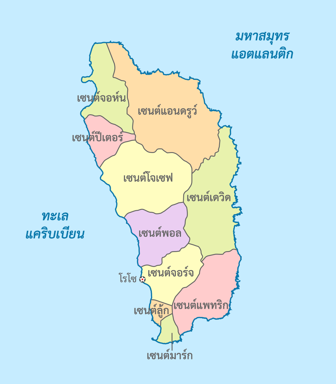
ไทย: แผนที่การแบ่งเขตการปกครองของประเทศดอมินีกา
English: Map of the administrative divisions of Dominica (in Thai) |
| Date | |
| Source |
This W3C-unspecified vector image was created with Inkscape . This vector image includes elements that have been taken or adapted from this file: |
| Author | Potapt |
Licensing[edit]
This file is licensed under the Creative Commons Attribution-Share Alike 3.0 Unported license.
- You are free:
- to share – to copy, distribute and transmit the work
- to remix – to adapt the work
- Under the following conditions:
- attribution – You must give appropriate credit, provide a link to the license, and indicate if changes were made. You may do so in any reasonable manner, but not in any way that suggests the licensor endorses you or your use.
- share alike – If you remix, transform, or build upon the material, you must distribute your contributions under the same or compatible license as the original.
File history
Click on a date/time to view the file as it appeared at that time.
| Date/Time | Thumbnail | Dimensions | User | Comment | |
|---|---|---|---|---|---|
| current | 00:35, 3 September 2022 | | 1,104 × 1,260 (354 KB) | Potapt (talk | contribs) | / |
| 00:15, 3 September 2022 |  | 1,104 × 1,260 (354 KB) | Potapt (talk | contribs) | / | |
| 23:54, 14 July 2021 |  | 1,104 × 1,260 (349 KB) | Potapt (talk | contribs) | / | |
| 20:43, 5 February 2017 |  | 1,104 × 1,260 (395 KB) | Potapt (talk | contribs) | User created page with UploadWizard |
You cannot overwrite this file.
File usage on Commons
The following 3 pages use this file: