File:Docklow and Hampton Wafer, Herefordshire, OS Map Sheet 198 - Hereford (Hills) 1898.jpg
Jump to navigation
Jump to search

Size of this preview: 768 × 600 pixels. Other resolutions: 307 × 240 pixels | 615 × 480 pixels | 984 × 768 pixels | 1,132 × 884 pixels.
Original file (1,132 × 884 pixels, file size: 1.28 MB, MIME type: image/jpeg)
Captions
Captions
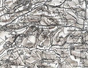
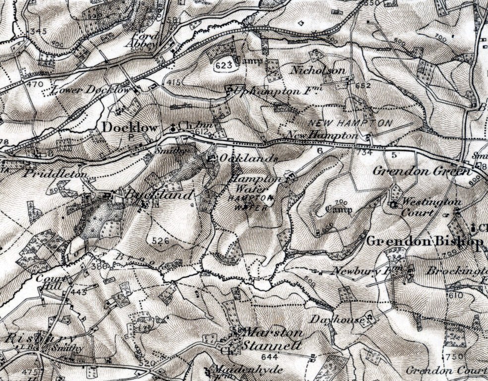
Docklow and Hampton Wafer, Herefordshire, OS Map 1898
Summary[edit]
_1898.jpg&action=edit§ion=1)
| Description |
English: 1898 Ordnance Survey map of Docklow and Hampton Wafer, Herefordshire, England in OS Map Sheet 198 - Hereford (Hills). Reproduced with the permission of the National Library of Scotland.[1] |
| Date | |
| Source | Ordnance Survey map 1898 |
| Author | Unknown author |
| Permission (Reusing this file) |
Public domain. OS maps become public domain 50 years after first publication, and include any subsequent reprint of the original, official or otherwise. This includes any republication from the original with adaptions, additions, redrawing, manipulation or incorporation into other images. |
Licensing[edit]
_1898.jpg&action=edit§ion=2)
|
This work is in the public domain in its country of origin and other countries and areas where the copyright term is the author's life plus 70 years or fewer. This work is in the public domain in the United States because it was published (or registered with the U.S. Copyright Office) before January 1, 1929. | |
| This file has been identified as being free of known restrictions under copyright law, including all related and neighboring rights. | |
File history
Click on a date/time to view the file as it appeared at that time.
| Date/Time | Thumbnail | Dimensions | User | Comment | |
|---|---|---|---|---|---|
| current | 20:43, 2 April 2020 | | 1,132 × 884 (1.28 MB) | Acabashi (talk | contribs) | Uploaded own work with UploadWizard |
You cannot overwrite this file.
File usage on Commons
There are no pages that use this file.
File usage on other wikis
The following other wikis use this file:
- Usage on en.wikipedia.org
_1898.jpg&oldid=724093043)