File:Dessein till krutmagasin på Ljungskär.jpg
Jump to navigation
Jump to search

Size of this preview: 719 × 600 pixels. Other resolutions: 288 × 240 pixels | 575 × 480 pixels | 921 × 768 pixels | 1,227 × 1,024 pixels | 2,455 × 2,048 pixels | 3,000 × 2,503 pixels.
Original file (3,000 × 2,503 pixels, file size: 5.24 MB, MIME type: image/jpeg)
Captions
Captions
Add a one-line explanation of what this file represents
Summary[edit]
| Description |
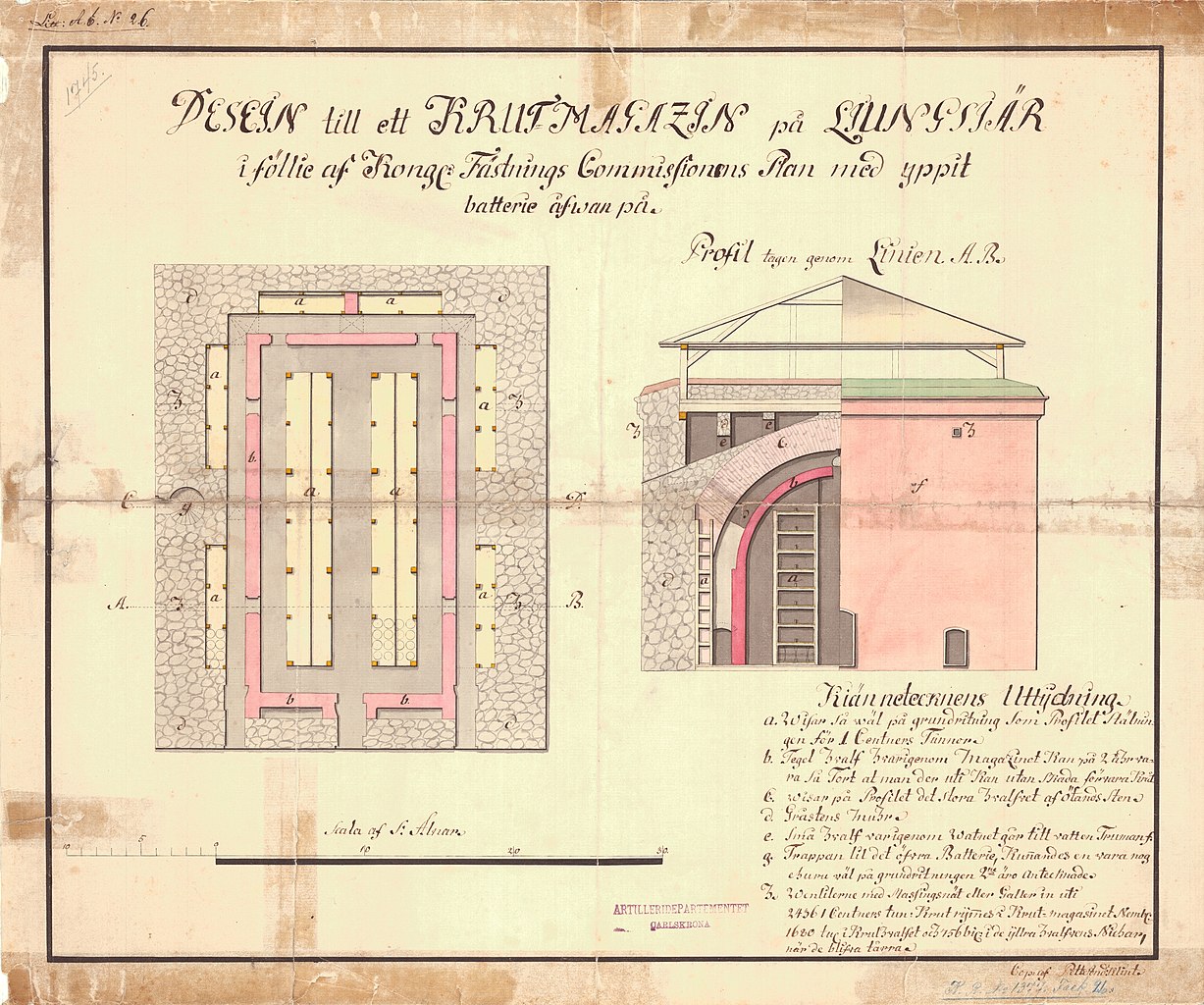
Svenska: Dessein till ett krutmagasin på Ljungskär, plan och profilritning |
| Date | |
| Source | https://digitaltmuseum.se/011024793799/ritning |
| Author | Unknown author |
Licensing[edit]
| This file is made available by its copyright holder under the Creative Commons Public Domain Mark 1.0. | |
| While the Public Domain Mark is not intended to be used as a license, community consensus has found that when a copyright holder applies the PDM to their own work, they are declaring their work to be in the public domain.
If a file is tagged PDM by someone other than the copyright holder, a more specific copyright tag such as one found at Commons:Copyright tags/General public domain must be applied. If this is your own work, please use {{Cc-zero}} instead. |
File history
Click on a date/time to view the file as it appeared at that time.
| Date/Time | Thumbnail | Dimensions | User | Comment | |
|---|---|---|---|---|---|
| current | 08:20, 2 November 2020 | | 3,000 × 2,503 (5.24 MB) | Tanzania (talk | contribs) | Uploaded a work by Okänd from https://digitaltmuseum.se/011024793799/ritning with UploadWizard |
You cannot overwrite this file.
File usage on Commons
The following page uses this file:
File usage on other wikis
The following other wikis use this file:
- Usage on sv.wikipedia.org