File:DJI 0033 (4).jpg
Jump to navigation
Jump to search

Size of this preview: 800 × 600 pixels. Other resolutions: 320 × 240 pixels | 640 × 480 pixels | 1,024 × 768 pixels | 1,280 × 960 pixels | 2,560 × 1,920 pixels | 4,000 × 3,000 pixels.
Original file (4,000 × 3,000 pixels, file size: 5.06 MB, MIME type: image/jpeg)
Captions
Captions
Add a one-line explanation of what this file represents
Summary[edit]
.jpg&action=edit§ion=1)
| Description |
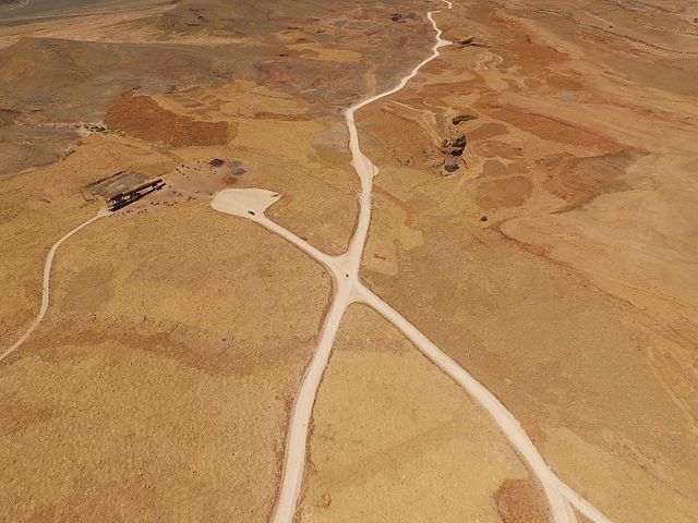
עברית: מכתש רמון הוא המכתש האירוזי הגדול בעולם. הוא מצוי בישראל ומהווה אחד מחמשת המכתשים שבנגב. נופו של מכתש רמון הוא ייחודי. על קצה המכתש מצויה העיירה מצפה רמון. |
| Date | התמונה צולמה במהלך טיול רגלי במסלולים המדהימים של מכתש רמון |
| Source | Own work |
| Author | מיטב אסולין |
| Camera location | | View this and other nearby images on: OpenStreetMap |
|---|
.jpg¶ms=030.617647_N_0034.888480_E_globe:Earth_type:camera_alt:625.436_source:exif_&language=en)
התמונה צולה עם
Licensing[edit]
.jpg&action=edit§ion=2)
I, the copyright holder of this work, hereby publish it under the following license:
This file is licensed under the Creative Commons Attribution-Share Alike 4.0 International license.
- You are free:
- to share – to copy, distribute and transmit the work
- to remix – to adapt the work
- Under the following conditions:
- attribution – You must give appropriate credit, provide a link to the license, and indicate if changes were made. You may do so in any reasonable manner, but not in any way that suggests the licensor endorses you or your use.
- share alike – If you remix, transform, or build upon the material, you must distribute your contributions under the same or compatible license as the original.

|
This image was uploaded as part of Wiki Loves Monuments 2016.
|
 |
File history
Click on a date/time to view the file as it appeared at that time.
| Date/Time | Thumbnail | Dimensions | User | Comment | |
|---|---|---|---|---|---|
| current | 16:44, 6 October 2016 | | 4,000 × 3,000 (5.06 MB) | Mutv1234512345 (talk | contribs) | User created page with UploadWizard |
You cannot overwrite this file.
File usage on Commons
The following page uses this file:
File usage on other wikis
The following other wikis use this file:
- Usage on he.wikipedia.org
- ויקיפדיה:מיזמי ויקיפדיה/ויקיפדיה אוהבת אתרי מורשת/מבוא/ללא לשוניות/תחרות 2012
- ויקיפדיה:מיזמי ויקיפדיה/ויקיפדיה אוהבת אתרי מורשת/ארכיון/תחרות 2012
- ויקיפדיה:מיזמי ויקיפדיה/ויקיפדיה אוהבת אתרי מורשת/זוכי התחרות בישראל 2012
- ויקיפדיה:מיזמי ויקיפדיה/ויקיפדיה אוהבת אתרי מורשת/ארכיון/תחרות 2017
- ויקיפדיה:מיזמי ויקיפדיה/ויקיפדיה אוהבת אתרי מורשת/זוכי התחרות בישראל/תחרות 2017
- ויקיפדיה:מיזמי ויקיפדיה/ויקיפדיה אוהבת אתרי מורשת/תחרות צילומים/ארכיון/תחרות 2020
- ויקיפדיה:מיזמי ויקיפדיה/ויקיפדיה אוהבת אתרי מורשת/זוכי התחרות בישראל 2020
- ויקיפדיה:מיזמי ויקיפדיה/ויקיפדיה אוהבת אתרי מורשת/זוכי התחרות בישראל 2021
- ויקיפדיה:מיזמי ויקיפדיה/ויקיפדיה אוהבת אתרי מורשת/תחרות צילומים/הסבר כללי
.jpg&oldid=873550584)