File:Crap Furo Spherical Panorama.jpg
Jump to navigation
Jump to search

Size of this preview: 800 × 400 pixels. Other resolutions: 320 × 160 pixels | 640 × 320 pixels | 1,024 × 512 pixels | 1,280 × 640 pixels | 2,560 × 1,280 pixels | 21,504 × 10,752 pixels.
Original file (21,504 × 10,752 pixels, file size: 39.87 MB, MIME type: image/jpeg)
Captions
Captions
Add a one-line explanation of what this file represents
Summary[edit]
| Warning | The original file is very high-resolution. It might not load properly or could cause your browser to freeze when opened at full size. |
|---|
| Description |
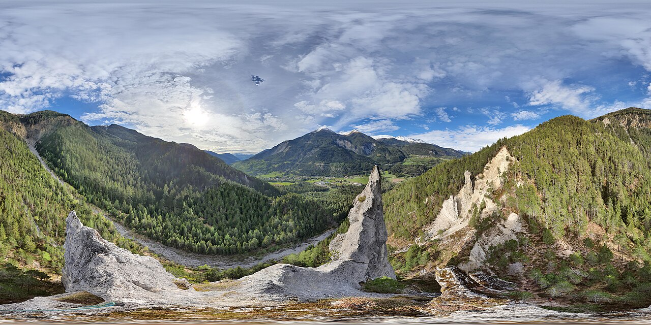
English: Spherical Panorama from Crap Furo (Albula/Alvra, Grisons, Switzerland)
Deutsch: Kugelpanorama vom Crap Furo (Albula/Alvra, Graubünden, Schweiz) mit Blick auf die Heckenlandschaft unterhalb von Brienz/Brinzauls, den rutschenden Teil der bewaldeten Bergkuppe Insellockergestein (Insel-Rutsch), die Burg Belfort von Süden, Surava mit der Eisenbahnlinie Albulabahn und Alvaneu im Albulatal. Über dem Tal auf der Seite gegenüber die Plessur-Alpen mit dem Piz Mulain.
Rumantsch: Panorama sferic digl Crap Furo (Albula/Alvra, Grischun, Svizra)
Italiano: Panorama sferico dal Crap Furo (Albula/Alvra, Grigioni, Svizzera) |
||
| Date | |||
| Source |
Own work
|
||
| Author | Capricorn4049 | ||
| Permission (Reusing this file) |
|
||
| Other versions |
|

| Camera location | | View this and other nearby images on: OpenStreetMap |
|---|
| 360° | View in 360° panoramic viewer
|
|---|
|
|
Further spherical panoramas can be found here. |

Licensing[edit]
I, the copyright holder of this work, hereby publish it under the following license:
This file is licensed under the Creative Commons Attribution-Share Alike 4.0 International license.
- You are free:
- to share – to copy, distribute and transmit the work
- to remix – to adapt the work
- Under the following conditions:
- attribution – You must give appropriate credit, provide a link to the license, and indicate if changes were made. You may do so in any reasonable manner, but not in any way that suggests the licensor endorses you or your use.
- share alike – If you remix, transform, or build upon the material, you must distribute your contributions under the same or compatible license as the original.
| Annotations | This image is annotated: View the annotations at Commons |
File history
Click on a date/time to view the file as it appeared at that time.
| Date/Time | Thumbnail | Dimensions | User | Comment | |
|---|---|---|---|---|---|
| current | 21:22, 3 May 2020 | | 21,504 × 10,752 (39.87 MB) | Capricorn4049 (talk | contribs) | Uploaded own work with UploadWizard |
You cannot overwrite this file.
File usage on Commons
The following 3 pages use this file:
- Albula/Alvra
- File:CrapFuroSphericalPanorama.jpg (file redirect)
- Category:Crap Furo
File usage on other wikis
The following other wikis use this file: