File:Confluence of Ohio and Big Sandy River, South Point, Ohio; Kenova, West Virginia; Ashland, Kentucky (14497039902).jpg
Original file (4,000 × 3,000 pixels, file size: 8.11 MB, MIME type: image/jpeg)
Captions
Captions
Summary[edit]
.jpg&action=edit§ion=1)
| Description |
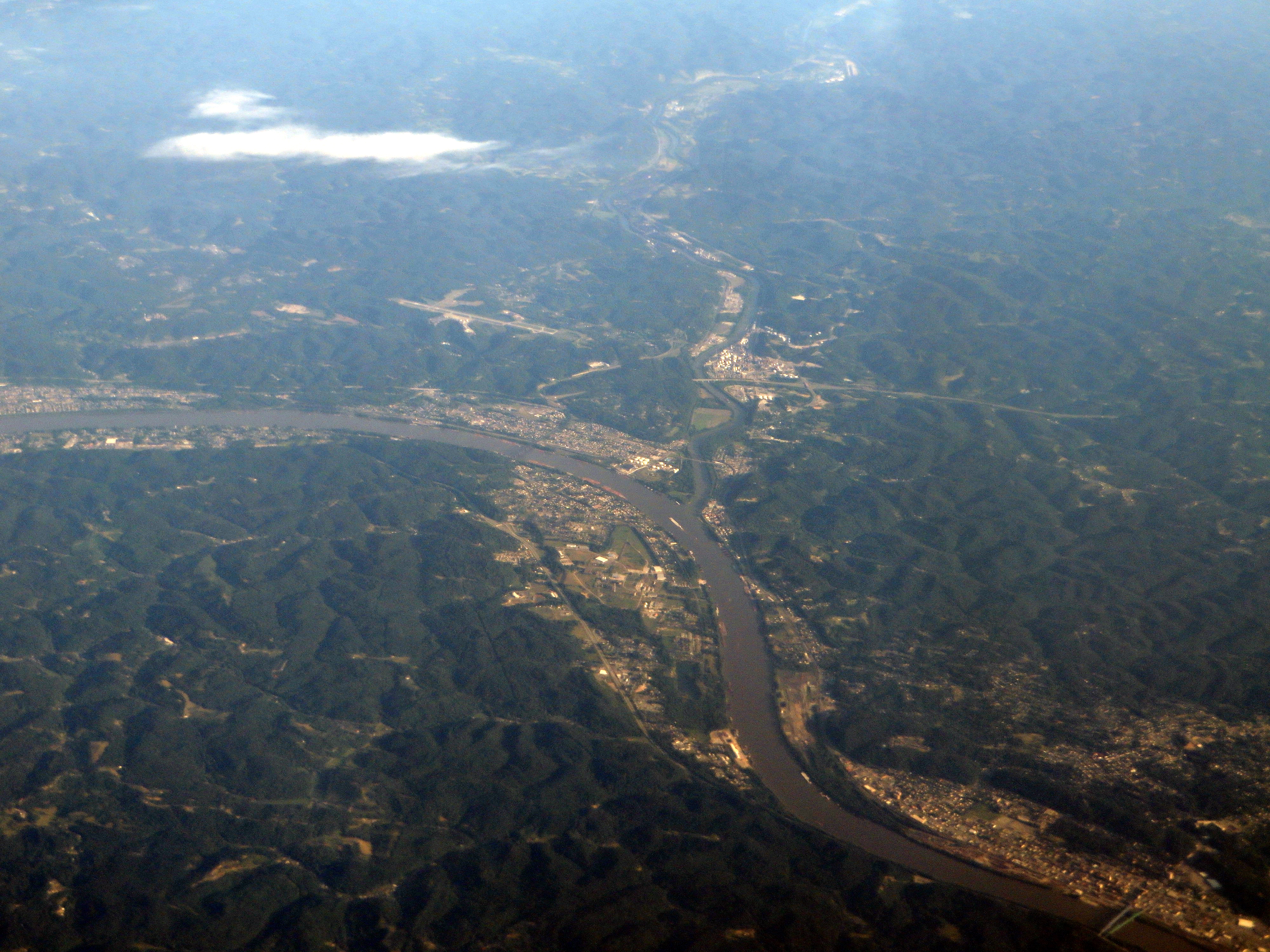
The Big Sandy River is a tributary of the Ohio River, approximately 29 miles (47 km) long, in western West Virginia and northeastern Kentucky in the United States. The river forms part of the boundary between the two states along its entire course. Via the Ohio River, it is part of the Mississippi River watershed. It is formed between Louisa, Kentucky, and Fort Gay, West Virginia, by the confluence of the Tug Fork and Levisa Fork. It flows generally northwardly in a highly meandering course, between Lawrence and Boyd counties in Kentucky and Wayne County in West Virginia. It joins the Ohio between Catlettsburg, Kentucky and Kenova, West Virginia, 8 miles (13 km) west of Huntington, West Virginia, at the common boundary between West Virginia, Kentucky, and Ohio. The river is navigable and carries commercial shipping, primarily coal mined in the immediate region. The name of the river comes from the presence of extensive sand bars. The Native American names for the river included Tatteroa, Chatteroi, and Chatterwha which had similar meaning to the English name. It was known to the Lenape as Sikeacepe, meaning "Salt River", from the presence of salt licks on the river. The name "Big Sandy" was in use no later than February, 1789. The tombstone of David White, an early settler along the river in Kentucky, marks his passing in 1817 with the note that he lived many years near the Mouth of the Big Sandy. Two well-known fiddle tunes take their name from the Big Sandy River: "Sandy River Belle" and the "Big Sandy River". Loretta Lynn's "Van Lear Rose" and Dwight Yoakam's "Bury Me" also mention the river. en.wikipedia.org/wiki/Big_Sandy_River_(Ohio_River) en.wikipedia.org/wiki/Wikipedia:Text_of_Creative_Commons_... |
| Date | |
| Source | Confluence of Ohio and Big Sandy River, South Point, Ohio; Kenova, West Virginia; Ashland, Kentucky |
| Author | Ken Lund from Reno, Nevada, USA |
| Camera location | | View this and other nearby images on: OpenStreetMap |
|---|
.jpg¶ms=038.413509_N_-082.593455_E_globe:Earth_type:camera_source:Flickr_&language=en)
Licensing[edit]
.jpg&action=edit§ion=2)
- You are free:
- to share – to copy, distribute and transmit the work
- to remix – to adapt the work
- Under the following conditions:
- attribution – You must give appropriate credit, provide a link to the license, and indicate if changes were made. You may do so in any reasonable manner, but not in any way that suggests the licensor endorses you or your use.
- share alike – If you remix, transform, or build upon the material, you must distribute your contributions under the same or compatible license as the original.
| This image was originally posted to Flickr by Ken Lund at https://flickr.com/photos/75683070@N00/14497039902. It was reviewed on 4 December 2015 by FlickreviewR and was confirmed to be licensed under the terms of the cc-by-sa-2.0. |
File history
Click on a date/time to view the file as it appeared at that time.
| Date/Time | Thumbnail | Dimensions | User | Comment | |
|---|---|---|---|---|---|
| current | 01:41, 4 December 2015 | | 4,000 × 3,000 (8.11 MB) | INeverCry (talk | contribs) | Transferred from Flickr via Flickr2Commons |
You cannot overwrite this file.
File usage on Commons
There are no pages that use this file.
Metadata
.jpg&oldid=867361836)
- Ohio River in Kentucky
- Ohio River in Ohio
- Ohio River in West Virginia
- Big Sandy River (Ohio River tributary)
- South Point, Ohio
- Kenova, West Virginia
- Ashland, Kentucky
- Aerial photographs of Ohio
- Aerial photographs of West Virginia
- Aerial photographs of Kentucky
- Fluvial geomorphology of Ohio
- Confluences in the United States
- Wayne County, West Virginia in the 2010s
- Tug Fork
- June in Wayne County, West Virginia