File:Colombia land 1970.jpg
Jump to navigation
Jump to search

Size of this preview: 463 × 599 pixels. Other resolutions: 185 × 240 pixels | 371 × 480 pixels | 744 × 963 pixels.
Original file (744 × 963 pixels, file size: 153 KB, MIME type: image/jpeg)
Captions
Captions
Add a one-line explanation of what this file represents
Summary[edit]
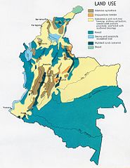
| Description | Land use map of Colombia. |
| Date | Depicts 1970; Made 9 March 2004 (according to Exif data) |
| Source | http://www.lib.utexas.edu/maps/colombia.html |
| Author | U.S. Central Intelligence Agency |
| This image is a work of a Central Intelligence Agency employee, taken or made as part of that person's official duties. As a Work of the United States Government, this image or media is in the public domain in the United States.
|

|
File history
Click on a date/time to view the file as it appeared at that time.
| Date/Time | Thumbnail | Dimensions | User | Comment | |
|---|---|---|---|---|---|
| current | 19:32, 27 October 2005 | | 744 × 963 (153 KB) | Brian0918 (talk | contribs) | Land use map of Colombia. http://www.lib.utexas.edu/maps/colombia.html {{PD-USGov-CIA}} Category:Maps of Colombia |
You cannot overwrite this file.
File usage on Commons
The following page uses this file:
File usage on other wikis
The following other wikis use this file:
- Usage on ar.wikipedia.org
- Usage on bn.wikipedia.org
- Usage on el.wikipedia.org
- Usage on en.wikipedia.org
- Usage on lt.wikipedia.org
- Usage on sl.wikipedia.org
- Usage on uk.wikipedia.org