File:Cidade City Djibouti Africa - Bases Militares China USA (29934552898).jpg
Jump to navigation
Jump to search
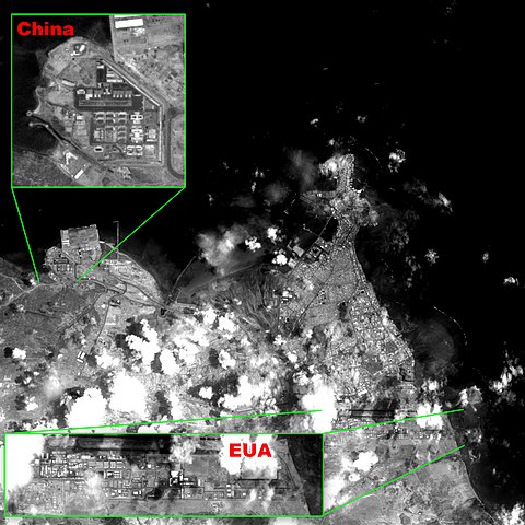
Size of this preview: 599 × 599 pixels. Other resolutions: 240 × 240 pixels | 480 × 480 pixels | 768 × 768 pixels | 1,024 × 1,024 pixels | 2,047 × 2,048 pixels | 2,879 × 2,880 pixels.
Original file (2,879 × 2,880 pixels, file size: 1.37 MB, MIME type: image/jpeg)
Captions
Captions
Add a one-line explanation of what this file represents
Summary[edit]
.jpg&action=edit§ion=1)
| Description |
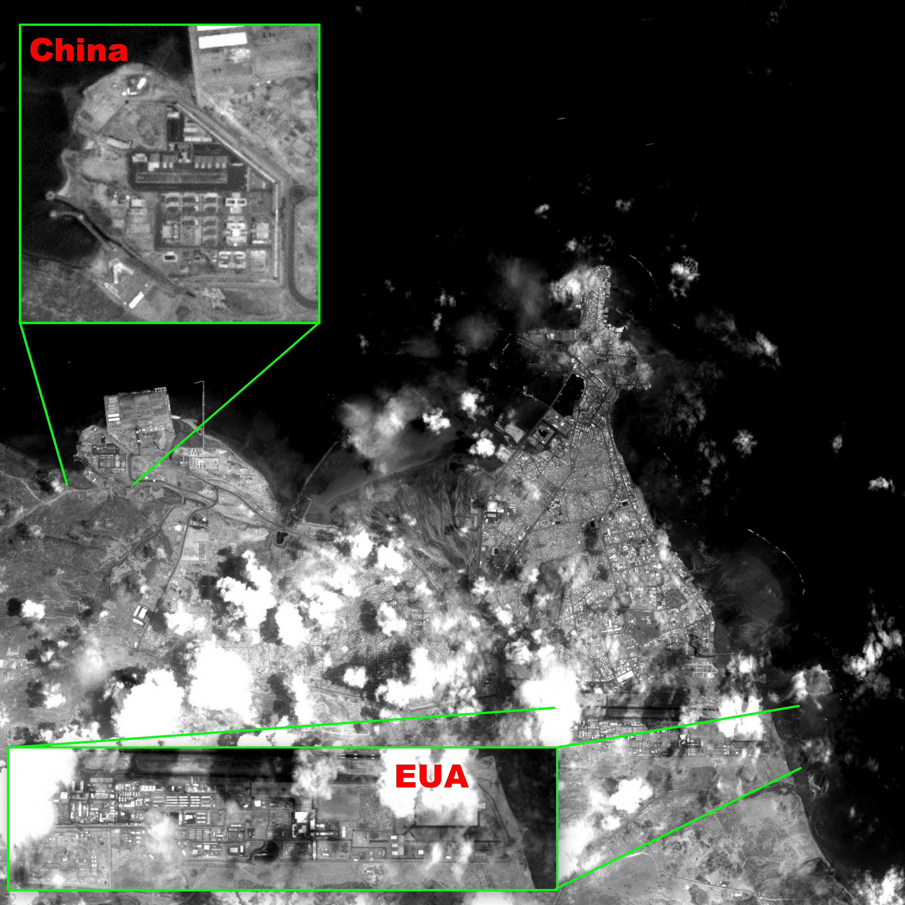
Português: Imagem CBERS4 PAN de alta resolução espacial (5m/pixel), gravada a bordo, da Cidade do Djibouti. Anotada para mostrar a proximidade, 12 km, e detalhes das bases militares Chinesa e Americana. Destacadas em resolução plena a nova base militar Chinesa, única fora da China, vizinha ao Porto de Doraleh, e a base militar Americana Camp Lemonnier, única na África, ao Sul do Aeroporto Internacional Ambouli. Assim como os EUA, França e Japão também tem bases militares no país. É um local geopoliticamente estratégico por ser localizado próximo ao Estreito Babelmândebe, já imageado aqui. Entrada no Mar Vermelho, por onde passam 5 milhões de barris de petróleo por dia com destino à Europa e Estados Unidos, via Canal de Suez. Imagem em P&B por ter apenas uma banda espectral; de 0,51 a 0,85 µm (verde ao começo do infra-vermelho próximo)
Imagem CBERS4 PAN5m Bases Militares Chinesa e Americana, Cidade do Djibouti, Africa Coordenadas do centro da imagem: 11°35'03.3"N 43°07'08.1"E Data: 13-04-2018 / 2018-13-04 P&B Cena: 070 / 087 Autor: Oton Barros (DSR/OBT/INPE)English: Djibouti City high spatial resolution (5m/pixel) recorded on board CBERS4 PAN image; illustrated to show how near, 7 miles, Chinese and American military bases are, and some of their details. Shown in full resolution, China´s new base, only outside China, besides Doraleh Port, and American base Camp Lemonnier, only in Africa, South of Ambouli Internacional Airport. Like the US, France and Japan also got military bases there. Near Bab-el-Mandeb Strait, already imaged here, it´s a geopolically strategic spot, Red Sea entrance, where 5 million oil barrels a day pass going to Europe and US via Suez Canal. Image in B&W since it has only one spectral band from 0.51 to 0.85 µm (green to near infrared).
Image CBERS4 PAN5m Bases Militares Chinesa e Americana, Cidade do Djibouti, Africa Image center: 11°35'03.3"N 43°07'08.1"E Date: 13-04-2018 / 2018-13-04 B&W Scene: 070 / 087 Author: Oton Barros (DSR/OBT/INPE) |
| Date | |
| Source | Cidade/City Djibouti/Africa - Bases Militares China / USA |
| Author | Coordenação-Geral de Observação da Terra/INPE |
Licensing[edit]
.jpg&action=edit§ion=2)
This file is licensed under the Creative Commons Attribution-Share Alike 2.0 Generic license.
- You are free:
- to share – to copy, distribute and transmit the work
- to remix – to adapt the work
- Under the following conditions:
- attribution – You must give appropriate credit, provide a link to the license, and indicate if changes were made. You may do so in any reasonable manner, but not in any way that suggests the licensor endorses you or your use.
- share alike – If you remix, transform, or build upon the material, you must distribute your contributions under the same or compatible license as the original.
| This image was originally posted to Flickr by Coordenação-Geral de Observação da Terra/INPE at https://flickr.com/photos/153282474@N02/29934552898. It was reviewed on 12 October 2020 by FlickreviewR 2 and was confirmed to be licensed under the terms of the cc-by-sa-2.0. |
File history
Click on a date/time to view the file as it appeared at that time.
| Date/Time | Thumbnail | Dimensions | User | Comment | |
|---|---|---|---|---|---|
| current | 05:07, 12 October 2020 | | 2,879 × 2,880 (1.37 MB) | Sturm (talk | contribs) | Transferred from Flickr via #flickr2commons |
You cannot overwrite this file.
File usage on Commons
The following 2 pages use this file:
File usage on other wikis
The following other wikis use this file:
- Usage on ca.wikipedia.org
- Usage on fi.wikipedia.org
- Usage on he.wikipedia.org
- Usage on www.wikidata.org
.jpg&oldid=876139271)