File:Chickasaw turnpike-path.png
Jump to navigation
Jump to search

Size of this preview: 800 × 471 pixels. Other resolutions: 320 × 188 pixels | 640 × 376 pixels | 1,024 × 602 pixels | 1,280 × 753 pixels | 3,223 × 1,896 pixels.
Original file (3,223 × 1,896 pixels, file size: 1.07 MB, MIME type: image/png)
Captions
Captions
Add a one-line explanation of what this file represents
Summary[edit]
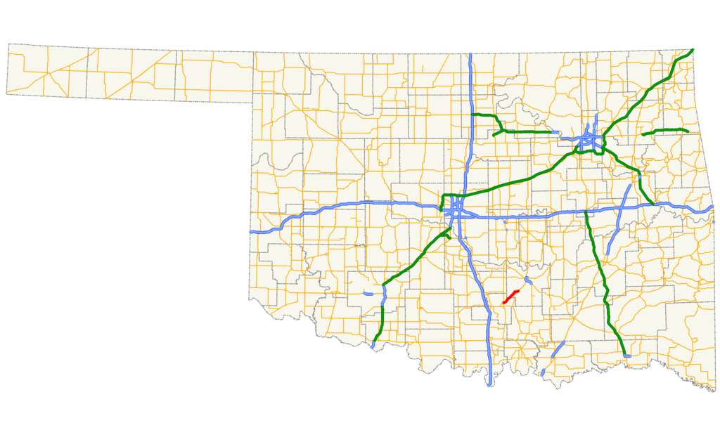
| Description | Map of the Chickasaw Turnpike within the state of Oklahoma. |
| Date | |
| Source |
self-made in QGIS |
| Author | Scott5114 |
| Permission (Reusing this file) |
PD |
Legend[edit]
| Roads | Borders | ||||||||||||||
|---|---|---|---|---|---|---|---|---|---|---|---|---|---|---|---|
|
|
Licensing[edit]
| I, the copyright holder of this work, release this work into the public domain. This applies worldwide. In some countries this may not be legally possible; if so: I grant anyone the right to use this work for any purpose, without any conditions, unless such conditions are required by law. |
File history
Click on a date/time to view the file as it appeared at that time.
| Date/Time | Thumbnail | Dimensions | User | Comment | |
|---|---|---|---|---|---|
| current | 09:20, 30 April 2013 | | 3,223 × 1,896 (1.07 MB) | Scott5114 (talk | contribs) | Updated to show truncation; removed white background |
| 00:15, 11 April 2008 |  | 3,425 × 2,031 (168 KB) | Scott5114 (talk | contribs) | thinner lines | |
| 23:53, 10 April 2008 |  | 3,425 × 2,031 (150 KB) | Scott5114 (talk | contribs) | {{Information |Description=Map of the Chickasaw Turnpike within the state of Oklahoma. |Source=self-made in QGIS |Date=2008-04-10 |Author=Scott5114 |Permission=PD |other_versions= }} Category:Maps of turnpikes in Oklahoma |
You cannot overwrite this file.
File usage on Commons
The following 2 pages use this file:
File usage on other wikis
The following other wikis use this file:
- Usage on ar.wikipedia.org
- Usage on de.wikipedia.org
- Usage on en.wikipedia.org
- Usage on es.wikipedia.org
- Usage on www.wikidata.org