File:Charlemont Place, Armagh - geograph.org.uk - 720902.jpg
Jump to navigation
Jump to search
No higher resolution available.
Charlemont_Place,_Armagh_-_geograph.org.uk_-_720902.jpg (640 × 480 pixels, file size: 89 KB, MIME type: image/jpeg)
Captions
Captions
Add a one-line explanation of what this file represents
|
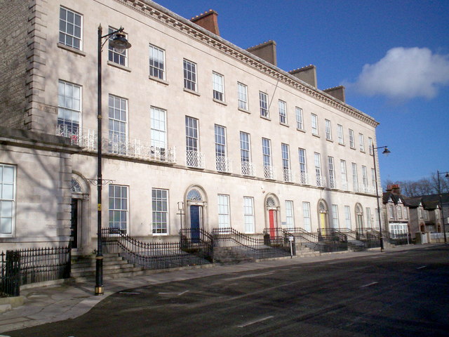
This is a photo of a listed building with HB number HB15/17/010 A-E. |
Summary[edit]
| Description |
English: Charlemont Place, Armagh When the Mall was developed as public walks in 1798, the racecourse having been removed from the area, it became one of the most desirable residential areas in Armagh. The fine houses of Charlemont Place were built on the east side between 1820 and 1840. The Southern Education and Library Board now occupy all five houses. |
| Date | |
| Source | From geograph.org.uk |
| Author | P Flannagan |
| Attribution (required by the license) | P Flannagan / Charlemont Place, Armagh / |
| Camera location | | View this and other nearby images on: OpenStreetMap |
|---|
_heading:112.00&language=en)
| Object location | | View this and other nearby images on: OpenStreetMap |
|---|
_heading:112.00&language=en)
Licensing[edit]

|
This image was taken from the Geograph project collection. See this photograph's page on the Geograph website for the photographer's contact details. The copyright on this image is owned by P Flannagan and is licensed for reuse under the Creative Commons Attribution-ShareAlike 2.0 license.
|
This file is licensed under the Creative Commons Attribution-Share Alike 2.0 Generic license.
Attribution: P Flannagan
- You are free:
- to share – to copy, distribute and transmit the work
- to remix – to adapt the work
- Under the following conditions:
- attribution – You must give appropriate credit, provide a link to the license, and indicate if changes were made. You may do so in any reasonable manner, but not in any way that suggests the licensor endorses you or your use.
- share alike – If you remix, transform, or build upon the material, you must distribute your contributions under the same or compatible license as the original.
File history
Click on a date/time to view the file as it appeared at that time.
| Date/Time | Thumbnail | Dimensions | User | Comment | |
|---|---|---|---|---|---|
| current | 04:17, 19 February 2011 | | 640 × 480 (89 KB) | GeographBot (talk | contribs) | == {{int:filedesc}} == {{Information |description={{en|1=Charlemont Place, Armagh When the Mall was developed as public walks in 1798, the racecourse having been removed from the area, it became one of the most desirable residential areas in Armagh. The f |
You cannot overwrite this file.
File usage on Commons
The following page uses this file:
File usage on other wikis
The following other wikis use this file:
- Usage on azb.wikipedia.org
- Usage on en.wikipedia.org
- Usage on www.wikidata.org