File:Champs - Montée de Morigeau.jpg
Original file (5,464 × 3,640 pixels, file size: 17.15 MB, MIME type: image/jpeg)
Captions
Summary[edit]
DescriptionChamps - Montée de Morigeau.jpg |
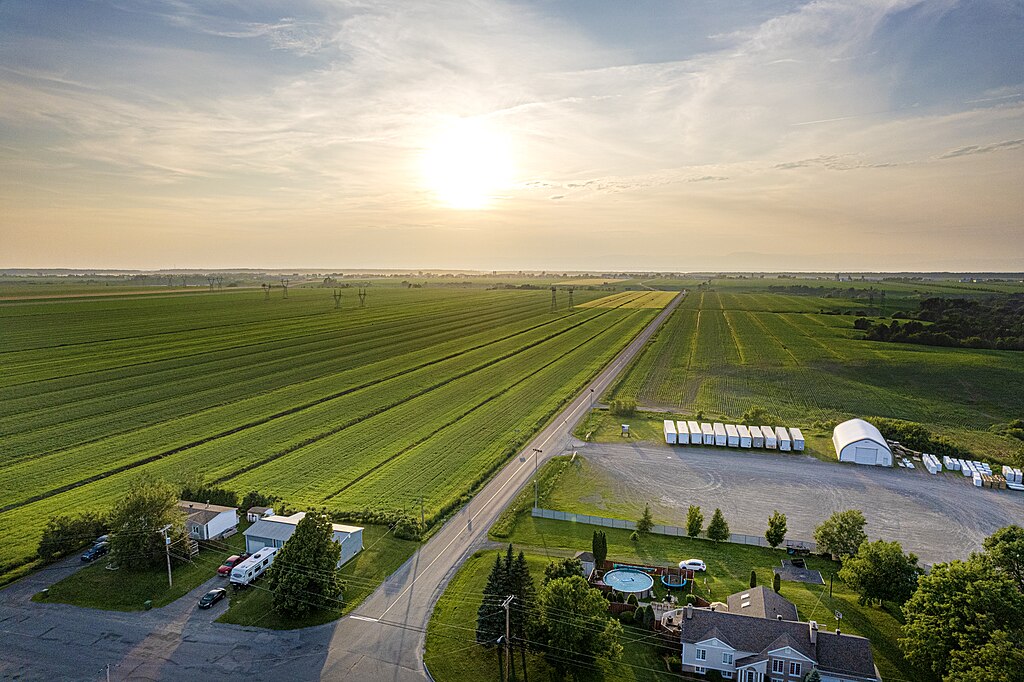
Français : La montée de Morigeau traverse des champs, au sud du hameau de Morigeau. |
Date | |
Source | Own work |
Author | Gabriel Picard |
Camera location | 46° 53′ 00.93″ N, 70° 40′ 12.25″ W | View this and other nearby images on: OpenStreetMap | 46.883591; -70.670069 |
---|
Licensing[edit]
- You are free:
- to share – to copy, distribute and transmit the work
- to remix – to adapt the work
- Under the following conditions:
- attribution – You must give appropriate credit, provide a link to the license, and indicate if changes were made. You may do so in any reasonable manner, but not in any way that suggests the licensor endorses you or your use.
- share alike – If you remix, transform, or build upon the material, you must distribute your contributions under the same or compatible license as the original.
This image has been assessed using the Quality image guidelines and is considered a Quality image.
العربية ∙ جازايرية ∙ беларуская ∙ беларуская (тарашкевіца) ∙ български ∙ বাংলা ∙ català ∙ čeština ∙ Cymraeg ∙ Deutsch ∙ Schweizer Hochdeutsch ∙ Zazaki ∙ Ελληνικά ∙ English ∙ Esperanto ∙ español ∙ eesti ∙ euskara ∙ فارسی ∙ suomi ∙ français ∙ galego ∙ עברית ∙ हिन्दी ∙ hrvatski ∙ magyar ∙ հայերեն ∙ Bahasa Indonesia ∙ italiano ∙ 日本語 ∙ Jawa ∙ ქართული ∙ 한국어 ∙ kurdî ∙ Lëtzebuergesch ∙ lietuvių ∙ македонски ∙ മലയാളം ∙ मराठी ∙ Bahasa Melayu ∙ Nederlands ∙ Norfuk / Pitkern ∙ polski ∙ português ∙ português do Brasil ∙ rumantsch ∙ română ∙ русский ∙ sicilianu ∙ slovenčina ∙ slovenščina ∙ shqip ∙ српски / srpski ∙ svenska ∙ தமிழ் ∙ తెలుగు ∙ ไทย ∙ Tagalog ∙ Türkçe ∙ toki pona ∙ українська ∙ vèneto ∙ Tiếng Việt ∙ 中文 ∙ 中文(简体) ∙ 中文(繁體) ∙ +/− |
File history
Click on a date/time to view the file as it appeared at that time.
Date/Time | Thumbnail | Dimensions | User | Comment | |
---|---|---|---|---|---|
current | 16:59, 9 July 2023 | 5,464 × 3,640 (17.15 MB) | Gacard (talk | contribs) | Uploaded own work with UploadWizard |
You cannot overwrite this file.
File usage on Commons
The following 3 pages use this file:
Metadata
This file contains additional information such as Exif metadata which may have been added by the digital camera, scanner, or software program used to create or digitize it. If the file has been modified from its original state, some details such as the timestamp may not fully reflect those of the original file. The timestamp is only as accurate as the clock in the camera, and it may be completely wrong.
Camera manufacturer | DJI |
---|---|
Camera model | FC3411 |
Exposure time | 1/2,000 sec (0.0005) |
F-number | f/2.8 |
ISO speed rating | 100 |
Date and time of data generation | 19:41, 6 July 2023 |
Lens focal length | 8.38 mm |
Latitude | 46° 53′ 0.93″ N |
Longitude | 70° 40′ 12.25″ W |
Altitude | 118.5 meters above sea level |
Orientation | Normal |
Horizontal resolution | 300 dpi |
Vertical resolution | 300 dpi |
Software used | Adobe Photoshop 24.4 (Windows) |
File change date and time | 22:31, 6 July 2023 |
Exposure Program | Normal program |
Exif version | 2.3 |
Date and time of digitizing | 19:41, 6 July 2023 |
APEX shutter speed | 10.965784 |
APEX aperture | 2.970854 |
APEX exposure bias | 0 |
Maximum land aperture | 2.97 APEX (f/2.8) |
Metering mode | Average |
Light source | Daylight |
Flash | Flash did not fire |
Color space | Uncalibrated |
File source | Digital still camera |
Scene type | A directly photographed image |
Exposure mode | Auto exposure |
White balance | Auto white balance |
Digital zoom ratio | 1 |
Focal length in 35 mm film | 22 mm |
Scene capture type | Standard |
Scene control | None |
Contrast | Normal |
Saturation | Normal |
Sharpness | Normal |
GPS tag version | 0.0.3.2 |
Serial number of camera | 42UQKB323A0BGF |
Lens used | 22.4 mm f/2.8 |
Date metadata was last modified | 18:31, 6 July 2023 |
Unique ID of original document | 28C08E0428902C6D1D4F4E6ED5320EB1 |
Structured data
Items portrayed in this file
depicts
some value
6 July 2023
46°53'0.928"N, 70°40'12.248"W
0.0005 second
2.8
8.38 millimetre
100
image/jpeg
2e1683c563455d8a3b7e9fe2b343ef5355ad0acc
17,979,844 byte
3,640 pixel
5,464 pixel
- Files with coordinates missing SDC location of creation
- CC-BY-SA-4.0
- Self-published work
- Photographs by Gabriel Picard
- Photographs by Gabriel Picard/Fields
- Photographs by Gabriel Picard taken in 2023
- Photographs by Gabriel Picard/Chaudière-Appalaches
- Photographs by Gabriel Picard/Roads
- Quality images
- Pages with maps