File:Chain Bridge Memorial, Palmerton, PA.jpg
Original file (3,946 × 2,629 pixels, file size: 5.74 MB, MIME type: image/jpeg)
Captions
Summary[edit]
DescriptionChain Bridge Memorial, Palmerton, PA.jpg |
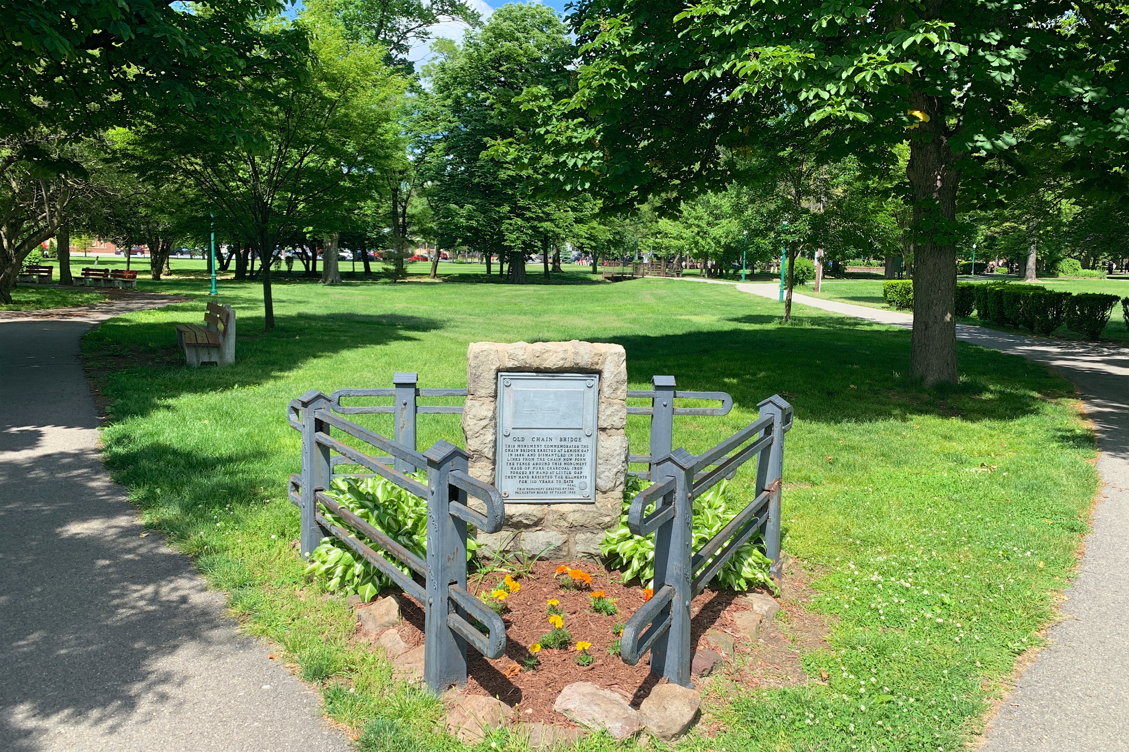
English: A memorial to the old chain bridge erected at Lehigh Gap in 1826 and dismantled in 1933. Links from the chain now form the fence around the monument in the community park of Palmerton, Pennsylvania. The park is a contributing property of the Palmerton Historic District.
|
||
Date | |||
Source | Own work | ||
Author | Zeete |
Camera location | 40° 48′ 08.91″ N, 75° 36′ 29.63″ W | View this and other nearby images on: OpenStreetMap | 40.802475; -75.608231 |
---|
Licensing[edit]
- You are free:
- to share – to copy, distribute and transmit the work
- to remix – to adapt the work
- Under the following conditions:
- attribution – You must give appropriate credit, provide a link to the license, and indicate if changes were made. You may do so in any reasonable manner, but not in any way that suggests the licensor endorses you or your use.
- share alike – If you remix, transform, or build upon the material, you must distribute your contributions under the same or compatible license as the original.
This image was uploaded as part of Wiki Loves Monuments 2019.
Afrikaans ∙ Alemannisch ∙ azərbaycanca ∙ Bahasa Indonesia ∙ Bahasa Melayu ∙ Bikol Central ∙ bosanski ∙ brezhoneg ∙ català ∙ čeština ∙ Cymraeg ∙ dansk ∙ davvisámegiella ∙ Deutsch ∙ eesti ∙ English ∙ español ∙ Esperanto ∙ euskara ∙ français ∙ Frysk ∙ Gaeilge ∙ galego ∙ hrvatski ∙ Ido ∙ italiano ∙ latviešu ∙ Lëtzebuergesch ∙ Malagasy ∙ magyar ∙ Malti ∙ Nederlands ∙ norsk ∙ norsk nynorsk ∙ norsk bokmål ∙ polski ∙ português ∙ português do Brasil ∙ română ∙ shqip ∙ sicilianu ∙ slovenčina ∙ slovenščina ∙ suomi ∙ svenska ∙ Tagalog ∙ Türkçe ∙ Yorùbá ∙ Zazaki ∙ Ελληνικά ∙ беларуская ∙ беларуская (тарашкевіца) ∙ български ∙ кыргызча ∙ македонски ∙ русский ∙ српски / srpski ∙ українська ∙ ქართული ∙ հայերեն ∙ नेपाली ∙ हिन्दी ∙ বাংলা ∙ മലയാളം ∙ ไทย ∙ 한국어 ∙ +/− |
File history
Click on a date/time to view the file as it appeared at that time.
Date/Time | Thumbnail | Dimensions | User | Comment | |
---|---|---|---|---|---|
current | 17:51, 4 September 2019 | 3,946 × 2,629 (5.74 MB) | Zeete (talk | contribs) | User created page with UploadWizard |
You cannot overwrite this file.
File usage on Commons
There are no pages that use this file.
Metadata
This file contains additional information such as Exif metadata which may have been added by the digital camera, scanner, or software program used to create or digitize it. If the file has been modified from its original state, some details such as the timestamp may not fully reflect those of the original file. The timestamp is only as accurate as the clock in the camera, and it may be completely wrong.
Camera manufacturer | Apple |
---|---|
Camera model | iPhone XS |
Exposure time | 1/972 sec (0.0010288065843621) |
F-number | f/1.8 |
ISO speed rating | 25 |
Date and time of data generation | 11:04, 27 May 2019 |
Lens focal length | 4.25 mm |
Latitude | 40° 48′ 8.91″ N |
Longitude | 75° 36′ 29.63″ W |
Altitude | 122.177 meters above sea level |
Orientation | Normal |
Horizontal resolution | 72 dpi |
Vertical resolution | 72 dpi |
Software used | Aperture 3.6 |
File change date and time | 11:04, 27 May 2019 |
Exposure Program | Normal program |
Exif version | 2.21 |
Date and time of digitizing | 11:04, 27 May 2019 |
Meaning of each component |
|
APEX shutter speed | 9.9245413041606 |
APEX aperture | 1.6959938128384 |
APEX brightness | 9.2585360648741 |
APEX exposure bias | 0 |
Metering mode | Pattern |
Flash | Flash did not fire, compulsory flash suppression |
DateTimeOriginal subseconds | 130 |
DateTimeDigitized subseconds | 130 |
Supported Flashpix version | 1 |
Color space | sRGB |
Sensing method | One-chip color area sensor |
Scene type | A directly photographed image |
Exposure mode | Auto exposure |
White balance | Auto white balance |
Focal length in 35 mm film | 26 mm |
Scene capture type | Standard |
GPS time (atomic clock) | 15:04 |
Speed unit | Kilometers per hour |
Speed of GPS receiver | 0.10612035550025 |
Reference for direction of image | True direction |
Direction of image | 285.98257448004 |
Reference for bearing of destination | True direction |
Bearing of destination | 285.98257448004 |
GPS date | 27 May 2019 |
Structured data
Items portrayed in this file
depicts
27 May 2019
40°48'8.910"N, 75°36'29.632"W
0.00102880658436213991 second
1.8
4.25 millimetre
image/jpeg
39cd90addb31c793cd13ad249d1548597895c226
6,023,627 byte
2,629 pixel
3,946 pixel
- National Register of Historic Places with known IDs
- CC-BY-SA-4.0
- Self-published work
- Images from Wiki Loves Monuments 2019
- Images from Wiki Loves Monuments 2019 in the United States
- Images from Wiki Loves Monuments 2019 in Pennsylvania
- Photos by User:Zeete
- Wiki Loves Monuments 2019 in the United States unreviewed
- Uploaded via Campaign:wlm-us
- United States photographs taken on 2019-05-27
- Pages with maps