File:Carlyle Lake Illinois aerial view.jpg
Jump to navigation
Jump to search

Size of this preview: 800 × 533 pixels. Other resolutions: 320 × 213 pixels | 640 × 427 pixels | 1,024 × 683 pixels | 1,500 × 1,000 pixels.
Original file (1,500 × 1,000 pixels, file size: 648 KB, MIME type: image/jpeg)
Captions
Captions
Add a one-line explanation of what this file represents
| Description |
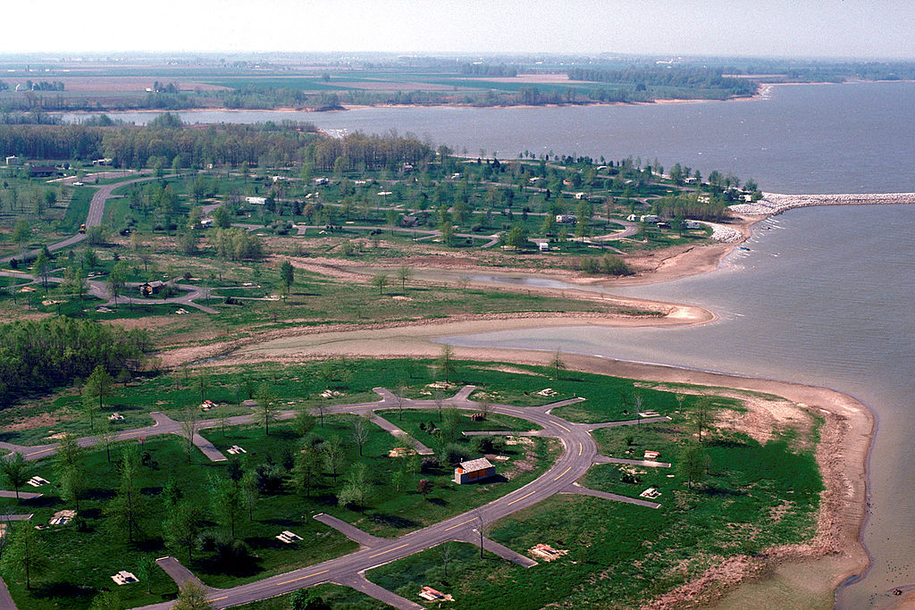
English: Aerial view of Carlyle Lake in Clinton County, Illinois, USA. The lake is impounded behind Carlyle Dam on the Kaskaskia River. The dam was constructed by the U.S. Army Corps of Engineers to create a water reservoir. The photograph shows the Coles Creek Recreation Area on the lake.
Coordinates: 38°39′20.42″N 89°15′55.97″W / 38.6556722°N 89.2655472°W |
|||
| Location | Clinton County, Illinois, USA | |||
| Date | February 9, 2000 – as given in the description, but the date seems unlikely given the green foliage and autumn colors. | |||
| Source |
U.S. Army Corps of Engineers Digital Visual Library Image page Image description page Digital Visual Library home page |
|||
| Author | U.S. Army Corps of Engineers, photographer not specified or unknown | |||
| Permission (Reusing this file) |
|
File history
Click on a date/time to view the file as it appeared at that time.
| Date/Time | Thumbnail | Dimensions | User | Comment | |
|---|---|---|---|---|---|
| current | 04:07, 1 April 2007 | | 1,500 × 1,000 (648 KB) | DanMS (talk | contribs) | {{Information | Description = {{en|Aerial view of Carlyle Lake in Clinton County, Illinois, USA. The lake is impounded behind Carlyle Dam on the Kaskaskia River. The dam was constructed by the U.S. Army Corps of Engineers to create a water reservoir. T |
You cannot overwrite this file.
File usage on Commons
The following page uses this file:
File usage on other wikis
The following other wikis use this file:
- Usage on en.wikipedia.org
- Usage on es.wikipedia.org
- Usage on hu.wikipedia.org
- Usage on vi.wikipedia.org
- Usage on www.wikidata.org