File:Caribbean Sea, Avila Mt, Caracas Panorama.jpg

Original file (13,347 × 2,575 pixels, file size: 14.42 MB, MIME type: image/jpeg)
Captions
Captions
Summary[edit]
| Description |
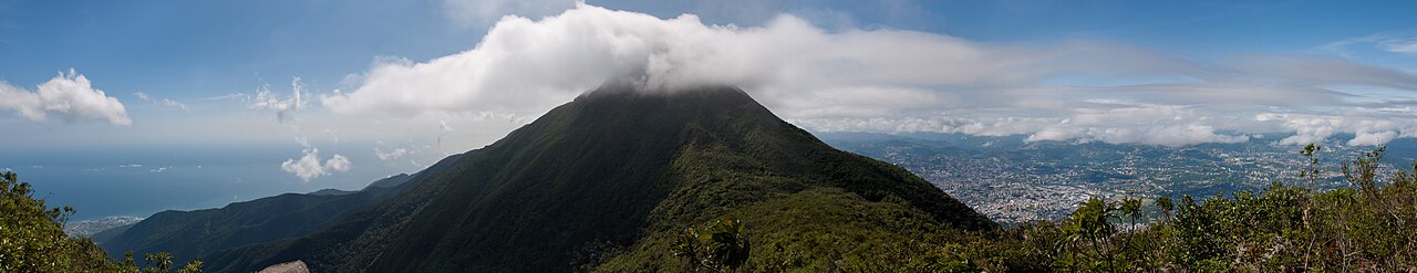
English: Panoramic image, taken from one of the highest parts in the Avila Mountain Chain. The Avila separates Caracas (1000 mts asl) from the Caribbean Sea. The picture was taken at a place called "La Silla" (spanish: "The Saddle"), situated among two peaks: Oriental peak (second highest peak at 2640 mts asl, visible in the middle) and Occidental peak (third highest peak, not visible, behind the camera). From this spot is possible see the city of Caraballeda (left in the picture), and Caracas valley (right in the picture).
Español: Imagen panorámica, tomada desde uno de los puntos más altos del El Ávila, un lugar conocido como La Silla. El Ávila separa Caracas del mar caribe, aunque la ciudad capital se encuentra a unos 1000 metros sobre el nivel del mar. En la foto es posible apreciar la diferencia de niveles entre la ciudad de Caraballeda, con su puerto deportivo (izquierda en la imagen) y la parte del Este de Caracas (a la derecha en la imagen desde el aeropuerto de La Carlota hacia el este). |
|||
| Date | ||||
| Source | Own work | |||
| Author | Paolo Costa Baldi | |||
| Permission (Reusing this file) |
|
Licensing[edit]
- You are free:
- to share – to copy, distribute and transmit the work
- to remix – to adapt the work
- Under the following conditions:
- attribution – You must give appropriate credit, provide a link to the license, and indicate if changes were made. You may do so in any reasonable manner, but not in any way that suggests the licensor endorses you or your use.
- share alike – If you remix, transform, or build upon the material, you must distribute your contributions under the same or compatible license as the original.

|
Permission is granted to copy, distribute and/or modify this document under the terms of the GNU Free Documentation License, Version 1.2 or any later version published by the Free Software Foundation; with no Invariant Sections, no Front-Cover Texts, and no Back-Cover Texts. A copy of the license is included in the section entitled GNU Free Documentation License. |
File history
Click on a date/time to view the file as it appeared at that time.
| Date/Time | Thumbnail | Dimensions | User | Comment | |
|---|---|---|---|---|---|
| current | 03:51, 18 July 2011 | 13,347 × 2,575 (14.42 MB) | Paolostefano1412 (talk | contribs) | {{Information |Description ={{en|1=This one was taken from one of the highest parts in the Avila Mountain Chain. The Avila separates Caracas (1000 mts asl) from the Caribbean Sea. The pic was taken at a place called "La Silla" (spanish: chair), situat |
You cannot overwrite this file.
File usage on Commons
The following 3 pages use this file:
File usage on other wikis
The following other wikis use this file:
- Usage on de.wikipedia.org
- Usage on en.wikipedia.org
- Usage on es.wikipedia.org
- Usage on es.wikivoyage.org
- Usage on io.wikipedia.org
- Usage on it.wikipedia.org
- Usage on nl.wikipedia.org