File:Caldera El Golfo 02.jpg
Jump to navigation
Jump to search

Size of this preview: 800 × 341 pixels. Other resolutions: 320 × 136 pixels | 640 × 273 pixels | 1,024 × 437 pixels | 1,280 × 546 pixels | 2,560 × 1,092 pixels | 16,714 × 7,128 pixels.
Original file (16,714 × 7,128 pixels, file size: 84.06 MB, MIME type: image/jpeg)
Captions
Captions
Add a one-line explanation of what this file represents
| Warning | The original file is very high-resolution. It might not load properly or could cause your browser to freeze when opened at full size. |
|---|
Summary[edit]
| Description |
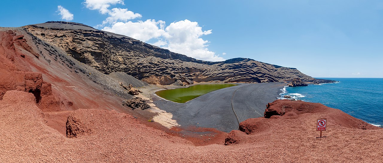
English: Panorama of the Caldera El Golfo and Charco de los Clicos, El Golfo, Lanzarote, Canary Islands, Spain after recovery work 2015/2016.
Deutsch: Panorama des Kraters El Golfo und des Charco de los Clicos, El Golfo, Lanzarote, Kanarische Inseln, Spanien nach den Sanierungsarbeiten 2015/2016. |
| Date | |
| Source | Own work |
| Author | H. Zell |
| Other versions |
|

|
| Camera location | | View this and other nearby images on: OpenStreetMap |
|---|
Licensing[edit]
I, the copyright holder of this work, hereby publish it under the following licenses:

|
Permission is granted to copy, distribute and/or modify this document under the terms of the GNU Free Documentation License, Version 1.2 or any later version published by the Free Software Foundation; with no Invariant Sections, no Front-Cover Texts, and no Back-Cover Texts. A copy of the license is included in the section entitled GNU Free Documentation License. |
This file is licensed under the Creative Commons Attribution-Share Alike 3.0 Unported license.
- You are free:
- to share – to copy, distribute and transmit the work
- to remix – to adapt the work
- Under the following conditions:
- attribution – You must give appropriate credit, provide a link to the license, and indicate if changes were made. You may do so in any reasonable manner, but not in any way that suggests the licensor endorses you or your use.
- share alike – If you remix, transform, or build upon the material, you must distribute your contributions under the same or compatible license as the original.
You may select the license of your choice.
This image has been assessed using the Quality image guidelines and is considered a Quality image.
|

|
This image has been assessed under the valued image criteria and is considered the most valued image on Commons within the scope: Charco de los Clicos, Lanzarote, after recovery work 2015-2016. You can see its nomination here. |
File history
Click on a date/time to view the file as it appeared at that time.
| Date/Time | Thumbnail | Dimensions | User | Comment | |
|---|---|---|---|---|---|
| current | 14:40, 8 June 2018 | | 16,714 × 7,128 (84.06 MB) | Llez (talk | contribs) | Reverted to version as of 14:36, 8 June 2018 (UTC) |
| 14:39, 8 June 2018 |  | 12,873 × 5,385 (52.58 MB) | Llez (talk | contribs) | downsized | |
| 14:36, 8 June 2018 |  | 16,714 × 7,128 (84.06 MB) | Llez (talk | contribs) | Reverted to version as of 16:57, 7 June 2018 (UTC) | |
| 14:18, 8 June 2018 |  | 16,714 × 7,128 (84.25 MB) | Llez (talk | contribs) | Reverted to version as of 14:03, 8 June 2018 (UTC) | |
| 14:15, 8 June 2018 |  | 16,618 × 7,128 (83.75 MB) | Llez (talk | contribs) | Horizon | |
| 14:03, 8 June 2018 |  | 16,714 × 7,128 (84.25 MB) | Llez (talk | contribs) | Correction of horizon | |
| 16:57, 7 June 2018 |  | 16,714 × 7,128 (84.06 MB) | Llez (talk | contribs) | {{Information |description ={{en|1=Panorama of the Caldera El Golfo and Charco de los Clicos, El Golfo, Lanzarote, Canary Islands, Spain after recovery work 2015/2016.}} {{de|1=Panorama des Kraters El Golfo und des Charco de los Clicos, El Golfo, Lanzarote, Kanarische Inseln, Spanien nach den SAnierungsarbeiten 2015/2016... |
You cannot overwrite this file.
File usage on Commons
The following 17 pages use this file:
- User:Eatcha/POTY-2018-Round-1-Results
- User:Llez/Featured Pictures
- User:Llez/Landscapes
- User talk:Llez/Archives/2018 (2)
- Commons:Featured picture candidates/File:Caldera El Golfo 02.jpg
- Commons:Featured picture candidates/Log/June 2018
- Commons:Featured pictures/Places/Natural/Spain
- Commons:Featured pictures/chronological/2018-A
- Commons:Picture of the Year/2018/Candidates
- Commons:Picture of the Year/2018/R1/Gallery/2018-A
- Commons:Picture of the Year/2018/R1/Gallery/ALL
- Commons:Picture of the Year/2018/R1/Gallery/M06
- Commons:Picture of the Year/2018/R1/Gallery/Panoramic views
- Commons:Picture of the Year/2018/R1/v/Caldera El Golfo 02.jpg
- Commons:Quality images/Subject/Places/Natural structures/archive 2018
- Commons:Quality images candidates/Archives June 11 2018
- Commons:Valued image candidates/Caldera El Golfo 02.jpg
File usage on other wikis
The following other wikis use this file:
- Usage on fr.wikipedia.org
- Usage on mg.wikipedia.org