File:CSX rail bridge, Twin Bridges.jpg
Jump to navigation
Jump to search

Size of this preview: 800 × 600 pixels. Other resolutions: 320 × 240 pixels | 640 × 480 pixels | 1,024 × 768 pixels | 1,280 × 960 pixels | 2,560 × 1,920 pixels | 2,816 × 2,112 pixels.
Original file (2,816 × 2,112 pixels, file size: 3.47 MB, MIME type: image/jpeg)
Captions
Captions
Add a one-line explanation of what this file represents
| Camera location | | View this and other nearby images on: OpenStreetMap |
|---|
|
This is an image of a place or building that is listed on the National Register of Historic Places in the United States of America. Its reference number is 00000200. |
| Description |
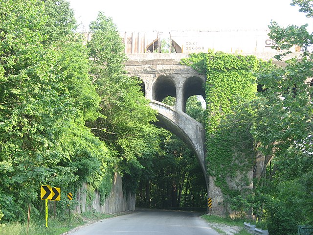
English: Southern side of a rail bridge that crosses Twin Bridges Road and White Lick Creek on the eastern edge of Danville, Hendricks County, Indiana, United States. Built in 1887, it and an adjacent road bridge are listed together on the National Register of Historic Places as the Twin Bridges. |
||
| Date | Taken on 4 June 2011 | ||
| Source | Own work | ||
| Author | Nyttend | ||
| Permission (Reusing this file) |
|
File history
Click on a date/time to view the file as it appeared at that time.
| Date/Time | Thumbnail | Dimensions | User | Comment | |
|---|---|---|---|---|---|
| current | 13:01, 6 June 2011 | | 2,816 × 2,112 (3.47 MB) | Nyttend (talk | contribs) | {{Information |Description={{en|Southern side of a rail bridge that crosses Twin Bridges Road and White Lick Creek on the eastern edge of {{w|Danville, Indiana|Danville}}, {{w|Hendricks County, Indiana|Hendricks County}}, {{w|Indiana}}, {{w|United States} |
You cannot overwrite this file.
File usage on Commons
There are no pages that use this file.
Metadata
Categories:
- Built in Indiana in 1906
- Bridges in the United States completed in 1906
- 1900s bridges in Indiana
- Concrete deck arch bridges in Indiana
- Concrete arch railway bridges in the United States
- Open-spandrel arch bridges
- CSX Transportation bridges
- Danville, Indiana
- Bridges in Indiana
- National Register of Historic Places in Hendricks County, Indiana
- Railway bridges in Indiana