File:CER-map-1929-danish.jpg
Jump to navigation
Jump to search
Size of this preview: 800 × 583 pixels. Other resolutions: 320 × 233 pixels | 640 × 467 pixels | 1,024 × 747 pixels | 1,303 × 950 pixels.
Original file (1,303 × 950 pixels, file size: 166 KB, MIME type: image/jpeg)
Captions
Captions
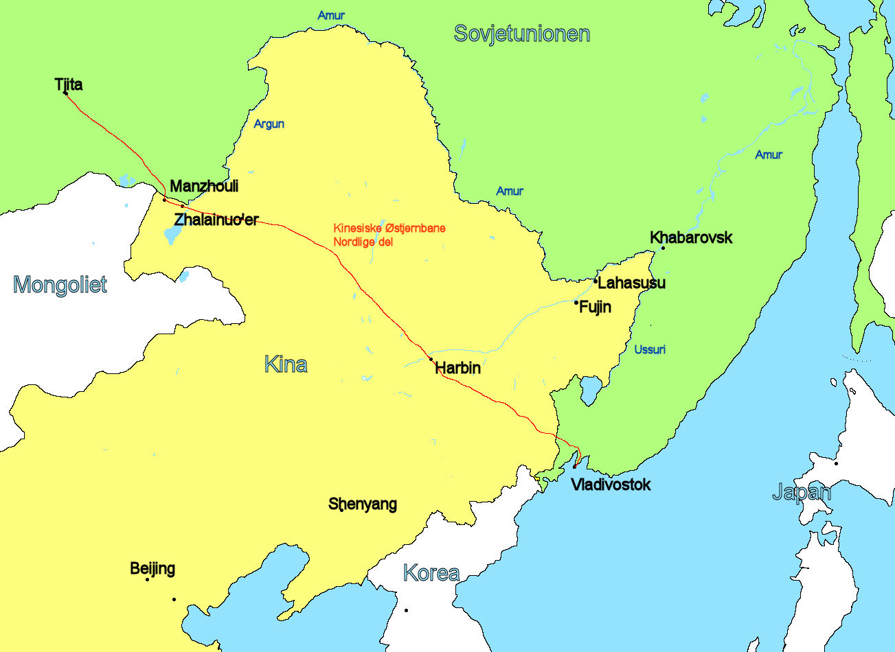
Map in Danish, Chinese Eastern Railroad, North. Sino-Soviet conflict 1929
Summary[edit]
| Description |
Dansk: Kort over Manchuriet og sovjetisk Fjernøsten med steder af betydning for den kinesisk-sovjetiske konflikt 1929
English: Map of Manchuria and Soviet Far East with places of importance Sino-Soviet cinflict 1929 |
| Date | |
| Source | Own work |
| Author | Ingmar~dawiki |
Licensing[edit]
I, the copyright holder of this work, hereby publish it under the following license:
This file is licensed under the Creative Commons Attribution-Share Alike 4.0 International license.
- You are free:
- to share – to copy, distribute and transmit the work
- to remix – to adapt the work
- Under the following conditions:
- attribution – You must give appropriate credit, provide a link to the license, and indicate if changes were made. You may do so in any reasonable manner, but not in any way that suggests the licensor endorses you or your use.
- share alike – If you remix, transform, or build upon the material, you must distribute your contributions under the same or compatible license as the original.
File history
Click on a date/time to view the file as it appeared at that time.
| Date/Time | Thumbnail | Dimensions | User | Comment | |
|---|---|---|---|---|---|
| current | 13:05, 13 May 2020 | | 1,303 × 950 (166 KB) | Ingmar~dawiki (talk | contribs) | Uploaded own work with UploadWizard |
You cannot overwrite this file.
File usage on Commons
There are no pages that use this file.
File usage on other wikis
The following other wikis use this file:
- Usage on da.wikipedia.org