File:Bridleway to Abergwesyn, Tywi Forest, Powys - geograph.org.uk - 1528910.jpg
Jump to navigation
Jump to search
No higher resolution available.
Bridleway_to_Abergwesyn,_Tywi_Forest,_Powys_-_geograph.org.uk_-_1528910.jpg (640 × 480 pixels, file size: 135 KB, MIME type: image/jpeg)
Captions
Captions
Add a one-line explanation of what this file represents
Summary[edit]
| Description |
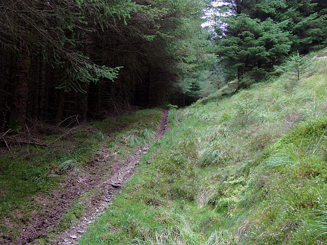
English: Bridleway to Abergwesyn, Tywi Forest, Powys The course of this bridleway is not quite as shown on the 1:50000 map on this page. The Get-a-map 1:25000 map is better.
When this bridleway was established there was no Llyn Brianne, no road in the Tywi Valley, and no plantation. The route will have served isolated farms in the valley and on the moors to Abergwesyn about 5 km to the east. |
| Date | |
| Source | From geograph.org.uk |
| Author | Roger Kidd |
| Attribution (required by the license) | Roger Kidd / Bridleway to Abergwesyn, Tywi Forest, Powys / |
| Camera location | | View this and other nearby images on: OpenStreetMap |
|---|
_heading:90.00&language=en)
| Object location | | View this and other nearby images on: OpenStreetMap |
|---|
_heading:90.00&language=en)
Licensing[edit]

|
This image was taken from the Geograph project collection. See this photograph's page on the Geograph website for the photographer's contact details. The copyright on this image is owned by Roger Kidd and is licensed for reuse under the Creative Commons Attribution-ShareAlike 2.0 license.
|
This file is licensed under the Creative Commons Attribution-Share Alike 2.0 Generic license.
Attribution: Roger Kidd
- You are free:
- to share – to copy, distribute and transmit the work
- to remix – to adapt the work
- Under the following conditions:
- attribution – You must give appropriate credit, provide a link to the license, and indicate if changes were made. You may do so in any reasonable manner, but not in any way that suggests the licensor endorses you or your use.
- share alike – If you remix, transform, or build upon the material, you must distribute your contributions under the same or compatible license as the original.
File history
Click on a date/time to view the file as it appeared at that time.
| Date/Time | Thumbnail | Dimensions | User | Comment | |
|---|---|---|---|---|---|
| current | 02:46, 3 March 2011 | | 640 × 480 (135 KB) | GeographBot (talk | contribs) | == {{int:filedesc}} == {{Information |description={{en|1=Bridleway to Abergwesyn, Tywi Forest, Powys The course of this bridleway is not quite as shown on the 1:50000 map on this page. The Get-a-map 1:25000 map is better. When this bridleway was estab |
You cannot overwrite this file.
File usage on Commons
There are no pages that use this file.