File:Bridgeport Bridge from west.jpg
Jump to navigation
Jump to search
Size of this preview: 800 × 450 pixels. Other resolutions: 320 × 180 pixels | 640 × 360 pixels | 1,024 × 576 pixels | 1,280 × 720 pixels | 2,816 × 1,584 pixels.
Original file (2,816 × 1,584 pixels, file size: 1.15 MB, MIME type: image/jpeg)
Captions
Captions
Add a one-line explanation of what this file represents
|
This is an image of a place or building that is listed on the National Register of Historic Places in the United States of America. Its reference number is 98000533. |
| Camera location | | View this and other nearby images on: OpenStreetMap |
|---|
| Description |
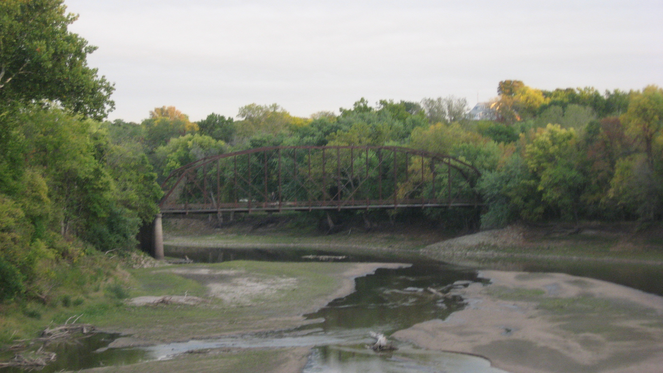
English: Western (upstream) side of the Bridgeport Bridge, which spans the Skunk River west of Burlington in the southeastern corner of the U.S. state of Iowa. The northern side of the river (left side of picture) is in Des Moines County, while the southern side (right side of picture) is in Lee County. Built in 1904, the bridge is listed on the National Register of Historic Places. |
||
| Date | Taken on 5 October 2013 | ||
| Source | Own work | ||
| Author | Nyttend | ||
| Permission (Reusing this file) |
|
File history
Click on a date/time to view the file as it appeared at that time.
| Date/Time | Thumbnail | Dimensions | User | Comment | |
|---|---|---|---|---|---|
| current | 05:32, 23 October 2013 | | 2,816 × 1,584 (1.15 MB) | Nyttend (talk | contribs) | {{NRHP|98000792}} {{Location|40|47|26|N|91|21|51|W}} {{Information |Description={{en|Western (upstream) side of the {{w|Flint River Bridge}}, which spans the {{w|Flint River (Iowa)|Flint River}} west of {{w|Burlington, Iowa|Burlington}} in the southeas... |
You cannot overwrite this file.
File usage on Commons
The following page uses this file:
- File:Flint River Bridge.jpg (file redirect)