File:Bely-txu-oclc-6654394-ns-40-42-2nd-ed-rotated.png
Jump to navigation
Jump to search

No higher resolution available.
Bely-txu-oclc-6654394-ns-40-42-2nd-ed-rotated.png (556 × 586 pixels, file size: 599 KB, MIME type: image/png)
Captions
Captions
Bely Island
Summary[edit]
| Description |
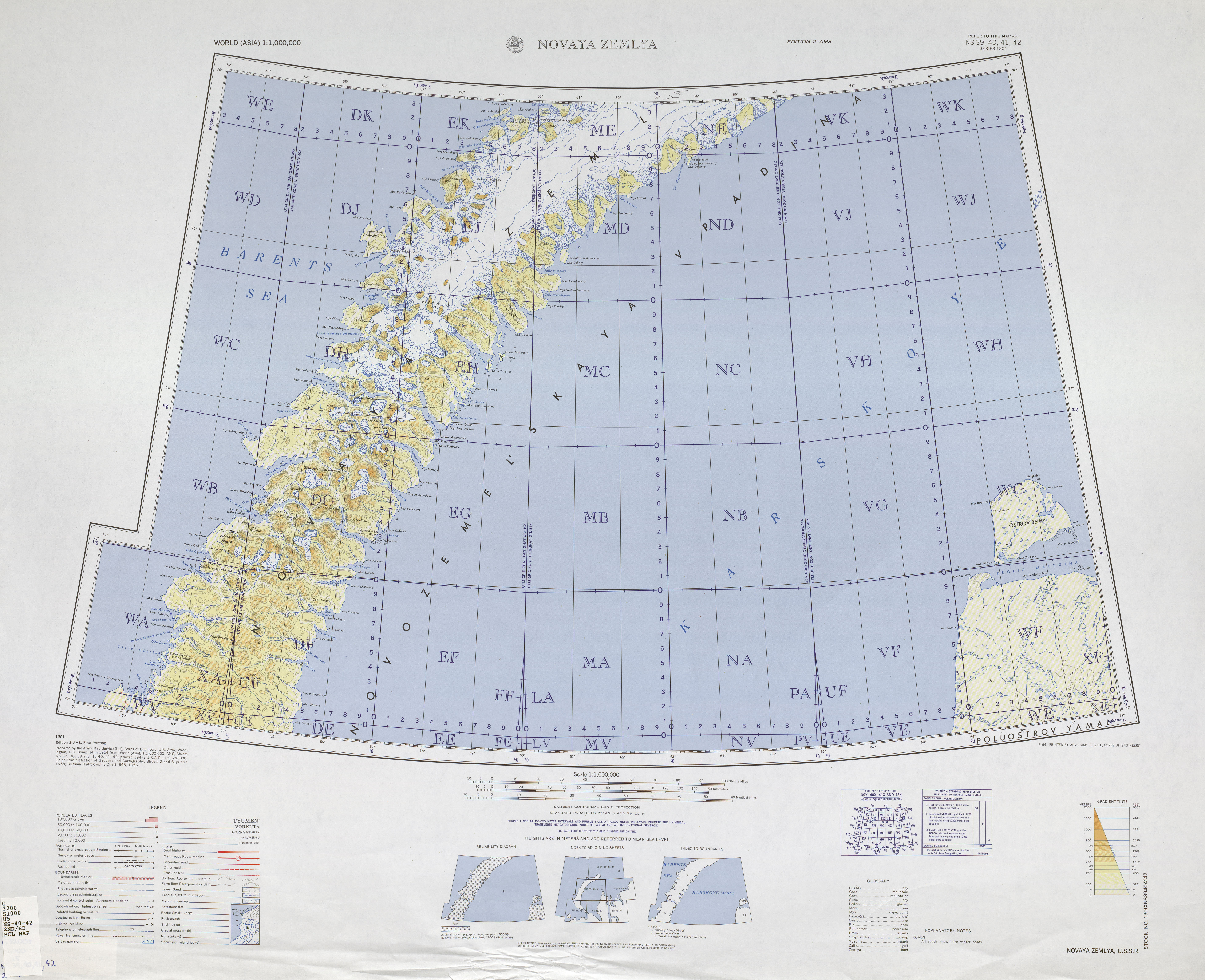
English: part of original map, covering Bely Island off Yamal Peninsula, Russian Arctic
Русский: Часть оригинальной карты, фрагмент показывает Белый остров рядом с полуостровом Ямал, на территории российской Арктики.
Čeština: část původní mapy zachycující Bílý ostrov nedaleko Jamalského poloostrova |
| Date | |
| Source | http://www.lib.utexas.edu/maps/imw/txu-oclc-6654394-ns-40-42-2nd-ed.jpg |
| Author | Army Map Service, Corps of Engineers, U.S. Army |
Licensing[edit]
This file is a work of a U.S. Army soldier or employee, taken or made as part of that person's official duties. As a work of the U.S. federal government, it is in the public domain in the United States.
|
 |
File history
Click on a date/time to view the file as it appeared at that time.
| Date/Time | Thumbnail | Dimensions | User | Comment | |
|---|---|---|---|---|---|
| current | 07:35, 10 August 2016 | | 556 × 586 (599 KB) | Miraceti (talk | contribs) | User created page with UploadWizard |
You cannot overwrite this file.
File usage on Commons
There are no pages that use this file.
File usage on other wikis
The following other wikis use this file:
- Usage on cs.wikipedia.org
- Usage on de.wikipedia.org
- Usage on en.wikipedia.org
- Usage on fi.wikipedia.org
- Usage on gl.wikipedia.org
- Usage on incubator.wikimedia.org
- Usage on ja.wikipedia.org
- Usage on pt.wikipedia.org
- Usage on ru.wikipedia.org